Texas State Highway 56
| ||||
|---|---|---|---|---|
 | ||||
| Route information | ||||
| Maintained by TxDOT | ||||
| Length: | 53.3 mi[1] (85.8 km) | |||
| Existed: | 1974 – present | |||
| Major junctions | ||||
| West end: |
| |||
|
| ||||
| East end: |
| |||
| Highway system | ||||
| ||||
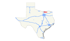
State Highway 56 is a state highway in the U.S. state of Texas that runs through Grayson and Fannin Counties in North Central Texas. This highway was designated in 1974 to replace U.S. Highway 82 when it was rerouted north of Whitesboro and Sherman. SH 56 has been extended further since then as the US 82 bypass continued to be extended north of Bonham and Honey Grove.
Through Sherman, SH 56 operates on a pair of one-way streets, Lamar (eastbound) and Houston (westbound).
Previous routes
SH 56 was originally designated by 1926 through the northwestern Panhandle, coinciding with the future route of U.S. Highway 54. Construction was completed by 1938, when the SH 56 designation was dropped in favor of US 54.
Junction list
| County | Location | mi | km | Destinations | Notes |
|---|---|---|---|---|---|
| Grayson | Whitesboro | ||||
| Southmayd | Interchange | ||||
| Sherman | Interchange | ||||
| Interchange; US 75 exit 58 | |||||
| Bells | |||||
| Fannin | Bonham | ||||
| Honey Grove | |||||
| 1.000 mi = 1.609 km; 1.000 km = 0.621 mi | |||||
References
This article is issued from Wikipedia - version of the Saturday, September 05, 2015. The text is available under the Creative Commons Attribution/Share Alike but additional terms may apply for the media files.
