Greater Tehran
| Greater Tehran تهران بزرگ | ||||||||||
|---|---|---|---|---|---|---|---|---|---|---|
| Metropolis | ||||||||||
| کلانشهر تهران · Tehran Metropolis | ||||||||||
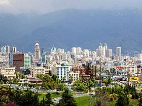
Clockwise from top: Azadi Tower, Shemiran, Ab o Atash Park, Mount Tochal seen from Modarres Expressway, Shams ol Emareh, Ferdows Garden, and Milad Tower seen from Parkway. | ||||||||||
| ||||||||||
 | ||||||||||
 Greater Tehran | ||||||||||
| Coordinates: 35°41′46″N 51°25′23″E / 35.69611°N 51.42306°ECoordinates: 35°41′46″N 51°25′23″E / 35.69611°N 51.42306°E | ||||||||||
| Country |
| |||||||||
| Province | Tehran | |||||||||
| County |
Tehran Shemiranat | |||||||||
| Bakhsh | Central | |||||||||
| Area | ||||||||||
| • Urban | 730 km2 (280 sq mi) | |||||||||
| • Metro | 1,274 km2 (492 sq mi) | |||||||||
| Elevation | 1,200 to 1,980 m (3,900 to 6,470 ft) | |||||||||
| Population (2011) | ||||||||||
| • Density | 11,354.6/km2 (29,408.3/sq mi) | |||||||||
| • Urban | 8,293,140[1] | |||||||||
| • Metro | 14,505,904[1] | |||||||||
| • Population Rank in Iran | 1st | |||||||||
| Population Data from 2011 Census | ||||||||||
| Time zone | IRST (UTC+03:30) | |||||||||
| • Summer (DST) | IRDT (UTC+04:30) | |||||||||
| Area code(s) | 021 | |||||||||
| Website | www.tehran.ir | |||||||||

Greater Tehran is the metropolitan urban area in Tehran Province that covers the contiguous cities of Tehran, Ray, Shemiranat, and other areas.
As of 2012, greater Tehran hosts a population of close to 14 million residents.[2]
Greater Tehran was formed in 1973 to include the villages surrounding the city of Tajrish (Evin, Darakeh, Niyavaran, Rostan Abad, Gholhak, Zargandeh, Elahiyeh, Davoudiyeh, Zarrabkhaneh) and the cities of Vanak and Rey to which “Kooye Siman” had been annexed during the years 1956 to 1966. At that time, the population of the conurbation was 4.5 million people.[3] The rapid population growth, fueled by migration and fast population growth in Iran, has been slowing down since the 1990s. This can be attributed to the changes in Family planning.
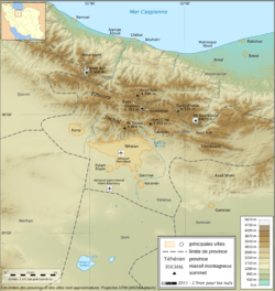
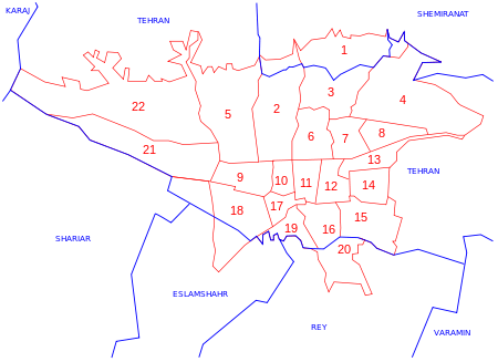
Map of Tehran Metropolis
Tehran metropolis is situated mostly in Tehran County, but also continues over some areas in Shemiranat County, Rey County, and Eslamshahr County, Damavand County, Firuzkuh County, Karaj County, Nazarabad County, Pakdasht County, Robat-Karim County, Savojbolagh County, Varamin County and Shahriar County.
References
- 1 2 جمعیت و خانوار شهرستان های کشور بر اساس سرشماری عمومی نفوس و مسکن 1390 (in Persian). Statistical Center of Iran. Retrieved 23 January 2015.
- ↑ PopulationData.net – Iran
- ↑ http://atlas.tehran.ir/Default.aspx?tabid=272
Tir
Abad
Jandarmeri
Bakhtari
Shemiran
Hosseyn
Abad
No
Ferdows
Sazman-e
Barnameh
Abad
Dastgah
Dastgah
Havayi
No
Chenar
Hassan
Morghi
Fallah
Abad
Niruz
Abad
Daru
Vali-Asr
Bari
Azari
Bokharaee
Abad
Abad
Aban
Qassab
Abad
Babaveyh
Abdol-Azim
Azadi
-Shahr
Haj-Seyf
Cheshmeh
Rah-Ahan


