Tamenglong
Tamenglong | |
|---|---|
| Town | |
 Tamenglong Location in Manipur, India | |
| Coordinates: 24°59′0″N 93°29′0″E / 24.98333°N 93.48333°ECoordinates: 24°59′0″N 93°29′0″E / 24.98333°N 93.48333°E | |
| Country |
|
| State | Manipur |
| District | Tamenglong |
| Population (2011) | |
| • Total | 140,143 |
| Languages | |
| • Spoken | Rongmei, Liangmai, Zeme |
| Time zone | IST (UTC+5:30) |
| PIN | 795141 |
| Telephone code | 03877 |
| Nearest city | Imphal |
| Website |
tamenglong |
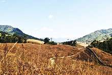
Tamenglong is a small town, district headquarters of Tamenglong district in the state of Manipur in India. The town is located in the western part of the state. People of Zeliangrong communities dominantly lives in this town . Rongmei language is dominantly spoken in and around the town. Tamenglong lies on the hilltop that descends to Barak river.
The land was believed to have been formed due to orogenic movement during cretaceous and Eocene period. The main rock formations are sandstone, shale, schist. Due to weak and fragile nature of rocks and high gradient of the hill slopes, landslide is a common phenomenon in the whole district in rainy season.
Tamenglong HQ can be reached through Roadways. From Imphal (State Capital) three buses depart at 6.00 am to reach Tamenglong the same afternoon.
Tamenglong District


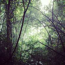
Tamenglong District is blessed with virgin forests, exotic orchids, rare and endangered plants, and wildlife. The forests can be grouped as tropical evergreen forest, subtropical forest and bamboo brakes. The dense tropical evergreen forests are located along both the sides of rivers flowing in the district, varieties of ground flora, creepers, herbs and grasses are found here. These forest are the main source of timbers. Cane brakes are found in and around water bodies. The sub-tropical forests are found on the highest altitudes. Varieties of orchids are found in this zone of forests. In the degraded forest areas the bamboo brakes are found in plenty. The forests are rich in wildlife. Pheasants, peafowl and junglefowl are important birds of this area. The sambar deer, hog deer, bear, fox, hyena, wild pig, wild dog, slow loris and serow are reported. Leopards and tigers are also reported from Barak valley area and Tousem area. Migrated herds of elephants are sighted in Tousem during winter. Krait, cobra, viper and python are found inside the forest. Large tortoises are found in the Zeilad lake. Varieties of cranes, ducks and teal are seen in the Zeilad lake. European kestrel (Falco tinnunculus), or lesser kestrel (Falco naumanni , locally akhoipuna or kiuhoipuna). Migratory birds visit Tamenglong from early winter till the last week of November. Tamenglong is called the land of the hornbill. Great pied hornbill (Buceros bicornis homrai), Indian pied hornbill (Anthracoceros malabaricus malabaricus) species are found. A number of exquisite orchids are found. They are epiphytic, lithophytic and terrestrial in nature. The Dendrobium, Vanda, Cymbidium, Cattleya and Lycaste are found in abundance. The Phius tunkervels, a rare terrestrial orchid is found in the Barak valley. Thunia alba which is known as bamboo orchid is found around Taobam village. Paphiopedilum is found in Leimatak area.
Places of Interest


Tamenglong district of Manipur is blessed with a topography of irregular undulation. It has in its small area most of the awesome features that nature mould to a hilly terrain. Turbulent waters, roaring waterfall, pitching dark caves, enchanting lakes of the wilderness, rocks chiseled to wondrous form and yet the thick blanket of dense tropical forest most part of which are still virgin. Highlighted below are some of the popular places that have attracted a number of tourists round the year.
- Along the river Barak there are seven waterfalls in series at close range. The picture is at the third step of the waterfall.
- The famous Tharon cave (Chalem-Ky) is located at about 27 km from the district HQ. The map of the entire cave is engraved and painted on a stone at the main entrance. Archeological excavation of the cave shows affinities with Hobinian culture of North Vietnam.
- The legendary Zeilad lake at Makoi (Atengba) is associated with a number of pythons, fishes and water birds. There are six other lakes nearby Guiphop Zei, Nrou Zei, Nap-sam Zei etc.
- The Buning (Npiulong) meadow is located on the western side of the picturesque Tamei town. A number of well-groomed uneven small mounts, numerous glittering brooks studded the stretch. Come June the meadow is coloured with enchanting ground orchids and various wild lilies. Cry of hoolock gibbon howling of foxes melodious chirping of birds altogether form Buning a big family of the wildlife evoking wonder and admiration of many who have witnessed the meadow.
Geography

Geographical Area 4,391 km2. Population 111,499 Altitude (above MSL) 1260 m Latitude (HQ) 24.59 N Longitude (HQ) 93.30 E Rainfall (HQ) 3135 mm. Temperature Maximum 31oC Minimum 4oC Literacy 70.40%
Flora and fauna


Tamenglong District is blessed with virgin forests, exotic orchids (Nkung), rare and endangered plants, and wildlife. The forests can be grouped as Tropical-Ever-green forest, Sub-tropical forest and bamboo brakes. The dense tropical evergreen forests are located along both the sides of rivers flowing in the district, varieties of ground flora, creepers, herbs and grasses are found here. These forest are the main source of timbers. Cane brakes are found in and around water bodies. The sub-tropical forests are found on the highest altitudes. Varieties of orchids are found in this zone of forests. In the degraded forest areas the bamboo brakes are found in plenty.
The forests are rich in wildlife. Pheasants, peafowl, jungle fowls are important birds of this area. The sambar, deer, hog deer, bear, fox, hyena, wild pig, wild dogs, slow loris, serow are reported. Leopard and tiger are also reported from Barak valley area and Tousem area. Migrated herds elephants are sighted in Tousem during winter. Krait, cobra, viper and python are found inside the forest. Large tortoises are found in the Zeilad lake. Varieties of cranes, ducks and teal are seen in the Zeilad lake.
European kestrel, Falco tinnunculus, or lesser kestrel, Falco naumanni (local name is Hoipuina / Kiuhoipuina), the migratory bird visits Tamenglong during the early winter till the last week of November.
Tamenglong is called as the land of the hornbill (chareng). Great pied hornbill (Buceros bicornis homrai), Indian pied hornbill (Anthracoceros malabaricus malabaricus) species are found. A number of exquisite orchids are found. They are epiphytic, lithophytic and terrestrial in nature. The Dendrobium, Vanda, Cymbidium, Cattleya and Lycaste are found in abundance. The Phius tunkervels, a rare terrestrial orchid is found in the Barak valley. Thunia alba which is known as bamboo orchid is found around Taobam village. Paphiopedilum is found in Leimatak area.
Major rivers


- Npin /Nkhu (Makru)
- Iyei
- Alaang / Ahang (Irang)
- Ahu / Nbiu (Barak)
Sub-Divisions
- Tousem
- Tamenglong
- Nungba
- Tamei
Transport

National Highways
- NH 53
State Highways
- I.T. Road
- Old Cachar Road
- Tamenglong Khongsang Road
People and Culture

.jpg)
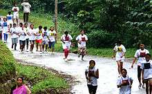
Tamenglong is inhabited by the majority Zeliangrong Naga tribe (comprising Rongmai, Liangmai, Zeme, and Puimai) and Kukis Tribe . Racially or physically and linguistically Zeliangrongs are Tibeto-Burman (Indo-Mongoloid) of Sino-Tibetan family of the Mongolian race. Based on history it is assumed that Mongoloid groups including Zeliangrong Nagas were inhabiting the upper course of the Yangtze and Howang Ho rivers in China in the prehistoric times.
The Zeliangrong belongs to patriarchal social system. Each clan enjoys equal status. Clan exogamy is strictly observed. Cross-cousin marriage is most preferred but parallel cross-cousin is seldom. Besides following many other normal customs of a Naga-tribe, they also have some strange and fearful customs. Some of them are as below: Nasitheimei or Nathitheimei:
Should a woman die in childbirth the child is not permitted to live but buried with the dead mother.
- Mandu (bone money)
- Is the bone price of wife. Patrilineal relatives of the wife demand this. On the death of a wife her father demands Mandu from the husband, or if he be dead, the late husband's nearest relative. Mandu ensures that every care will be taken both of wife and offspring.
- Marriage system
Besides normal marriage like by engagement or by elopement there are also other kinds of marriage.
- Noumang-mai-Nou-kao (Marriage by Service): With the agreement of both parties the boy stay at the girl's parents' house and stay for three to four years and live as husband and wife then finally return home.
- Chamemei : Here a girl is given in marriage even against her consent to a family to whom the girls parent are in debt or some obligations.
- Naokakhaomei: In an accidental death of a man, the nearest next brother will look after the children and remarry the wife of his brother.
Main Tribes (Inhabitants)
- Rongmei Naga
- Zeme Naga
- Liangmai Naga
- Npui Naga
Festivals
Festivals and Dances of the Zeliangrong are closely linked up with religion, which is associated with their economic vocation and socio-cultural ethos. Festivals reflect different stages of agricultural activities, here talents, physical strength are expressed. Every month there is a festival.
Listed below are some of the festivals:
- Gan-Ngai
- Rih-Ngai / Chaga Ngee
- Gudui-Ngai
- Banruhmei
Gan-Ngai
This festival is celebrated in the month of December–January after harvest for 5 (five) days. Blowing horn herald the festival, fresh fire is made with the ancient friction method and distributed in every household. Villagers, irrespective of age dressed in their best attire, keep up the dance and songs, intercepting only by short intervals of repose and break dedicated to feasting.
Rih-ngai / Chaga-Ngee
Celebrate during January–February is this War festival which is exclusively for male. No stranger is allowed to enter the village. Men abstain from sexual intercourse and foods cooked by women are not taken. An interesting feature is Raangh-Kapmei or shooting at an effigy of a warrior with pointed bamboo splits. It is believed that one who hit the effigy on:
The head, will be successful in war. The chest, will be successful in hunting. The abdomen, will be lucky in cultivation, etc.
Likewise there are altogether seven segments on the effigy, which they believed would reveal their fortune of the year.
Gudui-Ngai
Performed during the seed-sowing season in April. After completion of task like clearance of jungle for cultivation everyone will drink juice (dui) of ginger (Gu). Tug of war is performed between male and female as a symbolic representation of competition between God and Goddess for possessing the paddy. If the girls win it indicates a good harvest.
Banruhmei & Tarang
These are two feasts of merit performed by one who is bold, brave, philanthropist, generous and rich enough to feed the whole village. It is believed that if a man could perform both the feasts of merit during his lifetime, he is supposed to have accomplished his life's work.
During Banruhmei various songs and dances are performed observing strict forms. The entire villagers, irrespective of age, will participate the feast, which may last a few weeks. The wife of the host will perform a special dance with a rice beer cistern of gourd, pouring it out rhythmically.
Tarang (or Kaisumei) can be performed only by those who have performed Banruhmei, if he still can afford. Here the special house of merit called Tarang-kai is constructed.
Dances
The rich cultural heritage of the Zeliangrong is reflected in their varieties of art specially dances performed during their festivals. Dances are different in their steps, forms & seasons. Zeliangrong enjoy dancing throughout the day and the night.
Costumes are generally colourful along with ornaments and feathers of hornbill, which according to mythology was transformed from an old orphan boy, Guiliang
Deep thudding of drums shake the ground underfoot & jar the body. Endless steps and forms under the moonlight and glares of the torches, dances of the night is quite an experience. Zeiliangrong use a violin like musical instrument called Tara / Nrah to give accompany to songs .
Some of the popular dances of the Zeliangrong are as below:
- Jaopa lam = Victory dance
- Chari Lem / Ri lam = War dance
- Hansiangmai lam = Bamboo dance
- Rengdi Lem / Rangdai Lam = Dance of hornbill
- Mangrelim = Dance of fly
- Ngiuna lem / Khuairuna lam = Bee's dance
- Tariang lam = Spinning dance
- Chagaa Lem / Ga lam = Crab dance
- Maukana lam = Hawk dance
- Makhom lam = Fertility dance
Climate
Köppen-Geiger climate classification system classifies its climate as humid subtropical (Cwa).[1] Tamenglong is a highland which makes the temperatures cooler. The warmer months are extremely rainy. July receives most rain while December is the driest.
| Climate data for Tamenglong | |||||||||||||
|---|---|---|---|---|---|---|---|---|---|---|---|---|---|
| Month | Jan | Feb | Mar | Apr | May | Jun | Jul | Aug | Sep | Oct | Nov | Dec | Year |
| Average high °C (°F) | 18.6 (65.5) |
20 (68) |
23.8 (74.8) |
25.8 (78.4) |
25.9 (78.6) |
25.5 (77.9) |
25.4 (77.7) |
25.5 (77.9) |
25.1 (77.2) |
24.2 (75.6) |
23.6 (74.5) |
19.2 (66.6) |
23.55 (74.39) |
| Daily mean °C (°F) | 12.2 (54) |
13.8 (56.8) |
17.5 (63.5) |
20.1 (68.2) |
21.2 (70.2) |
21.9 (71.4) |
22.1 (71.8) |
22.2 (72) |
21.6 (70.9) |
19.9 (67.8) |
16.2 (61.2) |
13.1 (55.6) |
18.48 (65.28) |
| Average low °C (°F) | 5.9 (42.6) |
7.7 (45.9) |
11.2 (52.2) |
14.4 (57.9) |
16.5 (61.7) |
18.4 (65.1) |
18.9 (66) |
18.9 (66) |
18.1 (64.6) |
15.7 (60.3) |
10.9 (51.6) |
7.1 (44.8) |
13.64 (56.56) |
| Average precipitation mm (inches) | 34 (1.34) |
46 (1.81) |
168 (6.61) |
223 (8.78) |
324 (12.76) |
688 (27.09) |
728 (28.66) |
535 (21.06) |
323 (12.72) |
217 (8.54) |
42 (1.65) |
8 (0.31) |
3,336 (131.33) |
| Source: Climate-Data.org (altitude: 1266m)[1] | |||||||||||||
-

The school goers hideout fame Farmland Lake.
-

Raengon Banduan
-

Prayer Mountain
-

Nriangluang Kaipi
-

Roh Nouh Bung at Barak
-

Asho Naaploih at Barak
-

The famous Kacha Khou at Magulong
References
- 1 2 "Tamenglong - Climate graph, Temperature graph, Climate table". Climate-Data.org. Retrieved 2016-01-04.