Sukkur
| Sukkur سکر | |
|---|---|
| City | |
| Sukkur سکر (Sindhi) | |
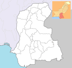
 Sukkur Location of Sukkur in map of Sindh Province | |
| Coordinates: 27°42′20″N 68°50′50″E / 27.70556°N 68.84722°ECoordinates: 27°42′20″N 68°50′50″E / 27.70556°N 68.84722°E | |
| Country | Pakistan |
| Province | Sindh |
| Area | |
| • Total | 5,165 km2 (1,994 sq mi) |
| Elevation | 67 m (220 ft) |
| Population (2011[1]) | |
| • Total | 1,383,124 |
| • Density | 164.6/km2 (426/sq mi) |
| Time zone | PST (UTC+5) |
| Calling code | 071 |
| Number of towns | 4 |
| Number of Union councils | 1 |
| Sukkur District Website dead link] | |
Sukkur , formerly Aror [ərōr] (Sindhi: اروڙ, Urdu: اروڑ) and Bakhar, is the 14th largest city of Pakistan[2] and third largest city of Sindh province, situated on the west bank of Indus River in Pakistan in Sukkur District. However, the word Sakhar in Sindhi means "superior", which the spelling of the city's name in Sindhi suggests is the origin of the name. modern-day Sukkur was built by the British general Sir Charles Napier in the 1840s.[3]
Administration
The city of Sukkur, as well as being Divisional and district headquarters, is the capital of Sukkur Division as a whole. Tehsils (Talukas) and contains many Union council.[4]
Demographics
Sukkur is noteworthy in Sindh and Pakistan generally for its comparative tolerance towards religious and ethnic minorities. City is a multi ethnic and has a mix of Sindhis, Punjabis, Brahuis, Balochis and Pakhtuns. The independence of Pakistan in 1947 saw the influx of Muslims which include Urdu-speaking Muhajirs, Bandhani-speaking Rajputs from Rajasthan, Memons from Bombay, Gujrat and Kathiawar were migrated from India and settled here, mostly in the aftermath of anti-Muslim riots when Pakistan was carved out of India as the result of Muslim vote; the muslim population of India voted for their separate homeland, the Pakistan. While some of the Bandhani, Memons, and Punjabis were settled here before partition, i.e., the independence of Pakistan in 1947
Sindhis are native to the area and speak its various dialects, including, utradi, Lari, Siraiki, Thari, Dadhki, etc. A large number of Punjabis were attracted to the city after the Indus treaty settlement. Most Pakhtuns are distinct and separately living near the railway station and its vicinity, while the Punjabis are settled around the downtown and chowk ghantaghar in central part of the of the city. The city therefore has cosmopolitan atmosphere with multiethnic and multicultural communities.[5]

Sukkur district
The district of Sukkur (whose name is derived from its headquarters Sukkur city) covers an area of 5,165 square kilometres. Geographically it is spanned from 27°05' to 28°02' north latitudes and from 68°47' to 69°43' east longitudes. The city of Sukkur is located at an altitude of 220 feet (67 m) from sea level, having terrestrial coordinates 68°52' east and 27°42' north. It is also the narrowest point of the lower Indus course.
Sukkur district shares its northern border with Shikarpur and the recently constituted Kashmore districts. Ghotki is located on the north-eastern side while Khairpur on the south. The border with India lies further east. Sukkur is also connected by road and by air with all major cities of Pakistan.
Climate
| Sukkur | ||||||||||||||||||||||||||||||||||||||||||||||||||||||||||||
|---|---|---|---|---|---|---|---|---|---|---|---|---|---|---|---|---|---|---|---|---|---|---|---|---|---|---|---|---|---|---|---|---|---|---|---|---|---|---|---|---|---|---|---|---|---|---|---|---|---|---|---|---|---|---|---|---|---|---|---|---|
| Climate chart (explanation) | ||||||||||||||||||||||||||||||||||||||||||||||||||||||||||||
| ||||||||||||||||||||||||||||||||||||||||||||||||||||||||||||
| ||||||||||||||||||||||||||||||||||||||||||||||||||||||||||||
The climate of Sukkur is characterised by very hot and hazy summer with dry and cool winter. Throughout the whole year wind speed is low and sunshine is abundant as the district exhibits a desert climate. Summer is very hot as the temperature can reach 50 °C (122 °F). Dry heat is experienced starting April to early June until the Monsoon season starts to arrive. Monsoons in the city of Sukkur are not very wet, but extremely high dew point couple up with very hot temperature makes the temperatures extremely uncomfortable. Dew point over 30 °C (86 °F) and heat index in excess of 65 °C (149 °F) are recorded on some days, which are some of highest heat indices recorded in the world. Monsoons recede by September, but it is not until late October that the short lived autumn season is experienced.[7] The average annual rainfall of the city is a scanty ... However, winter is mild and cool. Night temperatures rarely fall below freezing while day time temperatures are rather warm and comfortable. It is one of the few districts of Sindh to experience foggy conditions similar to that of north and central Punjab.
History

Sukkur has been an important strategic centre and trading route from time immemorial. Alor (or Aror, Sukkur) held the status of capital under the reign of Musikanos, when Alexander invaded the region in 326 BCE. The ruins of this ancient town still exist, 8 kilometres (5.0 mi) east of Rohri, in Sukkur district. The Rai dynasty built a huge temple of Shiva. In 711 CE, the Arabs conquered Sindh, led by 17-year-old Muhammad bin Qasim, and Sukkur (including all of Sindh and lower Punjab) became part of the Umayyad Caliphate.


Later Mughals and many semi-autonomous tribes ruled over Sukkur. The city was ceded to Mirs of Khairpur between 1809 and 1824. In 1833, Shah Shuja (a warlord of Kandahar, Afghanistan) defeated the Talpurs near Sukkur and later made a solemn treaty with the Talpur ruler, by which he relinquished all claims on Sindh. In 1843, the British (General Charles James Napier) defeated the Talpurs at the battles of Miani and Dubbo near Hyderabad. Sukkur, along with the rest of Sindh, was under British rule until the independence of Pakistan in 1947. The (current) district of Sukkur was constituted in 1901 out of part of Shikarpur District, the remainder of which was formed into the Larkana District. Sukkur saw a significant socio-economic uplift after the 1930s, when the British built the world's largest barrage here on the Indus River. The predominantly Muslim population supported Muslim League and Pakistan Movement. After the independence of Pakistan in 1947, the minority Hindus and Sikhs migrated to India while the Muslim refugees from India settled in the Sukkur.
Sukkur Barrage

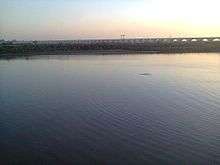
The Sukkur Barrage has 66[8][9] Gates. The Sukkur Barrage (formally called Lloyd Barrage), built under the British Raj on the Indus River, controls one of the largest irrigation systems in the world. It was designed by Sir Arnold Musto KCIE, and constructed under the overall direction of Sir Charlton Harrison, KCIE, as Chief Engineer. Construction of the barrage was started in 1923 and completed in January 1932. The 5,001 feet (1,524 m) long barrage is made of yellow stone and steel and can water nearly 10 million acres (40,000 km2) of farmland through its seven large canals. Some of the canals are larger than the Suez Canal.

In November 2004, the government of Pakistan initiated a rehabilitation project to revitalise its water storage capacity and distribution efficiency. The project was completed in July 2005, (with less than the allocated amount of Rs. 887 million). Experts believe that the rehabilitation of the barrage has enhanced its efficiency for another 60 to 70 years.[10]
Economy
Industry
Sukkur is a hub of many small and large scale industries. Among important industries are Biscuit factories, Vegetable (Cooking) oil and Vanaspati Ghee Mills, cotton textiles, cement, leather, tobacco, paint and varnish, pharmaceuticals, agriculture implements, metal foundries, hand pumps, lock making, rice-husking, and sugar. Small-scale cottage industries comprise hosiery, boat making, fishing accessories, thread ball spooling, trunk making, brass-wares, cutlery, ceramics. Milk Plant Engro Foods.
Agriculture
Sukkur had a large fertile and cultivable land area. During kharif, rice, bajra, cotton, tomatoes and peas are cultivated; whereas during rabi the main crops are wheat, barley, graham and melons. Sukkur is famous, world over, for its dates. Sukkur also has a large Riveraine forest along the course of the Indus. These tropical forests are found within the protective embankments on either side of the Indus. During 1997–98 the total area under forests was 510 km2 which yielded 55,000 cubic feet (1,600 m3) of timber and 27,000 cubic feet (760 m3) of firewood besides other mine products.[11][12]
Education
See List of educational institutions in Sukkur
Sites of interest
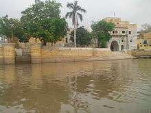
- Sadh Belo ساڌ ٻيلو Temple on River Indus

- Mount of Aror

- Jamia Masjid Bunder Road
- Tomb of Mian Adam Shah Kalhoro
- Tomb of the Seven Maidens Seven Sisters
- Tomb of Abdul Baqi, Ex-Governor of Bukkur.
- Bukkur Island
- Minaret of Mir Masum Shah
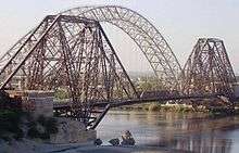
- Lansdowne Bridge Rohri
- Sukkur Barrage
- Lab-e-Mehran
- Muhammad bin Qasim Park
- Family Park
- KFC Sukkur
- Public Walking Track
- Icon By Ghouris
- 7 Eleven Super Store
- Friends Mart
See also
References
- ↑ http://www.thenews.com.pk/Todays-News-13-13637-Sindh-population-surges-by-81.5-pc,-households-by-83.9-pc
- ↑ http://www.pbs.gov.pk/sites/default/files//tables/POPULATION%20SIZE%20AND%20GROWTH%20OF%20MAJOR%20CITIES.pdf
- ↑ "Sukkur - 1889". http://www.sindhishaan.com. Sindhi Shaan. Retrieved 7 August 2015. External link in
|website=(help) - ↑ Union Administrations of Taluka Sukkur
- ↑ Umair, Bisma (13 July 2013). "Sukkur".
- ↑ "Climate Profile for Sukkur, Pakistan". MyWeather2. Retrieved 30 July 2010.
- ↑ http://www.wunderground.com/history/airport/OPSK/2013/7/6/DailyHistory.html?MR=1
- ↑ Kiana, Khaleeq (16 July 2013). "Rule violations threaten Sukkur Barrage". dawn.com. Retrieved 26 August 2014.
- ↑ "Sukku Barrage".
- ↑ "Sukkur Barrage Rehabilitated for another 60-70 years". 25 July 2005. Retrieved 26 August 2014.
- ↑ "Sukku at A Glance". sukkurcity.com. Retrieved 18 September 2014.
- ↑ "Explore Pakistan". findpk.com. Retrieved 18 September 2014.
External links
| Wikimedia Commons has media related to Sukkur. |
-
 Sukkur travel guide from Wikivoyage
 - District Government Sukkur
- Ghulam Muhammad Maher Medical College, Sukkur
- ADB Report on Sukkur Barrage 2001
- An Overview of the History and Impacts of the Water Issue in Pakistan
- Pakistan Floods Situation Report, 26 July 2005
| ||||||||||||||||||||||||||||||||||
| ||||||||||||||||||||||||||||||||||||||||||||||||||||||||||||||||||||||||||||||||||||||||||||||||||||||||||||||||||||||||||||||||||||||||||||||||||||||||||||||||||||
|