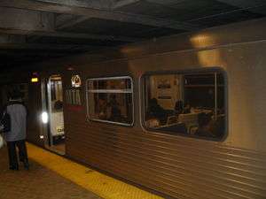
State Center (Baltimore Metro Subway station)
State Center | |||||||||||
|---|---|---|---|---|---|---|---|---|---|---|---|
 Westbound train at the State Center Metro Subway Station | |||||||||||
| Location |
302 West Preston Street (Preston & Eutaw Streets) Baltimore, MD | ||||||||||
| Coordinates | 39°18′06″N 76°37′23″W / 39.30158°N 76.62299°WCoordinates: 39°18′06″N 76°37′23″W / 39.30158°N 76.62299°W | ||||||||||
| Owned by | Maryland Transit Administration | ||||||||||
| Line(s) | |||||||||||
| Tracks | 2 | ||||||||||
| Connections | |||||||||||
| History | |||||||||||
| Opened | November 21, 1983 | ||||||||||
| Services | |||||||||||
| |||||||||||
The State Center Metro Subway Station is one of 14 stops along the Baltimore Metro Subway line. It is the tenth most northern and western station on the line, the first one in the area viewed by many as "downtown Baltimore," and is within a close walk of the Cultural Center Light Rail Stop and many area landmarks. Several Maryland Transit Administration bus lines operate nearby or lay over at the location, including nos:
- 5 to Mondawmin Metro Subway Station (WB)/ Cedonia (EB)
- 19 to Carney (NB)
- 21 to Mondawmin Metro Subway Station (NB)/ Fells Point (SB)
- 27 to Reisterstown Plaza Metro Subway Station (NB)/ Port Covington (SB)
- 91 to Rogers Avenue Metro Subway Station (NB)/ City Hall (SB)
- Note = Routes 5 and 27 are within close walk
The stop's lone entrance is located directly adjacent to the Maryland States Office Complex, hence the name "State Center." It is the location of a future transit-oriented development.
Layout
| ← Westbound toward Owings Mills. Next stop: Upton – Avenue Market | |
| Island platform, doors will open on the left | |
| Eastbound toward Johns Hopkins Hospital. Next stop: Lexington Market → | |
External links
This article is issued from Wikipedia - version of the Tuesday, January 12, 2016. The text is available under the Creative Commons Attribution/Share Alike but additional terms may apply for the media files.