Staouéli
| Staouéli سطوالي | |
|---|---|
| Municipality | |
| Commune of Staouéli | |
|
Sidi Fredj resort | |
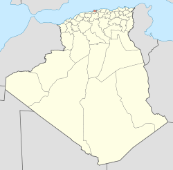
 Staouéli Location of Staouéli within Algeria | |
| Coordinates: 36°45′N 2°53′E / 36.750°N 2.883°ECoordinates: 36°45′N 2°53′E / 36.750°N 2.883°E | |
| Country |
|
| Province | Algiers |
| District | Zéralda |
| Government | |
| • PMA Seats | 11 |
| • PMA president | Saïd Bouifer(2002-2007) |
| Area | |
| • Total | 22.23 km2 (8.58 sq mi) |
| Population (1998) | |
| • Total | 38,915 |
| • Density | 1,800/km2 (4,500/sq mi) |
| Time zone | CET (UTC+01) |
| Postal code | 16101 |
| ONS code | 1645 |
Staouéli is a municipality in Algiers province, Algeria. It is located in Zéralda district, on a Presque-isle on the Mediterranean Sea, hosting the resort town of Sidi Fredj. There was a Grand Prix circuit located in Staouéli. Grands Prix were held there from 1928–1930, but the circuit is no longer operational.[1]
In 1843 the Trappists obtained a grant of 2500 acres of land on the site of the Battle of Staouéli (fought on June 19, 1830 during the French conquest of Algeria). Here they have built a monastery where some 100 monks lived and worked. On the wall of the monastery is the inscription: S'il est triste de vivre à la Trappe, qu'il est doux d'y mourir (While it is sad to live here, it is sweet to die here).
References
- ↑ Galpin, Darren. "Staouéli". GEL Motorsport Information Page. Retrieved 24 April 2013.
External links
![]() Media related to Staouéli at Wikimedia Commons
Media related to Staouéli at Wikimedia Commons

