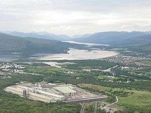
Lochaber


Lochaber (/lɒxˈɑːbər/) (Scottish Gaelic Loch Abar) is one of the 16 ward management areas of the Highland Council of Scotland and one of eight former local government districts of the two-tier Highland region. There are also earlier senses of Lochaber as a district, and Parish, within the county of Inverness (Inverness-shire),[1] and the county of Argyll[2] - north of Loch Eil - and as simply a district of Scotland.[3] All senses of Lochaber refer to an area in the west of the Scottish Highlands
The ward management area is one of five comprising the Highland Council's Ross, Skye and Lochaber corporate management area, which is one of three Highland Council corporate management areas. The Ross, Skye and Lochaber area consists of six out of the 22 wards of the council area and the Lochaber area consists of two wards, the Caol and Mallaig ward, which elects three councillors, and the Fort William and Ardnamurchan ward, which elects four councillors.[4] Each of the other wards of the corporate area is a separate ward management area.
There is also a Ross, Skye and Lochaber constituency of the House of Commons of the Parliament of the United Kingdom (at Westminster), but its boundaries are not exactly those of the council corporate management area. The constituency was created in 2005 with boundaries based on those of wards in use during the period 1999 to 2007.
According to legend a glaistig, en evil woman-goat hybrid, once lived in the area.[5]
History of local government
As statutory local government areas, the Highland region and its districts were created in 1975, under the Local Government (Scotland) Act 1973, and abolished in 1996. The 1973 legislation abolished local government counties and burghs throughout Scotland and created a new system of nine two-tier regions and three islands council areas. Each region consisted of a number of districts and the islands areas were created as unitary council areas.
The Lochaber district of the Highland region was created by merging the Ardnamurchan district and the Ballachulish and Kinlochleven electoral divisions of the former county of Argyll with the burgh of Fort William and the district of Lochaber of the former county of Inverness. Therefore the boundaries of the district included North Lorne, Glen Coe, Nether Lochaber, the western part of the Rannoch Moor, the Road to the Isles, Moidart, Ardgour, Morvern, Sunart, Ardnamurchan, and the Small Isles (Rùm, Eigg, Muck and Canna).
The 1994 legislation abolished regions and districts and established a system of 32 unitary council areas covering the whole of Scotland, and all of the Highland districts were merged into the new unitary Highland council area.
In 1996 the new Highland Council adopted the areas of the former districts as council management areas, and created area committees to represent them. The Lochaber management area then consisted of eight out of the 72 wards of the council area, each electing one councillor by the first past the post system of election. In 1999 ward boundaries were redrawn to create 80 new wards. Management area boundaries were not redrawn, however, and therefore area committees ceased to represent exactly the areas for which they were named and made decisions. The Lochaber committee continued to have eight members. The area manager throughout this period (1996–2007) was John Hutchison.
Ward boundaries were redrawn again in 2007 under the Local Governance (Scotland) Act 2004, and the council abolished its eight management areas in favour of three new corporate management areas and 16 new ward management areas. Each of the 22 new wards elects three or four councillors by the single transferable vote system, a system designed to produce a form of proportional representation, and the total number of councillors remains the same. Various ward management areas, including the Lochaber area, cover more than one ward.

Hydroelectric scheme
See also
References
- ↑ Maps on a National Library of Scotland website
- ↑ Map on National Library of Scotland website
- ↑ Maps on a National Library of Scotland website
- ↑ New Boundary Maps/Wards, Highland Council website
- ↑ Ash, Russell (1973). Folklore, Myths and Legends of Britain. Reader's Digest Association Limited. p. 442. ISBN 9780340165973.
Further reading
- Howat, Patrick, The Lochaber Narrow Gauge Railway, Northern Books from Famedram, ISBN 0-905489-43-8, now out of print
| ||||||
Coordinates: 56°48′25″N 5°37′50″W / 56.80689°N 5.63046°W