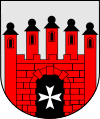
Słońsk
| Słońsk | ||
|---|---|---|
| Village | ||
|
Ruins of the local castle of the Knights Hospitaller | ||
| ||
 Słońsk | ||
| Coordinates: 52°33′46″N 14°48′22″E / 52.56278°N 14.80611°E | ||
| Country |
| |
| Voivodeship | Lubusz | |
| County | Sulęcin | |
| Gmina | Słońsk | |
| Population | 3,000 | |
| Website | http://www.slonsk.pl/ | |
Słońsk pronounced [swɔɲsk] (German: Sonnenburg) is a village in Sulęcin County of the Lubusz Voivodeship, in western Poland. It is located 12 kilometres (7.5 mi) east of the border crossing with Germany along national road DK22. The village lies about 25 kilometres (or 16 miles) northwest of Sulęcin and 36 kilometres (22 mi) southwest of Gorzów Wielkopolski.
The village borders Poland's Ujście Warty National Park stretching to the north. Słońsk had town privileges from 1808 to 1947, consequence of a small population size. During the Second World War, Słońsk (Sonnenburg) was the site of a former Nazi concentration camp, now a museum.
History
Present-day Słońsk was founded in the territory once belonging to the Kingdom of Poland and subsequently acquired by the German Margraviate of Brandenburg during the High Middle Ages. Most Slavic inhabitants of the region were gradually Germanicized in the centuries that followed.
Then known as Sonnenburg, the settlement first appears in documents in 1295. The Knights Templar held lands and buildings in the town. In 1312, the Margrave of Brandenburg and the Bishop of Lebus were joint overlords of Sonnenburg. Henning and Arnold von Uechtenhagen later received Sonnenberg as a fief and built the first castle there in 1341. From the 15th century, the town maintained a close connection with the Order of Saint John (the Knights Hospitaller), who had purchased it from Margrave Friedrich I of Brandenburg. The castle became the seat of the Bailiwick of Brandenburg of the Order, which greatly enlarged the town, building a new church (between 1474 and 1522), a new castle (between 1545 and 1564), and a model hospital (in the 19th century).
A severe prison was built in the town in 1832. It held such Polish fighters for independence as Karol Libelt and Bronisław Dąbrowski (the son of General Jan Henryk Dąbrowski). During World War II, defenders of the Poznań citadel were held in the prison after capture, and in 1944 some of the former fighters in the Warsaw Uprising were incarcerated there.

Concentration camp in prewar Słońsk
In 1933, German authorities created Sonnenburg concentration camp, in which such anti-Nazi activists as Carl von Ossietzky and Hans Litten were held.[1]
Before withdrawal, during the night of 30–31 January 1945, the SS executed 819 political prisoners from many European countries at Sonnenburg.[2][3]
After World War II
Sonnenburg (Słońsk) was captured by the Soviet Red Army in the spring of 1945 as the Second World War in Europe drew to a close. During the Potsdam Conference held from 17 July to 2 August 1945 Sonnenburg along with the rest of the recovered territories was awarded to postwar Poland, and renamed legally as Słońsk. Most of the German inhabitants fled ahead of the front or were expelled soon thereafter, as occurred throughout the former eastern territories of Nazi Germany. The town was repopulated with the Poles expelled by the Soviet Union from the formerly Polish territories of Kresy Wschodnie, and by settlers from central Poland. In 1947 Słońsk lost its town rights and was given the status of a village due to small population size.[2]
Słońsk photo gallery
-
.jpg)
Słońsk town-centre
-
.jpg)
Słońsk city hall
-

Town of Sonnenburg by Matthäus Merian
-

Słońsk castle before destruction
-
One of the city's streets
References
- ↑ Jean-Michel Palmier, Weimar in exile: the antifascist emigration in Europe and America, Verso, 2006 ISBN 1-84467-068-6, p. 41. Google Books
- 1 2 History of Słońsk
- ↑ Biuletyn Głównej Komisji Badania Zbrodni Przeciwko Narodowi Polskiemu Instytutu Pamięci Narodowej, Wrasaw, 1994, p. 273 Google Books
Literature
- Paul von Niessen: Die Johanniterordensballei Sonnenburg und Markgraf Johann von Brandenburg. (=Schriften des Vereins für Geschichte der Neumark. 29/30). Landsberg/Warthe 1913.
| ||||||||||||
Coordinates: 52°33′46″N 14°48′22″E / 52.56278°N 14.80611°E
|

