Shiriya River
| Shiriya (ശിരിയ) | |
| River | |
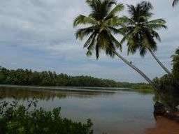
 A view of Shiriya river | |
| Country | |
|---|---|
| States | Kerala, Karnataka |
| Tributaries | |
| - right | Kallajethodu, Kanyanathodu, Erramatti Hole |
| Cities | Badoor village at Kozhikode, Kumbla at Kasaragod |
| Source | Anekundi Reserve Forest in Karnataka |
| - location | Karnataka, India |
| - elevation | 230 m (755 ft) |
| Length | 67 km (42 mi) |
| Basin | 587 km2 (227 sq mi) |
Shiriya River, called Kambaru River flowing near Kambaru Temple flows through Badoor village at Kozhikode and Kumbla a small town located 11 km north of Kasaragod town, in Kasaragod District, Kerala. Shiriya River, called Kambaru River flowing near Kambaru Temple, joins the Arabian sea between Kumbla and Uppala. River Shiriya and a few more minor rivers come together to form the Kumbala estuary some 10 km north of Kasaragod town.[1]
It hosts a range of flora and fauna that are inevitable for the life of the local people here. The estuary has many types of mangroves and associated plants and attracts a lot of migrant and resident birds, fish and crustaceans. Both side of the river is naturally at low level and cultivation of paddy, coconut,supari and banana was in practice. As the high cost of labour and availability had given bad effect on agriculture the land left barren . This river was rich in very good kind of fish and a clean blue water.
References
- ↑ "Bridge across the Shiriya river in ruins". India: The Hindu. 2015. Retrieved 27 May 2015.