Shenbei New Area
| Shenbei 沈北新区 | |||||||||||||||||||||||||||||||||||||||
|---|---|---|---|---|---|---|---|---|---|---|---|---|---|---|---|---|---|---|---|---|---|---|---|---|---|---|---|---|---|---|---|---|---|---|---|---|---|---|---|
| District | |||||||||||||||||||||||||||||||||||||||
 Shenbei Location in Liaoning | |||||||||||||||||||||||||||||||||||||||
| Coordinates: 42°02′49″N 123°31′50″E / 42.0469°N 123.5305°ECoordinates: 42°02′49″N 123°31′50″E / 42.0469°N 123.5305°E[1] | |||||||||||||||||||||||||||||||||||||||
| Country | People's Republic of China | ||||||||||||||||||||||||||||||||||||||
| Province | Liaoning | ||||||||||||||||||||||||||||||||||||||
| Sub-provincial city | Shenyang | ||||||||||||||||||||||||||||||||||||||
| Area[2] | |||||||||||||||||||||||||||||||||||||||
| • Total | 878 km2 (339 sq mi) | ||||||||||||||||||||||||||||||||||||||
| Population (2010) | |||||||||||||||||||||||||||||||||||||||
| • Total | 423,323 | ||||||||||||||||||||||||||||||||||||||
| • Density | 480/km2 (1,200/sq mi) | ||||||||||||||||||||||||||||||||||||||
| Time zone | China Standard (UTC+8) | ||||||||||||||||||||||||||||||||||||||
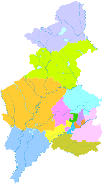
| Shenyang district map | |||||||||||||||||||||||||||||||||||||||
| |||||||||||||||||||||||||||||||||||||||
Shenbei New Area (simplified Chinese: 沈北新区; traditional Chinese: 沈北新區; pinyin: Shěnběi Xīn Qū) is a development zone and one of nine districts of Shenyang, the capital of Liaoning province, People's Republic of China, and forms part of the northern suburbs. It borders Dongling District to the southeast, Dadong District and Huanggu District to the south, Yuhong District to the southwest, Xinmin City and Faku County to the northwest; it also borders the prefecture-level cities of Tieling to the northeast and Fushun to the southeast.
References
- ↑ Google (2014-07-02). "Shenbei" (Map). Google Maps. Google. Retrieved 2014-07-02.
- ↑ 分地区土地面积和人口密度 (2012年末) (in Chinese). Shenyang Statistics Bureau. Retrieved 6 July 2014.
- www.xzqh.org (Chinese)
External links
| ||||||||||||||||||||||||||||||||||||||||||||||||||||||||||||||||||
| ||||||||||||||||||||||||||||||
This article is issued from Wikipedia - version of the Friday, January 22, 2016. The text is available under the Creative Commons Attribution/Share Alike but additional terms may apply for the media files.
