Scottsdale, Arizona
| Scottsdale, Arizona | |||
|---|---|---|---|
| City | |||
| City of Scottsdale | |||
|
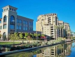
Downtown Scottsdale Waterfront | |||
| |||
| Nickname(s): "The West's Most Western Town" (official) | |||
 Location in Maricopa County, Arizona, USA | |||
 Scottsdale, Arizona Location in the United States | |||
| Coordinates: 33°30′N 111°56′W / 33.500°N 111.933°WCoordinates: 33°30′N 111°56′W / 33.500°N 111.933°W | |||
| Country | United States | ||
| State | Arizona | ||
| County | Maricopa | ||
| Incorporated | 1951 | ||
| Government | |||
| • Type | Council-Manager | ||
| • Mayor | Jim Lane (R) | ||
| Area | |||
| • Total | 184.2 sq mi (477.7 km2) | ||
| • Land | 184.0 sq mi (477.1 km2) | ||
| • Water | 0.2 sq mi (0.6 km2) | ||
| Elevation | 1,257 ft (380 m) | ||
| Population (2010)[1] | |||
| • Total | 217,385 | ||
| • Estimate (2014)[2] | 230,512 | ||
| • Rank | US: 95th | ||
| • Density | 1,305.2/sq mi (503.3/km2) | ||
| Time zone | MST (no DST) (UTC-7) | ||
| ZIP codes | 85250-85271 | ||
| Area code(s) | 480 | ||
| FIPS code | 04-65000 | ||
| GNIS ID | 11029[3] | ||
| Website |
www | ||
Scottsdale (O'odham: Vaṣai S-vaṣonĭ; Yaqui: Eskatel) is a city in the eastern part of Maricopa County, Arizona, adjacent to the Greater Phoenix Area. Named Scottsdale in 1894 after founder Winfield Scott and incorporated in 1951 with a population of 2000, the 2014 population of the city is estimated to be 230,512 according to the U.S. Census Bureau.[4] The New York Times described downtown Scottsdale as "a desert version of Miami's South Beach" and as having "plenty of late night partying and a buzzing hotel scene".[5] Its slogan is "The West's Most Western Town".[6]
Scottsdale, 31 miles long and 11.4 miles wide at its widest point, shares boundaries with many other municipalities and entities. On the west, Scottsdale is bordered by Phoenix, Paradise Valley, and unincorporated Maricopa County land. Carefree is also located along the western boundary, as well as sharing Scottsdale's northern boundary with the Tonto National Forest. To the south Scottsdale is bordered by Tempe. The southern boundary is also occupied by the Salt River Pima-Maricopa Indian Community, which also extends along the Eastern boundary, which also borders Fountain Hills, the McDowell Mountain Regional Park and more unincorporated Maricopa County land.[7]
History
Pre-European history
The area which would include what would become Scottsdale was originally inhabited by the Hohokam, from approximately 300 BC to 1450 AD.[8] This ancient civilization farmed the area and developed a complex network of canals for irrigation which was unsurpassed in pre-Columbian North America.[9] At its peak, the canals stretched over 250 miles, many of which built remains extant today, some having been renovated and put back into use in the 20th Century. Under still-mysterious circumstances, the Hohokam disappeared around 1450 or 1500, the most likely theory having to do with a prolonged drought. The later occupants of the area, the Pima and O'odham (also known as the Papago), are thought to be the direct descendants of the Hohokam people.[9]
Before European settlement, Scottsdale was a Pima village known as Vaṣai S-vaṣonĭ, meaning "rotting hay."[10] Some Pima remained in their original homes well into the 20th century. For example, until the late 1960s, there was a still-occupied traditional dwelling on the southeast corner of Indian Bend Road and Hayden Road. Currently, those Pima who live within Scottsdale reside in newer homes rather than traditional dwellings. Many Pima and Maricopa people continue to reside on the Salt River Pima-Maricopa Indian Community, which borders Scottsdale directly to the south and east.[11]
Early history and establishment
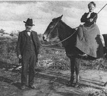
In the early to mid 1880s, U.S. Army Chaplain, Winfield Scott, visited the Salt River Valley and was impressed with the region, and its potential for agriculture.[12] Returning in 1888 with his wife, Helen, he purchased 640 acres for the paltry sum of $3.50 ($92 as of 2016) [13] an acre for a stretch of land where Downtown Scottsdale is now located.[14] Winfield and his brother, George Washington Scott, became the first residents of the town, which was then known as Orangedale, due to the large citrus groves planted by the Scott brothers, who were known as adept farmers, capable of cultivating citrus fruits, figs, potatoes, peanuts and almonds in the desert town.[15][16] Many of the community's original settlers, recruited by Scott from the East and Midwest, were educated and had an appreciation for cultural activities.[12] The town's name was changed to Scottsdale in 1894, after its founder.[14]

In 1896, these settlers established the Scottsdale Public School system,[12] and opened the first schoolhouse, which was followed by the opening of the first general store by J.L. Davis, which also housed the first post office for Scottsdale in 1897.[14][15][17] In the early 1900s the community supported a thriving artists and writers culture,[12] culminating in the opening of the region's first resort in 1909, the Ingleside Inn, located just south of the Arizona Canal and west of the Crosscut Canal (Indian School Road at about 64th Street) in what is today Scottsdale.[18][19] Also in 1909, Cavalliere's Blacksmith Shop opened in downtown Scottsdale, and the original schoolhouse was replaced by the much more expansive Little Red Schoolhouse, which remains standing to this day.[20] While not in its original building, Cavalliere's has been in continuance operation since that time.[21]
In 1912, both the Phoenix Street Railway Company and a competitor, the Salt River Valley Electric Railway Company, proposed building streetcar lines to Scottsdale[22] but due to an economic downturn, neither was built.
Between 1908 and 1933, due to the construction of the Granite Reef and Roosevelt dams (in 1908 and 1911, respectively), Scottsdale's population experienced a boom, growing steadily during those years, and Scottsdale became a small market town providing services for families involved in the agricultural industry.[12]
During the First World War Scottsdale and its environs supported a large cotton farming industry, which was due to the creation of Long Staple Egyptian Cotton, developed by the US Department of Agriculture. Although cotton is still grown in southern Arizona, Scottsdale's cotton boom ended with the loss of government contracts at the end of the war.[23]

In 1920, a second resort was opened on 12 acres of the property owned by the artist Jessie Benton Evans. Called the Jokake Inn, meaning "mud house", the structure still stands on the grounds of the world famous Phoenician Resort.[12][14][24]
The Depression years saw an influx of artists and architects to Scottsdale, which included, in 1937, the internationally renowned Frank Lloyd Wright. In 1937, Wright and his wife purchased 600 desert acres at the foot of the McDowell Mountains and established what is now known as Taliesin West, his winter home and his architectural firm's Southwestern headquarters.[12][14][25] Scottsdale and the rest of Phoenix have seen an everlasting influence from Frank Lloyd Wright. Many buildings throughout the region were designed by the famous architect. His significant influence on the regional architecture is commemorated through a major street which bears his name and a 125-foot (38 m) spire memorial designed by Wright himself in North Scottsdale.[26]
World War II and the post-war years
Among the more significant events during the years of World War II was the opening of Thunderbird II Airfield in 1942 (later became Scottsdale Airport),[27] where 5,500 pilot cadets received their primary flight training before the war's end. Scottsdale also was the site of a German prisoner of war camp at the current intersection of Scottsdale and Thomas Roads in what today is Papago Park,.[12][28]
In 1950, the town continued to grow as Motorola became the first of many technology companies to build a plant in Scottsdale. They would follow with a second plant in 1956.[12]
With a population of approximately 2000, the city was incorporated on June 25, 1951. The city appointed its first mayor, Malcolm White, and adopted the motto, "The West's Most Western Town".[12] The seal, depicting a mounted cowboy surrounded by a 64-pointed starburst, was designed by Mrs. Gene Brown Pennington.[29]
Development of Indian Bend Wash, 1950s–1970s
The town began a period of rapid population growth after its incorporation in 1951, growing from 2000 to 10,000 residents during the 1950s.[12] This growth necessitated development into the flood plain known as the Indian Bend Wash. Flood plains throughout history have been enticing locations for development due to their flatness, ease of building and inexpensiveness. This is even more temptation in a desert environment, when flooding so rarely happens. As Scottsdale expanded, the Indian Bend Wash virtually bisected the city in half north to south. In the late 1950s, the problem became more and more pronounced, until in 1959 the Maricopa County Flood Control District (MCFCD) was formed by the Arizona State Legislature. The MCFCD became the lead player for developing a comprehensive flood plan for the entire county.[30]
At the same time, the Army Corps of Engineers also began to look into the problems of flooding in Maricopa County. Over the course of the next several years, they would present several plans, all of which revolved around constructing concrete canals and levees to channel and divert the flood waters, as well as building bridges over the canal, similar to the storm drains of Los Angeles. However, during MCFCD meetings held between 1961 and 1963, a different course of action was being developed. This plan would become known as the multi-use, or Greenbelt, concept. The two concepts were at odds with one another until the canal plan was defeated in a bond referendum in 1965. In 1966 a study was commissioned which validated the Greenbelt concept as a way to prevent flood damage. After a major flood in 1972, work on the Greenbelt project began in earnest, and continued through 1984, by which point the major Greenbelt was completed, although minor projects continue through the current day.[30] Today, the 12-mile (19 km) long Scottsdale Greenbelt connects four city parks — Vista del Camino Park, Eldorado Park, Indian School Park and Chaparral Park — through a 25-mile (40 km) bike path.
Further expansion and development, 1970s–1980s
The 1960s and 70s continued to see the city's growth, the population exploding to almost 68,000 by 1970.[31] Most of the unused property within the city limits was to the north, so that was the direction in which the city expanded. The city, which in 1959 had spanned 5 square miles, had expanded its borders to now encompass 62 square miles.[12] Large ranch tracts covered huge areas in the northern part of the city. One of the largest of these was the McCormick ranch, a 4,236 acre ranch serving much of the eastern boundary of Scottsdale and was owned by Fowler and Anne McCormick. Fowler's paternal grandfather was Cyrus McCormick, the inventor of the grain reaper, and his maternal grandfather was John D. Rockefeller.[32] When Anne died in 1970, the property was sold to Kaiser-Aetna for $12.1 million.[33] This started a series of large-scale, master planned communities within the borders of Scottsdale, some of which included Scottsdale Ranch (1978),[34] Gainey Ranch (1980),[32] McDowell Mountain Ranch (1992),[35] Desert Mountain (1986),[36] and DC Ranch (1990s).[37]
In 1975, the "east Shea" section, bordering Fountain Hills, was annexed by the city, expanding its area from 62.2 square miles to 88.6 square miles. This was followed by a four-year period from 1981 to 1984 during which the city annexed almost 80 additional square miles.[31]
Faced with this rapid expansion and growth, many residents became concerned about losing their southwestern scenery. The McDowell Sonoran Conservancy was born in 1991.[38] Teaming with developers, a plan was developed to set aside the McDowell Mountains and adjoining areas in a huge preserve. In 1995, the citizens of Scottsdale voted to implement a sales tax to purchase acreage for this purpose. When completed, the 36,000 acres planned for the McDowell Sonoran Preserve will be nearly one-third of Scottsdale's land area, equal in size the Bryce Canyon National Park.[12][37]
Superfund
From the 1950s through the 1970s, several large manufacturing companies in the Scottsdale and Tempe areas used the solvent trichloroethylene (TCE) in their manufacturing and operating processes.[39] In 1981, TCE began to show up in two Scottsdale drinking wells, and in 1983, the Indian Bend Wash superfund site was listed on the Environmental Protection Agency's National Priorities List.[39] Physical construction of environmental remediation systems was completed by 2006, with soil cleanup expected to be completed in five years and groundwater cleanup completed in 30 years.[39]
Sign ordinance, and other civic innovations
To the dismay of many businesses, in the early 1970s, the city passed one of the earliest sign ordinances, restricting the size and height of signs and billboards. The city stated it was protecting the safety of its residents, which it claimed were getting into traffic accidents craning their necks to see higher signs. The ordinance was highly controversial at the time and the city was taken to the U.S. Supreme Court, but now such ordinances are common. Scottsdale also contracted out its fire department in what was to be a wave of the privatization of operations of city government that never materialized. Afraid of lawsuits if it used the red color of firetrucks of other cities in the U.S., the company that took over the contract painted the fire engines chartreuse. The city also developed the first robot arm garbage truck, replacing crews who dumped cans into a train of open trailers pulled by a truck, with a single operator sitting in an air conditioned cab.[40]
Modern
From its official incorporation in 1951 with a population of 2000, the city of Scottsdale has grown to a 2010 Census of 217,385. It is now the state's sixth-largest city. Scottsdale is commonly defined by its high quality of life, and in 1993 was named the "Most Livable City", in the United States by the United States Conference of Mayors.[41] It is continually ranked as one of the premier golf and resort destinations in the world,[42][43][44][45][46][47] with a sizable portion of tax revenue being derived from tourism. It is also home to the Phoenix Open Golf Tournament held at the Tournament Players Club every year and the Barrett-Jackson car show held at WestWorld.
Geography
The city is located in the Salt River Valley, or the, "Valley of the Sun", in the northern reaches of the Sonoran Desert. Scottsdale, 31 miles long and 11.4 miles wide at its widest point, shares boundaries with many other municipalities and entities. On the west, Scottsdale is bordered by Phoenix, Paradise Valley, and unincorporated Maricopa County land. Carefree is also located along the eastern boundary, as well as sharing Scottsdale's northern boundary with the Tonto National Forest. To the south Scottsdale is bordered by Tempe. The southern boundary is also occupied by the Salt River Pima-Maricopa Indian Community, which also extends along the Eastern boundary, which also borders Fountain Hills, the McDowell Mountain Regional Park and more unincorporated Maricopa County land.[7]
According to the United States Census Bureau, the city has a total area of 184.4 square miles (478 km2). 184.2 square miles (477 km2) of it is land and 0.2 square miles (0.52 km2) of it (0.12%) is water.
Cityscape
The city is loosely divided into four areas: South Scottsdale (McKellips Road north to Thomas Road),[48] Old Town (Downtown) Scottsdale, Central Scottsdale (also known as the "Shea Corridor", extending from Camelback Road north to Shea Boulevard), and North Scottsdale. The real estate market in Scottsdale is among the most expensive in the United States. In 2005, Scottsdale was among the top ten markets in the nation for luxury home sales, and one of two cities outside of California. Scottsdale was ranked tenth with $594 million in luxury home sales.[49]

South Scottsdale has for many years been the working class region of Scottsdale. The median resale home price is $291,500, compared to $667,450 in North Scottsdale.[50] A portion of McDowell Road in South Scottsdale used to be known as "Motor Mile", having at one time 31 dealerships represented along the street. The strip, at one time, generated over $10 million in sale tax revenue each year and was one of the most profitable auto-miles in the United States. In recent years, many of these dealerships have left the city, including 6 in 2008 alone.[51][52] South Scottsdale is the home to a new research center for Arizona State University, known as SkySong, a collaboration between the university, local business, and global companies.[53] The development has attracted the research and development arms of a number of international corporations.[54]
Old Town Scottsdale is an area with many streets, old fashion stores, restaurants, bars, nightclubs, and art galleries. It contains the major nightlife for the area and is a major art center of metro Phoenix. Scottsdale's main cultural district is also in this area, which includes the high-end Scottsdale Fashion Square Mall, one of the twenty largest malls in the United States,.[55] The district has currently seen a revival, with new condominiums and hotels under construction.

The Shea Corridor is so named because it is in close proximity to the east-west running Shea Boulevard. The homes in this region were generally built during the 1970s. Real estate in the Shea Corridor (Central Scottsdale) has increased during the 1990s, and overall, the Phoenix-Mesa-Scottsdale real estate market saw the largest gain in home prices in the nation during the mid-2000s with a 38.4% increase in value.[56] There are a number of communities in this central region of Scottsdale that remain among the most highly desired residential areas in the metropolitan area, including Gainey Ranch and McCormick Ranch. A large portion of Scottsdale Road in the Shea Corridor has been dubbed the Resort Corridor for the high number of resorts locating on the street. The second Ritz Carlton in the Phoenix metropolitan area will be constructed along this corridor.[57][58]
North Scottsdale is currently the most actively developed area of Scottsdale as it was historically the least built up. This portion of the city also claims many of the most expensive homes in Arizona, with many exceeding $5 million in value. The city's borders are rapidly expanding to the east and west in this area, containing the McDowell Mountain range. Much of the residential boom in North Scottsdale is driven by available land to build coupled with the fast growth of Scottsdale Airpark, the second largest employment center in the Phoenix metropolitan, and estimated to become the largest by 2010.[59] The Scottsdale Airpark, home to over 55,000 employees, 2,600 businesses and 23,000,000 square feet (2,100,000 m2) of office space is expected to continue growing by over 3,000 employees per year.[60] Many important companies are headquartered or have regional headquarters in the park, including AXA, GE Capital, DHL, Discount Tire Company, Fidelity Investments, JDA Software, GoDaddy.com, The Vanguard Group, And Quicken Loans.
Climate
Scottsdale's climate is arid. Winters are mild and summers are extremely hot. The lowest temperature ever recorded in the city is 19.0 °F (−7.2 °C), on February 20, 1955, and the highest temperature ever recorded was 119 °F (48 °C), on June 26, 1972.[61]
| Climate data for Scottsdale | |||||||||||||
|---|---|---|---|---|---|---|---|---|---|---|---|---|---|
| Month | Jan | Feb | Mar | Apr | May | Jun | Jul | Aug | Sep | Oct | Nov | Dec | Year |
| Record high °F (°C) | 87 (31) |
92 (33) |
99 (37) |
105 (41) |
112 (44) |
119 (48) |
118 (48) |
119 (48) |
113 (45) |
108 (42) |
95 (35) |
85 (29) |
119 (48) |
| Average high °F (°C) | 69 (21) |
73 (23) |
78 (26) |
86 (30) |
95 (35) |
103 (39) |
105 (41) |
103 (39) |
100 (38) |
89 (32) |
78 (26) |
68 (20) |
87.3 (30.8) |
| Daily mean °F (°C) | 54 (12) |
58 (14) |
62 (17) |
69 (21) |
78 (26) |
86 (30) |
90 (32) |
89 (32) |
84 (29) |
73 (23) |
62 (17) |
53 (12) |
71.5 (22.1) |
| Average low °F (°C) | 39 (4) |
42 (6) |
46 (8) |
52 (11) |
60 (16) |
68 (20) |
75 (24) |
75 (24) |
68 (20) |
56 (13) |
45 (7) |
38 (3) |
55.3 (13) |
| Record low °F (°C) | 20 (−7) |
19 (−7) |
24 (−4) |
30 (−1) |
35 (2) |
45 (7) |
53 (12) |
52 (11) |
45 (7) |
26 (−3) |
23 (−5) |
20 (−7) |
19 (−7) |
| Average precipitation inches (mm) | 1.08 (27.4) |
1.20 (30.5) |
1.11 (28.2) |
0.28 (7.1) |
0.14 (3.6) |
0.03 (0.8) |
1.06 (26.9) |
1.36 (34.5) |
0.68 (17.3) |
0.64 (16.3) |
0.69 (17.5) |
1.10 (27.9) |
9.37 (238) |
| Mean monthly sunshine hours | 257.3 | 259.9 | 319.3 | 354.0 | 399.9 | 408.0 | 378.2 | 359.6 | 330.0 | 310.0 | 255.0 | 244.9 | 3,876.1 |
| Source: Weather.com[62] | |||||||||||||
Demographics
| Historical population | |||
|---|---|---|---|
| Census | Pop. | %± | |
| 1920 | 1,047 | — | |
| 1930 | 2,761 | 163.7% | |
| 1950 | 2,032 | — | |
| 1960 | 10,026 | 393.4% | |
| 1970 | 67,823 | 576.5% | |
| 1980 | 88,622 | 30.7% | |
| 1990 | 130,075 | 46.8% | |
| 2000 | 202,705 | 55.8% | |
| 2010 | 217,385 | 7.2% | |
| Est. 2014 | 230,512 | [63] | 6.0% |
| U.S. Decennial Census[64] 2014 Estimate[2] | |||
As of the census of 2010, there were 217,385 people, there are 69,967 owner-occupied housing, 32,306 renter occupied, and 101,273 households residing in the city. The population density was 1,181.4 inhabitants per square mile (455.6/km²). There were 124,001 housing units at an average density of 673.9 per square mile (259.9/km²). The racial makeup of the city was 89.27% White, 1.67% Black or African American, 0.80% Native American, 3.33% Asian, 0.09% Pacific Islander, 2.54% from other races, and 2.28% from two or more races. 8.84% of the population were Hispanic or Latino of any race.
There were 101,290 households out of which 20.0% had children under the age of 18 living with them. According to the 2010 census 51.7% of Scottsdale's population were females, while 48.3% were males. In the city the population was spread out with 17.7% under the age of 18, 5.0% from 20 to 24, 32.6% from 25 to 49, 22.8% from 50 to 64, and 19.9% who were 65 years of age or older. The median age was 42 years.
According to a 2007 estimate, the median income for a household in the city was $70,533, and the median income for a family was $92,289. The per capita income for the city was $49,158. About 3.4% of families and 5.8% of the population were below the poverty line, including 5.4% of those under age 18 and 5.9% of those age 65 or over.
Religion
Scottsdale is home to a large number of churches, chapels, temples, synagogues, mosques and other places of religious worship. Though the majority of Scottsdale residents consider themselves of, or practicing of, the Christian faith(s) - including Protestant and Roman Catholic - the city's high population growth over the years has resulted in a more diverse population. Most notably, greater numbers of Eastern Orthodox and Jews have been added to the population. Though smaller in number, Muslim, Hindu, Sikh and Buddhist communities also exist within the city of Scottsdale. There is also a small population of members of The Church of Jesus Christ of Latter-day Saints (Mormons), as is common throughout Phoenix, Arizona, and the Western United States.
The first church founded in Scottsdale was the First Baptist Church of Scottsdale, which was built by Scott and his family. The church has named a small non-profit coffee shop on the corner of their campus after Scott, called Winfield's.
Congregation Beth Israel, the oldest Reform Judaism congregation in the Phoenix metropolitan area is located in Scottsdale,[65] and is the largest congregation in Arizona.[66]
In North Scottsdale, there is the Jewish Community Center of Phoenix and the New Shul. The community center was originally located in central Phoenix, it had eventually outgrown the location and was looking to relocate and build a more expansive campus. The New Shul is an egalitarian synagogue, unaffiliated with any Jewish religious movements. The spiritual leaders are Rabbi Michael Wasserman and Rabbi Elana Kanter.
Recently, a new Armenian Apostolic church was built in the city, representing the larger numbers of Armenians in the Phoenix Metropolitan Area.
Economy
The tourism industry is Scottsdale's primary employer, accounting for 39% of the city's workforce. In 2005, Scottsdale attracted over 7.5 million visitors to the city, providing an economic impact of over $3.1 billion.[67] The city of Scottsdale by itself is home to more than 70 resorts and hotels, boasting over 15,000 hotel rooms. This large hospitality market primarily caters to a higher-end, white-collar demographic.
The city of Scottsdale is tied with Atlanta for fourth, after New York City, Las Vegas, and Chicago respectively, as having the most AAA Five-Diamond hotels and resorts in the United States. In 2015, AAA bestowed four such properties in Scottsdale with the highest honor: The Phoenician, The Canyon Suites, Four Seasons Resort Scottsdale at Troon North, and the Fairmont Princess Resort and Spa.[68]
Scottsdale boasts the highest number of destination spas per capita of any city in the United States.[69]
The region's year-round warm weather and abundant sunshine is a major factor in Scottsdale's tourism appeal. In particular, during the winter, thousands of wealthy tourists from the midwest, the northeast, and as far away as Canada, flood the area with long-term visits (known locally as "snowbirds"). These tourists, who often practice the same migration routine annually, often end up purchasing second homes in the area.[70]
Over the past several years however, Scottsdale's growing abundance of trendy, high-end nightlife, upscale restaurants, art galleries and luxury shopping, has made it a highly popular travel destination for the younger, white-collar, more style-conscious, travel set.
The famed Mayo Clinic has one of its three major branches in Scottsdale.[71] This and its resulting effects have made Scottsdale a strong destination nationally for medical care.
The aviation industry has also grown in Scottsdale, with the construction of Scottsdale Airport in North Scottsdale, in the 1960s. Today, it is one the busiest single-runway airports in the United States in terms of aircraft operations. Though there is little to no commercial air service, nearly all operations are corporate or general aviation.
The immediate area surrounding the Scottsdale Airport, known locally as the Airpark, has developed rapidly as a regional center of commerce. By 2004, the Airpark had grown to become the second-largest employment center in the Phoenix Metropolitan Area, with over 50,000 people being employed within a few-mile radius of the airport itself — notably in financial, retail, service, technological, design and manufacturing fields. The Airpark houses more nearly 2,500 individual businesses, with a combined economic impact of over $3 billion annually, and growing.
The largest employment center in the Phoenix Metropolitan Area is the combined central areas of Midtown and Downtown Phoenix, with an estimated 65,000 employees. Considering the many large, yet-to-be-developed parcels and opportunities for growth in and around the still highly desired Airpark area in North Scottsdale, it is expected to overtake the central Phoenix markets in the near future, becoming the single largest center of employment in the Phoenix Metropolitan Area.
Among the companies headquartered in Scottsdale are APL, Dial, Discount Tire, Fender, Go Daddy, JDA Software, Kahala, Kona Grill, Magellan Health, Medicis, Paradise Bakery & Café, P.F. Chang's China Bistro, Rural Metro, Taser, and United Blood Services.
Top employers
According to the City's 2014 Comprehensive Annual Financial Report,[72] the top employers in the city are:
| # | Employer | # of Employees |
|---|---|---|
| 1 | Honor Health | 6,134 |
| 2 | General Dynamics C4 Systems | 2,929 |
| 3 | Scottsdale Unified School District | 2,583 |
| 4 | City of Scottsdale | 2,446 |
| 5 | The Vanguard Group | 2,186 |
| 6 | Mayo Clinic | 1,851 |
| 7 | Scottsdale Insurance Company | 1,501 |
| 8 | International Cruise & Excursions, Inc. (ICE) | 1,350 |
| 9 | CVS Caremark | 1,088 |
| 10 | McKesson | 1,000 |
Arts and culture

In 2005, the city's annual Scottsdale Arts Festival was ranked the number-one such event in United States by American Style Magazine.[73]
The highest concentrations of galleries, studios and museums that are open to the public can be found in Downtown Scottsdale. Its Scottsdale Arts District can be segmented into three distinct districts. The largest is the Scottsdale Main Street Arts District, home to the largest and most diverse collection of styles and genres, the more contemporary Marshall Way Arts District, and the more touristy and western-themed Old Town district, which has the Scottsdale Museum of Contemporary Art. The very popular Scottsdale Artwalk is held weekly, every Thursday evening.
Scottsdale's affluent culture has been depicted by shows such as MTV's My Super Sweet 16, which filmed an episode in the area in 2006, and by the short-lived CBS reality show Tuesday Night Book Club.[74][75]
Annual cultural events and fairs

"The West's most western town" prides itself in its rich Western history, preserving while heavily promoting its plethora of "western" activities and events. The Scottsdale Arabian Horse Show has taken place since 1955. Today, the show attracts thousands of visitors and tourists, to see nearly 2000 purebred Arabian and Half-Arabian horses competing for various prizes and recognition. The show also features over 300 vendors and exhibitions, and over 25 demonstrations and shows.[76]
Perhaps the most famous present-day "cowboy" event is the Scottsdale Jaycees Parada del Sol, an annual month-long event that has been held in Scottsdale since 1954. Originally named The Sunshine Festival, the PRCA Rodeo was added in 1956. Cowboys and cowgirls from across the nation converge in Scottsdale to participate in this cultural and historical event. The event begins each year with the Parada del Sol Parade, the world's largest horse-drawn parade with over 150 entries in any given year.[77]
Since 1971, Scottsdale has been home to the Barrett-Jackson Auto Show. Due to the success of this week-long event held every January, the organizers behind it have more recently inaugurated similar but smaller shows in Palm Beach, Florida and Las Vegas, Nevada. Now held at the expansive West World exhibition complex in North Scottsdale, the event is an auto enthusiast's and collector's spectacle. The show is known for featuring both exotic, luxury automobiles and historic vehicles which have been expertly restored to mint condition.
Since 2007, Scottsdale has been hosting low and high fashion shows in the annual Scottsdale Fashion Week[78] (not quite comparable to those of New York City), including popular department store line fashion designers and some higher end ones during the month of November.
In what is considered to be the longest continually running festival of its kind in the nation, the Scottsdale Culinary Festival is held annually during April. Though many of its individual events are held city-wide, they concentrate in the downtown area. Entirely, it is estimated that the week-long festival draws over 40,000 people.[79] The most heavily attended such event is the festival's Great Arizona Picnic, an outdoor fair-like showcase of both well-known local and national chefs and restaurants. It is held on the lawn of the Scottsdale Civic Center Mall.
The annual Scottsdale International Film Festival, concentrates in the use of film to foster of the world's cultures, lifestyles, religions, and ethnicities.
Museums and art galleries

Scottsdale is home to more than 125 professional art galleries and studios, one of the highest per-capita anywhere in the nation.[80] The city has quickly become a center for art in the United States. According to the Scottsdale Convention & Visitor's Bureau and American Style Magazine, the city has become one of the country's largest art markets, usually only sharing ranks with New York City, New York and Santa Fe, New Mexico in terms of commerce generated as a direct result of art sales and purchasing.
Its galleries and studios are most famous for their western and Native American themed art, though a growing devotion to the contemporary arts has taken hold over the past couple of decades – an element most visible by the large number of modern art galleries which have opened along the Marshall Way Arts District, and the opening of the Scottsdale Museum of Contemporary Art (also referred to as SMoCA) in 1999. Both are located in Downtown Scottsdale.[81] Located in the touristy Old Town district of Downtown Scottsdale, the Scottsdale Civic Center Mall is home to the intimate two-theater Scottsdale Center for the Performing Arts, the Scottsdale Historical Museum, as well as the Scottsdale Museum of Contemporary Art. SMoCA is the only permanent museum dedicated solely to the contemporary arts in the state of Arizona. Also located in Old Town, Western Spirit: Scottsdale's Museum of the West opened in January 2015, featuring historical and cultural exhibits from 19 states of the American West, including Arizona.[82]
Taliesin West, famed architect Frank Lloyd Wright's winter home and school from 1937 until 1959, is now one of the most popular tourist attractions in Arizona. The complex is located in the northeast fringe of the city, at the base of the McDowell Mountains.
Shopping
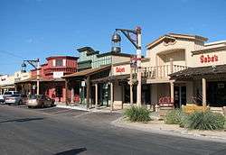
The city is home to corporate retail outlets, as well as independent boutiques.
There are many shopping areas within the city of Scottsdale, ranging from small districts to large centers. The most notable regional centers include the Kierland Commons in North Scottsdale, and the Scottsdale Fashion Square in Downtown Scottsdale, a major destination for high-end retailers. These shopping centers (and others) in Scottsdale claim dozens of marquee brands that are unique to both Phoenix and the Southwestern region.
At nearly 2 million square feet, the Scottsdale Fashion Square is routinely ranked as one of the most profitable shopping malls per square foot in the Southwest United States. The center is anchored by Nordstrom, Macy's, Neiman Marcus, Dillard's, and Barneys New York department store. The center is also home to retailers Armani Exchange, Burberry, Hugo Boss, Kate Spade, Gucci, Louis Vuitton, L'Occitane en Provence, Tourneau, Swarovski, Juicy Couture, GUESS, Tiffany and Co., Ferragamo, Michael Kors, Jimmy Choo, Cartier, Abercrombie and fitch, Lucky Brand Jeans, Ed Hardy, Prada, Steve Madden, Marciano, Carolina Herrera, Bvlgari, Bottega Veneta, Lacoste and Kenneth Cole among hundreds of others. The center's Tiffany and Co. store, in particular, reported that over the past few years this location earned one of the company's highest sales figures per square foot in the United States. In 2009 Scottsdale fashion Square underwent an expansion and added stores such as H&M, Forever 21, Barneys New York, and True Religion. In addition to these stores it expanded across the street with places like Yogurtland, American Apparel and Urban Outfitters. Currently there are plans for Prada to open within the mall.[83]
The city currently has three additional shopping complexes planned or under construction - Scottsdale Quarter, Palmeraie and One Scottsdale - all of which will be located in North Scottsdale.
One Scottsdale, a collaboration between Macerich and DMB Associates, in particular aims to be the next luxury retail center for the Phoenix-area. In a three-mile (5 km) radius, the center sees an average household income of $110,292, and its 10-mile (16 km) zone has more households earning over $100,000 than several famous retail destinations, including Bal Harbour, Naples, Aspen, and The Hamptons.[84]
Palmeraie, a 300,000-square-foot (28,000 m2), outdoor mixed-use project planned for the SWC of Indian Bend and Scottsdale Rds, has already received commitments from Hermès, Yves Saint Laurent, and John Varvatos.[85][86]
The city also plays host to the annual Scottsdale Fashion Week each November. The event routinely features runway shows from influential local, national and international designers, most recently and notably, Kate Spade, St. John, Betsey Johnson, and Façonnable.
Nightlife

Named by The New York Times as one of the "hippest and most happening" places in the country, Scottsdale is home to a variety of high-end nightclubs, restaurants, hotels, lounges and bars. Over the past decade in particular, these establishments have grown in great numbers, many catering to a more "young, fashion-conscious crowd."[87] This is evident by the growing number of trendy, style-conscious hotels that have opened up throughout Downtown Scottsdale which equally cater to the nightlife crowds. Most notably, the Morgan Hotel Group's all-white Mondrian Hotel (which went out of business), the FireSky Resort & Spa, the independent mid-century Hotel Valley Ho and the W Hotel.
The majority of nightlife is concentrated in Downtown Scottsdale, between Camelback and Osborn roads. This is the most active and popular nightlife destination in the Phoenix Metropolitan Area. Similar to well-known nightclub districts in other major cities, much like Atlanta's Buckhead district and Miami's South Beach, most of Downtown Scottsdale's major bars and clubs are generally located within walking distance, often providing a vibrant and buzzing scene during most evenings. Thursdays through Sundays being the most active, as crowds of over 40,000-strong are known to congregate to this area.[88]
To raise its national nightlife profile further, Scottsdale recently began hosting the annual Scottsdale's Ultimate Block Party on New Year's Eve. The growing New Year's Eve party routinely attracts over 25,000 people.
Indian gaming
Southeast Scottsdale borders the Salt River Pima-Maricopa Indian Community. For several years, the Scottsdale Pavilions, a major outdoor shopping center, marked the only commercial property operating on tribal lands. In 1998, the tribe opened the first permanent casino in the Scottsdale area, Casino Arizona, at Loop 101 and McKellips Road. The success of Casino Arizona led to the construction of a second location, Casino Arizona at Indian Bend, in a temporary facility less than 8 miles (13 km) north.
The passage of Proposition 202 in November 2002 redefined casino gaming in Arizona, permitting "Vegas-style" blackjack and poker, expanded number of slot machines and wider food and beverage service options.[89] Both casinos underwent significant expansions following the passage of Proposition 202, with Casino Arizona at Indian Bend more than doubling in size.
In 2010, the temporary tent facilities hosting the 120,000-square-foot (11,000 m2) Casino Arizona at Indian Bend were deconstructed following the opening of Casino Arizona at Talking Stick Resort. The 240,000-square-foot (22,000 m2) casino is adjoined to the newly constructed 15-story Talking Stick Resort & Spa, which features the Talking Stick golf course, a 36-hole golf course designed by Ben Crenshaw and Bill Coore. Today, the two casinos collectively have over 2,000 slot machines and 100 table games.[90]
Historic properties in Scottsdale
There are numerous properties in the city of Scottsdale which are considered to be historical and have been included either in the National Register of Historic Places[91] or the Scottsdale Historic Register.[92] The gallery at the end of the article contains images of some of these properties with a short description of the same.
Sports and recreation
The city is the spring training home of the San Francisco Giants, who practice at Scottsdale Stadium in Downtown Scottsdale.[93] Scottsdale Stadium also hosts the Scottsdale Scorpions, a minor league baseball team in the Arizona Fall League. In February 2011 the Colorado Rockies and Arizona Diamondbacks began sharing a new spring training facility, Salt River Fields at Talking Stick, located on the city's eastern border with the Salt River Pima-Maricopa Indian Community.
Though none play specifically in the city of Scottsdale, all of the "Big Four" North American major league sports organizations have franchises and play within the Phoenix Metropolitan Area - NBA's Phoenix Suns, NFL's Arizona Cardinals, MLB's Arizona Diamondbacks and NHL's Arizona Coyotes, as well as a WNBA franchise, the Phoenix Mercury.

The city is widely known as a premier destination in the United States for golf. In all, the city is home to more than 200 area courses offering layouts that range from the rolling green fairways of traditional courses, to desert golf designs. In 2006, the Robb Report cited Scottsdale as, "America's Best Place to Live for Golf."[94] The Boulders Resort & Golden Spa and Four Seasons Hotel|Four Seasons Resort Scottsdale at Troon North were selected in 2005 as the second and fourth best golf resorts in the nation by Travel + Leisure Golf magazine.[95] Other notable golf courses in the area include FireRock, Troon North, The Phoenician, and Silverleaf, and Desert Mountain.
Arizona United, a member of the United Soccer Leagues Professional Division, play their home matches at Scottsdale Stadium.
Since 2010, the historic WM Waste Management Phoenix Open Golf Tournament – formerly the FBR Open and Phoenix Open, which originally began in 1932 - is now held annually each January at the Tournament Players Club (or "TPC") in North Scottsdale. The TPC is adjacent to the large Fairmont Scottsdale Resort. It is the largest-attended stop of the annual PGA Tour, attracting well over 500,000 people to the 4-day event alone.
Hiking, rock climbing and other similar outdoor activities are enormously popular throughout the Phoenix-area, in large part to the immediate accessibility of mountain areas within or very near the city limits. Citizens flock ritually to local favorite Camelback Mountain, located in the eastern section of Phoenix, just adjacent to Scottsdale, as well as the McDowell Mountains in the more recently developed McDowell Sonoran Preserve, at the city's northeastern fringes.
Government

Scottsdale is governed by a mayor and city council, all of whom are elected "at large" to represent the entire city. A city manager is responsible for the executive leadership of the city staff, as well as implementing council policies, developing programs and budgets to respond to council goals, and ensuring that citizens receive effective and efficient city services. The city manager also serves as the city treasurer.
The current mayor is Republican Jim Lane.
The distinctive Scottsdale City Hall was designed by architect Bennie Gonzales in 1968, and was designed with an interior kiva for community meetings.[96]
Education
Public education in Scottsdale is provided for by both the Scottsdale Unified School District (SUSD), which serves most of Scottsdale, most of the town of Paradise Valley, as well as parts of Tempe and east Phoenix,[97] and the Paradise Valley Unified School District (PVUSD), which serves northeast Phoenix and North Scottsdale. SUSD serves 25,668 students in 33 schools and employs 3,862, including 1,551teachers.[97] SUSD's 33 schools include five high schools: Arcadia High School, Coronado High School, Chaparral High School, Desert Mountain High School, and Saguaro High School. PVUSD is the 7th largest school district in the state, with approximately 30,000 students and 3,800 employees.[98] It contains 47 schools, including 7 high schools. The high schools which serve portions of Scottsdale are Horizon High School and Pinnacle High School.[99]
The primary institution of higher education in the city is Scottsdale Community College, which opened in 1970 on the Salt River Pima Maricopa Indian Reservation. In 1999, the school opened a second campus in the Scottsdale Airpark allowing it to serve the business community and north Scottsdale. Other institutions of higher education with locations in Scottsdale include the University of Phoenix and the Scottsdale Culinary Institute.[100] Many students at nearby Arizona State University in Tempe also live in Scottsdale and commute.
Scottsdale has a main branch and four branches within the Scottsdale Public Library System.[101][102]
Infrastructure
Freeways
Thanks in large part to State Route 101 – locally known as Loop 101 — the city of Scottsdale has convenient freeway access to nearly every city in the Phoenix Metropolitan Area, the state of Arizona and beyond.
Air
The city is also home to Scottsdale Municipal Airport (IATA: SDL, ICAO: KSDL), a single-runway airport located in North Scottsdale. While the airport serves some tour and commuter flights, the plurality of aircraft operations are corporate and transient general aviation traffic.
Commercial air travel is served by Phoenix Sky Harbor International Airport (IATA: PHX, ICAO: KPHX) in Phoenix and Phoenix Mesa Gateway Airport (IATA: AZA, ICAO: KIWA) in Mesa.

Public transit
Public bus service in the Phoenix Metropolitan Area is operated as Valley Metro, and provides regular bus service.
The city of Scottsdale runs a network of local neighborhood circulators, labeled the "Scottsdale Trolley." Using trolley-replica buses, the public service is free to riders. There are currently two circulating "routes", known individually as the Downtown Trolley and the Neighborhood Trolley. These connect at the Loloma Station transit center in downtown Scottsdale.
The Downtown Trolley circulates through downtown Scottsdale, and the Neighborhood Trolley circulates from downtown Scottsdale to neighborhoods throughout South Scottsdale, connecting with the city of Tempe's own free public circulator, the Tempe Orbit at Roosevelt and Scottsdale Road. From there, riders can transfer onto the Tempe Orbit, and travel to Tempe, including Arizona State University's main campus, and the downtown Tempe, or Mill Avenue, area.[103]
For a time between December 2007 and 2009, Scottsdale was a member of the board of Metro, whose light rail line connects the neighboring cities of Phoenix, Tempe and Mesa.[104] There was a study in 2001, and some discussion since, of extending the light rail line into Scottsdale. The city's Transportation Master Plan[105] identifies Scottsdale Road as the city's high-capacity corridor, which could be light rail, modern streetcar service, or bus rapid-transit (BRT).
A street railway interurban line was proposed to connect Scottsdale with Phoenix, Tempe, and Mesa as early as 1913[106] but was never built; Scottsdale is the largest American city that has never had a rail line.[107]
Utilities
Scottsdale is served by the following utilities:
- Electric: Arizona Public Service and Salt River Project
- Gas: Southwest Gas
- Telephone: CenturyLink QC
- Water: City of Scottsdale, Global Water Resources
Notable people
Sister cities
Scottsdale has six sister cities, as designated by Sister Cities International: [108]
-
 Álamos (Mexico)
 -
 Cairns, Queensland (Australia)
 -
 Interlaken (Switzerland)
 -
 Haikou (China)
 -
 Kingston (Canada)
 -
 Marrakech (Morocco)
Gallery of historic buildings
- Historic Scottsdale, Arizona (NRHP = National Register of Historic Places)
-

Scottsdale Grammar School, a.k.a. "The Litte Red Schoolhouse", built in 1909 (NRHP). This was the first permanent school in Scottsdale with classrooms for grades one through eight.
-

Roald Amundsen Pullman Private Railroad Car, built 1928. Located in McCormick-Stillman Railroad Park, Scottsdale, Arizona, the Amundsen, on different occasions reportedly carried Presidents Hoover, Roosevelt (FDR), Truman and Eisenhower. (NRHP)
-

George Ellis House built in 1925 (NRHP). George Ellis began his residential architecture and construction career in Scottsdale by building this small redwood cottage.
-

Louise Lincoln Kerr House built in 1925 (NRHP). Louise Lincoln Kerr, an important and influential musician, composer, and patron of the arts. This image is of her residence and the studio building she constructed for performances.
-
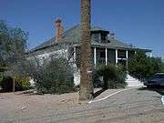
Frank Titus House built in 1875 (NRHP). Frank Titus, a wealthy railroad investor, had a citrus farm and horse-breeding ranch on his original 160-acre property. It is the only remaining Victorian residence in Scottsdale.
-
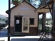
Walter "Gabe" Brooks Machine Shop built in 1930. The shop, which was Scottsdale first machine shop, was moved to the McCormick-Stillman Railroad Park in Scottsdale, Arizona and is now the "Gabe Brooks Museum".
-
The Valley Field Riding and Polo Club of Scottsdale, Arizona, was built in 1924. It is located 2530 N. 64 St. The property is located within the premises of a private gated community and is in a total state of abandonment. It was listed in the National Register of Historic Places in 2009, reference number 08001405.
-
On June 29, 1978, actor Bob Crane of Hogan's Heroes fame was murdered in apartment 132A of the Winfield Place Apartments (now the Winfield Place Condominium). The complex is located at 7430 E. Chaparral Road.[1]
-
Apartment 132A of the Winfield Place Apartments where Crane was murdered.
-
A funeral wreath on the door of apartment 132A.
- Historic Old Town Scottsdale, Arizona (SHR = Scottsdale Historic Register)
-

Historic Old Adobe Mission "Our Lady of Perpetual Help Church", built in 1933 and currently (2012) under restoration (SHR).
-

Cavalliere's Blacksmith Shop in Old Town Scottsdale. Date of construction: 1920. Date placed on Scottsdale Historic Register: May 23, 2000 by Resolution No. 5550
-

Farmer's State Bank (now housing the Rusty Spur Saloon) in Old Town Scottsdale. Date of construction: 1921. Date placed on the Scottsdale Historic Register: May 23, 2000 by Resolution No. 5550
-
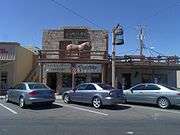
First U.S. Post Office Building (now housing Porter's Western Store) in Old Town Scottsdale. Date of construction: 1929. Date placed on Scottsdale Historic Register: May 23, 2000 by Resolution No. 5550
-

Johnny Rose's Pool Hall (now housing a Mexican Imports store) located in Old Town Scottsdale. Date of construction: 1923. Date placed on Scottsdale Historic Register: October 3, 2000 by Ordinance No. 3341, 22-ZN-2000
-
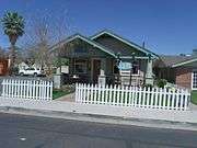
Charles Miller House in Old Town Scottsdale. Date of construction: 1913. Date placed on Scottsdale Historic Register: February 16, 2010 by Ordinance No.3886, 11-ZN-2009. Charles Miller and partners founded the first electric company for the town in 1918.
-
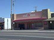
Sprouse-Reitz Drugstore in Old Town Scottsdale. Date of construction: 1954 Renamed The Pink Pony and currently a Steak House. Scottsdale Historic Register
-

Noriega's Home and Livery Stable in Old Town Scottsdale. Was the home of the Noriega family, one of Scottsdale's first settlers. Scottsdale Historic Register.
See also
References
- ↑ "American FactFinder". United States Census Bureau. Retrieved 2012-06-18.
- 1 2 "Population Estimates". United States Census Bureau. Retrieved July 5, 2015.
- ↑ U.S. Geological Survey Geographic Names Information System: Scottsdale, Arizona
- ↑ "United States Census Bureau". United States Census Bureau. December 2014. Retrieved January 11, 2015.
- ↑ "The 31 Places to Go This Summer". The New York Times. May 31, 2008. Retrieved May 23, 2010.
- ↑ "Official website".
- 1 2 "Scottsdale Overview, Page 10" (PDF).
- ↑ "Hohokam". Encyclopedia.com.
- 1 2 "Hohokam Culture". Encyclopædia Britannica.
- ↑ Saxton, Dean, Saxton, Lucille, & Enos, Susie. (1983). Dictionary: Tohono O'odham/Pima to English, English to Tohono O'odham/Pima. Tucson, AZ: The University of Arizona Press
- ↑ "The Best of Scottsdale".
- 1 2 3 4 5 6 7 8 9 10 11 12 13 "The West's Most Western Town". Scottsdaleaz.gov.
- ↑ Consumer Price Index (estimate) 1800–. Federal Reserve Bank of Minneapolis. Retrieved November 10, 2015.
- 1 2 3 4 5 "History of Scottsdale". Scottsdale Convention & Visitor's Bureau.
- 1 2 "About Scottsdale". InSider Scottsdale.
- ↑ "Scottsdale, AZ". DesertUSA.
- ↑ "Scottsdale's History in Pictures". Scottsdale Public Library.
- ↑ Phoenix City Directory. Arizona Directory Company. 1912. p. 3.
- ↑ "Scottsdale's History in Images". Scottsdale Public Library.
- ↑ "Scottsdale's History in Images". Scottsdale Public Library.
- ↑ "Scottsdale Historic Register" (PDF). Scottsdaleaz.gov.
- ↑ "Electric Railway Journal articles archived by the Phoenix Trolley Museum". Retrieved 2011-07-11.
- ↑ "History of Cotton in Arizona: A Timeline" (PDF). Jandatri.com. Archived from the original (PDF) on January 27, 2015. Retrieved January 27, 2015.
- ↑ "Jokake Inn History". The Phoenician Inn.
- ↑ "Taliesin Historical Legacy". Taliesin.
- ↑ "The Frank Lloyd Wright Spire". Live Better in Scottsdale.
- ↑ "Scottsdale Airport History". Scottsdaleaz.gov.
- ↑ "Papago Park POW Camp".
- ↑ Myers, Patricia Seitters. "Scottsdale: Jewel in the Desert".
- 1 2 "Indian Bend Wash Book" (PDF). Scottsdaleaz.gov.
- 1 2 "Key Events in the History of Scottsdale". Scottsdale Museum.
- 1 2 "The Story Behind Scottsdale's McCormick Ranch". Arizona Oddities.
- ↑ "History of McCormick Ranch". McCormick-Stillman Railroad Park.
- ↑ "Scottsdale Ranch History".
- ↑ "McDowell Mountain Ranch History".
- ↑ "Desert Mountain History".
- 1 2 "DC Ranch History".
- ↑ "What Trail Led Us Here". McDowell Sonoran Conservancy.
- 1 2 3 "Indian Bend Wash: Construction Complete." United States Environmental Protection Agency. Page last updated on February 16, 2007. Retrieved on February 28, 2007.
- ↑ Scottsdale Arizona CVB : Hotels, Golf and Vacation Planning for Scottsdale AZ
- ↑ "Scottsdale History." Scottsdale Convention & Visitors Bureau. Retrieved on June 1, 2006.
- ↑ "Best Golf States". Golf Digest.
- ↑ "Top 10 Golf Destinations". Golf Travel.
- ↑ "Top 10 Golf Destinations In The World". Top Golf.
- ↑ "Top 10 US Golf Destinations". Accuweather.
- ↑ "Top 10 Golf Destinations". World Travelers.
- ↑ "Top 10 Golf Locations". Travels Madness.
- ↑ Koeppel, Geri. "Older area of Scottsdale has built-in value." Arizona Republic. November 30, 2008. Retrieved on December 3, 2008
- ↑ http://www.keyfactorrealty.com/Scottsdale
- ↑ Butler, Jay; Lambrakis, Christine. "Greater Phoenix August Resale Market Housing Price Increases Slow." Arizona State University. September 14, 2005. Retrieved on August 9, 2006.
- ↑ Auto Dealerships Get New Purpose
- ↑ Airpark loses GM dealership
- ↑ The Sky Song Center
- ↑ "SkySong: Project Overview." skysongcenter.com. February 2007. Retrieved on April 29, 2007.
- ↑ "Largest Shopping Malls in the United States (2004)." American Studies, Eastern Connecticut State University. December 17, 2005. Retrieved on August 9, 2006.
- ↑ Christie, Les. "Real estate cools down." CNN (CNN Money). May 16, 2006. Retrieved on July 6, 2006.
- ↑ "Ritz-Carlton to build $400 million Scottsdale resort-residential complex". USA Today. 2006-06-22. Retrieved 2008-09-01.
- ↑ Balazs, Diana (2008-07-15). "Ritz-Carlton developer won't appeal ruling". The Arizona Republic. Retrieved 2008-09-01.
- ↑ Scottsdale Area Chamber of Commerce
- ↑ 50,000 work in airpark area
- ↑ "Scottsdale Weather: Records & Averages." Yahoo! Retrieved on April 30, 2007.
- ↑ "Average Weather for Scottsdale, AZ – Temperature and Precipitation". Weather.com. Retrieved 2008-04-20.
- ↑ "Annual Estimates of the Resident Population for Incorporated Places: April 1, 2010 to July 1, 2014". Retrieved June 4, 2015.
- ↑ "U.S. Decennial Census". Census.gov. Retrieved May 3, 2014.
- ↑ History of CBI, Synagogue website, Our Community. Accessed December 4, 2008.
- ↑ Ettenborough, Kelly. Arizona's Sanctuaries, Retreats, and Sacred Places, Big Earth Publishing, 2003, 9781565794382, p. 25.
- ↑ "Headline News." Downtown Scottsdale Bulletin. November 7, 2006. Retrieved on April 18, 2007.
- ↑ "AAA/CAA Five Diamond Hotels - January 16, 2015" (PDF). AAA. January 16, 2015. Retrieved February 27, 2015.
- ↑ Hogan, Shanna. "Scottsdale is tops in country for spas." East Valley Tribune. July 11, 2006. Retrieved on July 13, 2006.
- ↑ Roxborough, Shannon. "Tourists often wind up buying second homes." northjersey.com. April 15, 2007. Retrieved on April 18, 2007.
- ↑ "Mayo Clinic Scottsdale (website)." Retrieved on April 29, 2007.
- ↑ City of Scottsdale Comprehensive Annual Financial Report, for the Year ended June 30, 2014
- ↑ http://americanstyle.com
- ↑ Scharnberg, Kirsten. "A new sin city: 'Snottsdale'." Chicago Tribune. July 4, 2006. Retrieved on July 6, 2006.
- ↑ Rose, Jaimee. "Welcome to Marissa's world." Arizona Republic. April 26, 2006. Retrieved on July 6, 2006.
- ↑ cpcomapreable, Judy. "Scottsdale Arabian Horse Show." About.com. Retrieved on August 9, 2006.
- ↑ "Scottsdale Jaycees Parada del Sol - History." Scottsdale Jaycees. Retrieved on August 16, 2006.
- ↑ http://www.scottsdalefashionweek.com/
- ↑ http://www.scottsdaleculinaryfestival.org/
- ↑ "Listings of Scottsdale Art Galleries." Scottsdale Convention & Visitors Bureau. Retrieved on July 6, 2006.
- ↑ Staff Writer. "Things to do in Phoenix." The Arizona Republic. June 7, 2006. Retrieved on December 7, 2006.
- ↑ "Scottsdale's Museum of the West". Scottsdale's Museum of the West. February 17, 2015. Retrieved February 17, 2015.
- ↑ http://www.fashionsquare.com/Shopping/Details/111032
- ↑ Macerich and DMB Associates Form Regional Partnership: Financial News - Yahoo! Finance
- ↑ http://www.wwd.com/retail-news/the-palmerai-heats-up-luxury-retail-competition-in-arizona-1793133
- ↑ "Save the date ... for a really long time". October 26, 2008.
- ↑ Higgins, Michelle (September 23, 2005). "Where's the Party? Scottsdale!". The New York Times. Retrieved May 23, 2010.
- ↑ Clark, Jayne (December 20, 2007). "Old West meets New West in Scottsdale, Ariz.". USA Today. Retrieved May 23, 2010.
- ↑ http://www.cardplayer.com/cardplayer-magazines/47-15-25/articles/12951-passage-of-proposition-202-brings-immediate-expansion-to-casino-arizona
- ↑ http://www.worldcasinodirectory.com/arizona/scottsdale
- ↑ National Register of Historic Places
- ↑ Scottsdale Historic Register
- ↑ "Scottsdale Stadium." City of Scottsdale (website). Retrieved on April 18, 2007.
- ↑ Bennett, Liam. "Scottsdale's Fantasy 18." Scottsdale Convention & Visitors Bureau. Retrieved on June 1, 2006.
- ↑ Staff Writer. "2005 World's Best Golf Resorts." Travel + Leisure Golf. Retrieved on July 6, 2006.
- ↑ Scarp, Mark (2008-12-04). "Gonzales left his creative imprint on Scottsdale". East Valley Tribune. Retrieved 2009-01-04.
- 1 2 "Scottsdale Unified School District: About Us.". Scottsdale Unified School District. Retrieved January 24, 2014.
- ↑ "Paradise Valley Unified School District Description". Paradise Valley Schools.
- ↑ "Paradise Valley Unified School District Schools". Paradise Valley Schools.
- ↑ Fudala, Joan (2001). Historic Scottsdale: A Life from the Land. Singapore: Historical Publishing Network. p. 77. ISBN 1-893619-12-5.
- ↑ Scottsdale Public Library Locations and Hours
- ↑ The Appaloosa Library
- ↑ Scottsdale Trolleys
- ↑ Powell, Brian (2007-12-13). "City opts for seat at Valley light-rail planning table". East Valley Tribune. Retrieved 2009-02-01.
- ↑ Transportation Master Plan
- ↑ "Interurban Line Proposed". Phoenix Gazette. 1913-06-20.
- ↑ Schwieterman, Joseph P. (2004). When the Railroad Leaves Town: American Communities in the Age of Rail Line Abandonment, Western United States. Kirksville, MO: Truman State University Press. p. xxiv. ISBN 1931112134. OCLC 56968524.
- ↑ "Interactive City Directory: Scottsdale, Arizona". Sister Cities International, Inc. Retrieved March 28, 2013.
External links
- Official government website
- Scottsdale Area Chamber of Commerce
- Scottsdale Convention and Visitors Bureau
-
 Media related to Scottsdale, Arizona at Wikimedia Commons
.svg.png)

