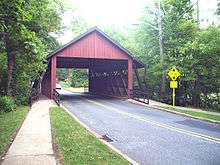
Scarborough Bridge
The Scarborough Bridge is a wooden covered bridge in the Barclay Farms neighborhood of Cherry Hill, New Jersey. It carries 2 lanes of Covered Bridge Road (the bridge's namesake), as well as 2 sidewalks for pedestrians and bicyclists. The bridge was named after Bob Scarborough, a housing developer who established the Barclay Farms neighborhood, where the bridge is located. A bridge was needed in the area to extend the subdivision street system over the North Branch, which is a small tributary of the Cooper River. The bridge was designed by Malcolm Wells and was open to traffic on February 14, 1959.[1] The bridge was renovated in 1993.[2] Having a town truss design, the Scarborough Bridge is considered a historical landmark for the community.
References
|
|---|
| | Neighborhoods |
|
|---|
| | Education | Primary & Secondary
Schools | |
|---|
| | Other education | |
|---|
|
|---|
| | Landmarks | |
|---|
| | Media | |
|---|
| | Culture | |
|---|
|
