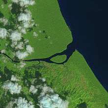
Sarstoon Island
 Satellite image of Sarstoon Island taken by Landsat 8 | |
| Geography | |
|---|---|
| Location | Sarstoon River |
| Coordinates | 15°53′28″N 88°55′29″W / 15.8910°N 88.9247°WCoordinates: 15°53′28″N 88°55′29″W / 15.8910°N 88.9247°W |
| Area | 0.65 km2 (0.25 sq mi) |
| Country | |
|
Belize | |
| District | Toledo |
| Demographics | |
| Population | uninhabited |
Sarstoon Island is an island near the mouth of the Sarstoon River along the Belize–Guatemala border. The border runs along the channel south of the island, making the island part of Belizean territory. However, Guatemala has made claims to the island as part of the Belizean–Guatemalan territorial dispute.[1] The island is mostly swampland and covers approximately 0.65 square kilometres (0.25 sq mi).[2]
In 2015, the government of Belize announced its intentions to build a forward operating base for the Belize Coast Guard on Sarstoon Island.[1][3]
References
- 1 2 "PM Barrow confirms Guatemalan Military hostility in Sarstoon Area". The San Pedro Sun. August 26, 2015. Retrieved September 12, 2015.
- ↑ "Sarstoon Island Not Suitable for Forward Operating Base". The Guardian (Belize City). August 20, 2015. Retrieved September 13, 2015.
- ↑ Trujillo, Renee (June 3, 2015). "Government Moves to Install Operating Base at the Sarstoon". LoveFM. Retrieved September 12, 2015.
This article is issued from Wikipedia - version of the Wednesday, September 16, 2015. The text is available under the Creative Commons Attribution/Share Alike but additional terms may apply for the media files.