Sandakphu
| Sandakphu | |
|---|---|
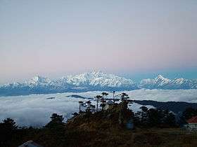
 View from the highest point in West Bengal | |
| Highest point | |
| Elevation | 3,636 m (11,929 ft) |
| Listing | List of Indian states and territories by highest point |
| Coordinates | 27°6′21″N 88°0′6″E / 27.10583°N 88.00167°ECoordinates: 27°6′21″N 88°0′6″E / 27.10583°N 88.00167°E [1] |
| Geography | |
 Sandakphu Location of Sandakphu peak | |
| Location | Darjeeling district, West Bengal, India |
| Parent range | Singalila Ridge |
| Topo map | Google topographic map[2] |
| Climbing | |
| Easiest route | Hiking or by car |


Sandakphu or Sandakfu or Sandakpur (3636 m; 11,941 ft) is the highest peak in the state of West Bengal, India. It is the highest point of the Singalila Ridge in Darjeeling district on the West Bengal-Nepal border. The peak is located at the edge of the Singalila National Park and has a small village on the summit with a few hostels. Four of the five highest peaks in the world, Everest, Kangchenjunga, Lhotse and Makalu can be seen from its summit.[3]
From Sandakphu, the best view of the mountain Kangchenjunga is possible, which is known as the Sleeping Buddha or the Sleeping Shiva.
Climate
The temperature swings from -20 °C (including wind chill factor) in winter to +15 °C in summer. Sandakphu gets snowfall in late December to early February.
How to reach
Sandakphu can be reached in two different ways, either by car or by trekking . The trekking starts from Mane Bhanjang via Chitire, Meghma, Tonglu, Tumling, Gairibas, Kalapokhri, Bekhe to Sandakphu. From Manebhanjang one can hire 1950's made Land Rovers which climbs up to Sandakphu and Phalut. The journey on Land Rover is not quite smooth on the rough mountain roads.
Trekking
The trek along the Singalila Ridge to Sandakphu and Phalut is one of the most popular ones in the Eastern Himalayas due to the grand vistas of the Kangchenjunga range and the Everest range which can be seen from the ridge, and also for the seasonal wildflower blooms and birding. Treks begin at Manebhanjan which is 28 km (1 hour approx. by road) from Darjeeling.[4]
The trekking routes inside the Singalila National Park have four legs or stages.
- Manebhanjan to Meghma (2600 m): This is a 4-hour trek through the lower forest. The route goes via Chitre which has a Hotel (Eagle's Nest). If time and circumstances permit, trekkers can walk to Chitre instead of staying in Mane Bhanjang. This will allow them some leeway the next day. The place is isolated and much cleaner. Earlier, you could have just start the walk without any guide/porter. Thesedays however, guides and porters are mandatory for the trek and have to be booked in Manebhanjan. The first two k.m. is a steep walk starting from Manebhanjan to Chitre.
There is another shorter route via Dhotre which can be reached by hired vehicle from Siliguri. The trekking route takes one directly to Tonglu or Tumling (5 km). Staying facilities in Dhotre is very basic.
- Meghma to Gairibans (2621 m): There are two alternative trekking routes. Both go via Tonglu (3070 m) and Tumling (2900 m). The boundary of the national park passes though Tumling where a checkpost is located. From Tumling, a shorter trail cuts through Nepal and Jaubari (2750 m).
- Gairibans to Sandakphu (3636 m): This is a steep 4 hour climb. Roughly halfway up the climb is the village of Kala Pokhri (3186 m). The trekkers hut in Gairibans is clean and a good place to stay though a bit removed from the trek path.
- Sandakphu to Phalut (3600 m): This is the most pristine stretch of the trek, offering great views of Kangchenjunga and Mt. Everest. It is a one-day trek via Sabarkum (3536 m) covering 21 km. But the main problem of this Sandakphu-Phalut route is that there is no water source in between, so trekkers have to carry enough water to reach Phalut. Since 2009. water and food have been made available at Sabarkum. However, this is a remote place and chances are that one will not find anyone here, let alone water and food during the rainy season and winter. It is advisable to carry one's own water. In case the trekker is unable to proceed further towards Phalut from Sabarkum, one can turn right towards Moley (3 km) trekkers hut where food is available. Trekkers planning to return from Sabarkum or Moley can take the route directly to Sirikhola or Gorkhe. Do not attempt this route without your porter or guide as it is not marked like the route to Sandakphu.
Descent
The descent from Sandakphu can be accomplished in several ways:
- Retracing the way back to Manebhanjan.
- A steep descent to the village of Sirikhola on the banks of the River Sirikhola, via Gurdum (2300 m), and from there to Rimbick.
- There is now a 4WD motorable road to Sandakphu, so one can hire a cab down to Manebhanjan and Darjeeling via Tumling and Tonglu if needed. The drive on the gravel road, however, is very arduous.
- Most of the places on the trekking route use solar power, so charging mobile phone and other devices is a challenge for trekkers. However, a few days off the grid is a worthwhile experience.
Features
 Singalila Range and Kanchenjungha from Sandakphu |
 The trekkers hut in Gairibans, West Bengal, India |
 The wide view of Sandakphu |
 A panoramic view of Sandakphu. |
References
- ↑ Sandakphu Top - Wikimapia
- ↑ Google topographic map
- ↑ Sandakphu & Singalila Trek
- ↑ , Sandakphu, Trek to Sandakphu, August 1, 2015