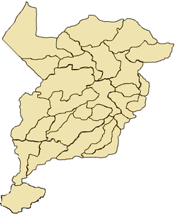
San Lorenzo, San Marcos
| San Lorenzo | |
|---|---|
|
General Justo Rufino Barrios, President of Guatemala from 1873 to 1885, was born in San Lorenzo. | |
 San Lorenzo Location in Guatemala | |
 San Lorenzo Location in San Marcos Department | |
| Coordinates: 15°17′N 91°47′W / 15.283°N 91.783°W | |
| Country |
|
| Department |
|
| Government | |
| • Mayor (2016-2020) | José Tema [1] (LIDER) |
| Climate | Cwb |
San Lorenzo (Spanish pronunciation: [san loˈɾenso]) is a municipality in the San Marcos department of Guatemala. It was founded in 1812 year by Spanish families.
This is the birthplace of Justo Rufino Barrios-who served as President of Guatemala from 1873 until his death in 1885 and whose native house has been declared as a National Heritage.[2]
Tourism
San Lorenzo's most representative historic landmark is "Justo Rufino Barrios" hacienda, birth place of general Barrios and named National Heritage by the government.[2]
Climate
San Lorenzo has temperate climate (Köppen: Cwb).
| Climate data for San Lorenzo | |||||||||||||
|---|---|---|---|---|---|---|---|---|---|---|---|---|---|
| Month | Jan | Feb | Mar | Apr | May | Jun | Jul | Aug | Sep | Oct | Nov | Dec | Year |
| Average high °C (°F) | 17.2 (63) |
17.6 (63.7) |
19.1 (66.4) |
19.8 (67.6) |
19.4 (66.9) |
18.5 (65.3) |
18.4 (65.1) |
18.9 (66) |
18.3 (64.9) |
17.7 (63.9) |
17.8 (64) |
17.5 (63.5) |
18.35 (65.02) |
| Daily mean °C (°F) | 9.8 (49.6) |
10.0 (50) |
11.4 (52.5) |
12.7 (54.9) |
13.7 (56.7) |
13.6 (56.5) |
13.4 (56.1) |
13.3 (55.9) |
13.4 (56.1) |
12.7 (54.9) |
11.5 (52.7) |
10.7 (51.3) |
12.18 (53.93) |
| Average low °C (°F) | 2.4 (36.3) |
2.5 (36.5) |
3.8 (38.8) |
5.7 (42.3) |
8.0 (46.4) |
8.7 (47.7) |
8.5 (47.3) |
7.7 (45.9) |
8.5 (47.3) |
7.7 (45.9) |
5.2 (41.4) |
4.0 (39.2) |
6.06 (42.92) |
| Average precipitation mm (inches) | 5 (0.2) |
6 (0.24) |
19 (0.75) |
58 (2.28) |
179 (7.05) |
248 (9.76) |
176 (6.93) |
207 (8.15) |
262 (10.31) |
174 (6.85) |
26 (1.02) |
10 (0.39) |
1,370 (53.93) |
| Source: Climate-Data.org[3] | |||||||||||||
Geographic location
San Lorenzo has an area of 25 Km², which makes it one of the smallest municipalities of both San Marcos Department and Guatemala. It is located 23 km West of San Marcos, the department capital, and is surrounded by San Marcos municipalities.[4]
 |
Comitancillo |  | ||
| Río Blanco | |
Tejutla and San Marcos[4] | ||
| ||||
| | ||||
| San Antonio Sacatepéquez and San Pedro Sacatepéquez[4] |
See also
- Guatemala portal
- Geography portal
- La Aurora International Airport
- Tapachula International Airport
References
- ↑ "San Marcos elige autoridades municipales". Prensa Libre (in Spanish) (Guatemala). 8 September 2015. Retrieved 8 September 2015.
- 1 2 "Estatua del general don Justo Rufino Barrios". La Ilustración Guatemalteca (in Spanish) (Guatemala: Síguere, Guirola & Cía.) I (20). 15 May 1896.
- ↑ "Climate: San Lorenzo". Climate-Data.org. Retrieved 5 September 2015.
- 1 2 3 SEGEPLAN. "Municipios del departamento de San Marcos". Secretaría General de Planificación (in Spanish). Archived from the original on 10 July 2015.
External links
Coordinates: 15°01′16″N 91°44′16″W / 15.02111°N 91.73778°W
