San Cristóbal Hill
| Cerro San Cristóbal Tupahue | |
|---|---|
|
View of Cerro San Cristóbal | |
| Highest point | |
| Elevation | 880 m (2,890 ft) |
| Coordinates | 33°25′30″S 70°37′58″W / 33.425138°S 70.632906°WCoordinates: 33°25′30″S 70°37′58″W / 33.425138°S 70.632906°W |
| Geography | |
 San Cristóbal Hill | |
| Parent range | Andes |
| Climbing | |
| First ascent | Unknown |
| Easiest route | From Santiago |
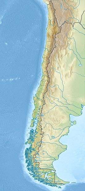
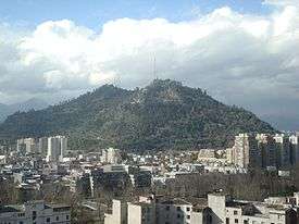
Cerro San Cristóbal (Tupahue, San Cristóbal Hill) is a hill in northern Santiago, Chile. It rises 880 m AMSL and about 300 m above the rest of Santiago; the peak is the second highest point in the city, after Cerro Renca. Cerro San Cristóbal was named by the Spanish conquistadors for St Christopher, in recognition of its use as a landmark. Its original indigenous name is Tupahue.
History and attractions
Cerro San Cristóbal began to be used in 1903 with the installation of the Mills Observatory, currently known as the Manuel Foster Observatory, twin of the Lick Observatory of the University of California.[1]
On its summit there is a sanctuary dedicated to the Immaculate Conception, with a 22 meter statue of the Blessed Virgin Mary, an amphitheater and a chapel. The statue of the Immaculate Conception measures 14 meters tall, and the pedestal on which it rests is 8.3 meters in height. It weighs 36,610 kilograms.[2] Within the pedestal there is a small chapel in which Pope John Paul II prayed and blessed the city of Santiago on April 1, 1987. The statue is lit up at night by lights placed on its sides, allowing it to be viewed from all over Santiago both day and night.
At the foot of the statue there is an amphitheater for holding masses or other religious ceremonies. Near the statue, there is also a small chapel for praying.
At the foothills of Cerro San Cristóbal are the Chilean National Zoo and a Japanese-style garden, and up there are also two municipal pools, Tupahue and Antilén.
Cerro San Cristóbal houses Santiago's largest public park: the Santiago Metropolitan Park (Parque Metropolitano).
Statue of the Virgin Mary on the top of Cerro San Cristóbal. |
Access
The summit of Cerro San Cristóbal can be reached by foot (about a 45 minute walk, involving a 300m change in elevation), by car via the road joining the Santiago Metropolitan Park, or by the Funicular of Santiago (the base of which sits next to the Zoo at the North end of Pio Nono in Barrio Bellavista). A cable car provided service to the top of the hill from the Providencia neighborhood entrance until 2011, but it has been shut down indefinitely, and the facilities are derelict. From the top of the hill, visitors can enjoy two pools - Tupahue and Antilén - or access the National Zoo of Chile, at the Bella Vista entrance to Cerro San Cristóbal. The newly inaugurated Children’s Park of Cerro San Cristóbal provides a new entrance to the hill via Avenida Perú.[3]
References
- ↑ El Observatorio de San Cristóbal. Zig-Zag (magazine), editorial. Vol.2 No.65. Retrieved November 15, 2012.
- ↑ Photo Virgin on San Cristóbal Hill. www.iglesia.cl. In Spanish.
- ↑ Casi 16 mil personas han visitado el Parque de la Infancia del cerro San Cristóbal a dos semanas de su apertura. Ministerio de Vivienda y Urbanismo. 11 May 2012. Retrieved 23 November 2012.
External links
| Wikimedia Commons has media related to Cerro San Cristóbal. |
- Parque Metropolitano's official site
- Virtual Tour on 360° of San Cristobal Hill Chilexplora.com
- Photographs of Mills Observatory from the Lick Observatory Records Digital Archive, UC Santa Cruz Library's Digital Collections
