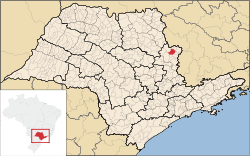
São José do Rio Pardo
| São José do Rio Pardo | |
|---|---|
| Municipality | |
 Location in São Paulo state | |
 São José do Rio Pardo Location in Brazil | |
| Coordinates: 21°35′44″S 46°53′19″W / 21.59556°S 46.88861°WCoordinates: 21°35′44″S 46°53′19″W / 21.59556°S 46.88861°W | |
| Country |
|
| Region | Southeast Region |
| State | São Paulo |
| Area | |
| • Total | 419 km2 (162 sq mi) |
| Population (2015) | |
| • Total | 54,388 |
| • Density | 130/km2 (340/sq mi) |
| Time zone | BRT/BRST (UTC-3/-2) |
São José do Rio Pardo is a municipality in the state of São Paulo in Brazil. The population is 54,388 (2015 est.) in an area of 419 km².[1] The elevation is 676 m. It was founded by Colonel Antônio Marçal Nogueira de Barros in 1870. In the same year, a chapel to Saint Joseph was built. It became a municipality in 1885, when it was separated from Casa Branca.[2] In the late 1800s and the early 1900s the town received a mass of immigration from northern Italy, those immigrants went to town for working in the coffee fields in replacement of the slave workforce, since slaves were set free in 1888 by an act of Princess Isabel.
References
External links
| ||||||||||||||||||||||||||||||||||||||||||||||||||||||||||||||||||||
This article is issued from Wikipedia - version of the Tuesday, November 24, 2015. The text is available under the Creative Commons Attribution/Share Alike but additional terms may apply for the media files.