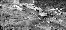
Glen Afton Branch
| Glen Afton Branch then Rotowaro Branch | |
|---|---|
 | |
| Overview | |
| Status | Closed beyond Rotowaro |
| Termini |
Huntly Glen Afton |
| Operation | |
| Opened | 1911 |
| Closed | 1977 |
| Owner | New Zealand Railways Corporation |
| Operator(s) | New Zealand Railways Department |
| Character | Rural |
| Rolling stock | None |
| Technical | |
| Line length | 7.97 km (4.95 mi) |
| No. of tracks | Single |
| Track gauge | 1,067 mm (3 ft 6 in) |
The Glen Afton Branch was a branch railway line of 7.9 km (originally 14.1 km) in the Waikato in New Zealand, built to serve coal mines in the Awaroa district west of Huntly at Rotowaro, Pukemiro and Glen Afton. Rotowaro is Māori for "coal lake".
Known as the Glen Afton Branch to about 1974, then as the Rotowaro Branch to 3 November 1988, then as the Rotowaro Industrial Line. By 2014 it was again named the Rotowaro Branch.[1]
The first 5 km was authorised in 1910, and required a road-rail bridge over the Waikato River, with an extension which carried the railway over the main highway. The bridge, constructed from 1911 to October 1914, had 10 spans of Australian hardwood (8 of 30.5m and 2 of 12.2m) on steel and reinforced concrete piers. The nearby Wilton Collieries Co complained that they too did not have public money put into building their line and river bridge.[2] In November 1959 a separate road bridge was opened.
The first 5 km of track opened about 1911.
This seems to be confirmed by a 1914 report saying the Huntly-Awaroa line is complete over the first 3 mi (4.8 km) section, "well advanced" by co-operative labour over the next 2 1⁄2 mi (4.0 km) and "fair progress" with 5 small contracts to a proposed station 7 1⁄4 mi (11.7 km) from Huntly, "where coal from the Pukemiro collieries will be delivered for transport. An addition is being made to the combined bridge over the Waikato river to carry it over the Main South road. It is hoped by the end of the ensuing summer to have the rails laid to the junction with the Pukemiro collieries line. As the works now in hand draw to a close, it is proposed to continue operations on this line in the direction of the Burnt bridge. The expenditure upon the railway and bridge during last financial year amounted to £16,503, and for the current year a vote of £30,000 is proposed."[3] In 2015 prices £46,503 would be equivalent to $6.8m.[4]
The 2.5 km extension from Rotowaro to Pukemiro and Glen Afton was built between 1915 and 1924, although a further proposed extension beyond Glen Afton did not proceed. The hill section from Rotowaro to Glen Afton was difficult to construct, with a large "summit" cutting just before Glen Afton. Grades on the hill section were up to 1 in 50, with 150m (7.5 chain) radius curves.
There were several short private lines to mines at Rotowaro, Pukemiro and Glen Afton. The branch line was dieselised in 1966, with a special NZRLS excursion train on 12 March 1966 to mark the change, hauled by two BB class steam locos. Passenger trains, mainly for miners, ran to 23 June 1972, apart from a special train for railway enthusiasts on 16 December 1972 hauled by a DI class diesel loco. The Rotowaro to Glen Afton section west of Rotowaro was closed from 5 March 1973, as the mines had run out of coal. The line was shortened from 14.10 km to 7.97 km.
From 1977 the section to Rotowaro, Pukemiro and Glen Afton was handed over to the Bush Tramway Club who operate over about 5 km of former NZR line, though the last 2.5 km to Glen Afton is no longer usable. The section to Rotowaro was renamed from Rotowaro Industrial Line to Rotowaro Branch in 2011.[5]
References
- ↑ "Northern Region Rail - KiwiRail". www.kiwirail.co.nz. Retrieved 2015-12-10.
- ↑ "A Waikato railway". Evening Post, Volume LXXXIV, Issue 72, 21 September 1912, Page 3
- ↑ "Public Works Statement.". Waikato Argus. 1914-10-21. p. 4. Retrieved 2015-10-31.
- ↑ "Inflation Calculator". www.rbnz.govt.nz. Retrieved 2015-10-31.
- ↑ "Rotowaro Branch". Land Information New Zealand. Retrieved October 2014.
- Churchman, Geoffrey B., and Hurst, Tony; The Railways of New Zealand: A Journey Through History p104 (1990, HarperCollins, Auckland) ISBN 1-86950-015-6
- Hermann, Bruce J; North Island Branch Lines pp 14,15,16 (2007, New Zealand Railway & Locomotive Society, Wellington) ISBN 978-0-908573-83-7
External links
Solid Energy - Rotowaro mine leaflet, including photo of rail loading area
| ||||||||||||||||||||||||||||||||||||||||||||||||||||