Ribeira da Torre
| Ribeira da Torre | |
|---|---|
|
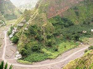
Povoação da Varzinha at the left bank of Ribeira da Torre | |
| Basin | |
| Main source |
Rabo Curto near Pico da Cruz Santo Antão |
| Source elevation | 1500 m |
| River mouth |
Atlantic Ocean 17°10′N 25°06′W / 17.16°N 25.1°WCoordinates: 17°10′N 25°06′W / 17.16°N 25.1°W |
| Country | Cape Verde |
| Physiognomy | |
| Length | 12 km |
Ribeira da Torre (Portuguese: the "tower") is a stream that flows in the northeastern part of the island of Santo Antão in Cape Verde. The stream flows mostly from south to north and is nearly 12 km in length. It flows in the area between Ribeira Grande and Vale do Paul in the lower part.
Geography
The stream are one of the most widest and torrential in Santo Antão. The river passes around Água das Caldeiras west of Cova do Paul and flows from south to north into the Atlantic in Ribeira Grande, the size and the flow of Ribeira Grande gives its name to the town.
The name Ribeira da Torre originates from a towering prominent mountain, Topo de Miranda located 2.5 km from the right bank.
The river valley is extremely wide, The upper section is in the locality of Xoxô (name likely of Mandinka origin), flows circular in an active eroded phase known as Rabo Curto. The lower part features an essential zone of alluvial flows, the diagonal part is quitely regular, the inner slope is around 3% and is 7 km long.
Its slopes are terraced and has systems of irrigation to keep the soil and water. Agriculture is common and sugar canes, bananas, mandiokas, papayas and sweet potatoes are grown in the valley.
The unpaved secondary road crosses and passes much of the river's distance particularly from south of Ribeira Grande up to the upper middle part of the river and features pathways and a few smaller roads.
See also
Further reading
- Carlos Ferrão, Estudos sobre a Ilha de Santo Antão (Studies on Santo Antão Island), Imprensa Nacional, Lisbon, 1898, p. 116
- Nótula sobre aspectos recentes e actuais da erosão fluvial na ilha de Santo Antão (article by Suzanne Daveau on Finisterra. Revista portuguesa de geografia, vol. XXIV, no. 46, 1988, p. 287-301)
External links
- A climb to Topo de Miranda (Portuguese)
- Visit Cape Verde - Ribeira da Torre (Portuguese)
| ||||||||||||||||||||||||||
