Ribeira Seca (Ribeira Grande)
| Ribeira Seca | ||
| Civil Parish | ||
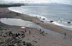
 Santa Bárbara beach on the northern coast of Ribeira Seca, the most popular destination for surfers on the island. | ||
|
||
| Official name: Freguesia de Ribeira Seca | ||
| Name origin: Portuguese for dry ravine | ||
| Country | ||
|---|---|---|
| Autonomous Region | ||
| Island | São Miguel | |
| Municipality | Ribeira Grande | |
| Localities | Bandejo, Morro de Cima, Ribeira Seca | |
| Center | Rotunda | |
| - elevation | 20 m (66 ft) | |
| - coordinates | 37°48′57″N 25°32′16″W / 37.81583°N 25.53778°WCoordinates: 37°48′57″N 25°32′16″W / 37.81583°N 25.53778°W | |
| Highest point | Pico do Barrosa | |
| - elevation | 901 m (2,956 ft) | |
| - coordinates | 37°45′54″N 25°29′46″W / 37.76500°N 25.49611°W | |
| Lowest point | Sea Level | |
| - location | Atlantic Ocean | |
| Area | 12.59 km2 (5 sq mi) | |
| - urban | .75 km2 (0 sq mi) | |
| Population | 2,950 (2011) | |
| Density | 234 / km2 (606 / sq mi) | |
| Settlement | c. 1515 | |
| - Parish | 12 December 1575 | |
| - Civil Parish | 25 October 1576 | |
| LAU | Junta Freguesia | |
| - location | Rua do Mourato, 1 | |
| President Junta | Carlos Manuel Paiva Anselmo | |
| President Assembleia | João Brum | |
| Timezone | Azores (UTC-1) | |
| - summer (DST) | Azores (UTC0) | |
| Postal Zone | 9600-224 | |
| Area Code & Prefix | (+351) 292 XXX-XXXX | |
| Patron Saint | São Pedro | |
| Wikimedia Commons: Ribeira Seca (Ribeira Grande) | ||
| Website: http://www.jfribeiraseca.net | ||
| Geographic detail from Instituto Geográfico Português (2010) | ||
Ribeira Seca (Portuguese for dry river) is a parish in the municipality of Ribeira Grande in the Azores. The population in 2011 was 2,950,[1] in an area of 12.59 km².[2] It is located near the north coast of the island.
References
This article is issued from Wikipedia - version of the Friday, November 13, 2015. The text is available under the Creative Commons Attribution/Share Alike but additional terms may apply for the media files.
