Refugio, Texas
| Refugio, Texas | |
|---|---|
| City | |
|
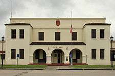
Refugio City Hall | |
|
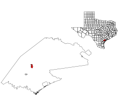
Location of Refugio, Texas | |
 | |
| Coordinates: 28°18′21″N 97°16′29″W / 28.30583°N 97.27472°WCoordinates: 28°18′21″N 97°16′29″W / 28.30583°N 97.27472°W | |
| Country | United States |
| State | Texas |
| County | Refugio |
| Area | |
| • Total | 1.6 sq mi (4.1 km2) |
| • Land | 1.6 sq mi (4.1 km2) |
| • Water | 0.0 sq mi (0.0 km2) |
| Elevation | 46 ft (14 m) |
| Population (2000) | |
| • Total | 2,941 |
| • Density | 1,880.7/sq mi (726.1/km2) |
| Time zone | Central (CST) (UTC-6) |
| • Summer (DST) | CDT (UTC-5) |
| ZIP code | 78377 |
| Area code(s) | 361 |
| FIPS code | 48-61436[1] |
| GNIS feature ID | 1345013[2] |
Refugio (/rəˈfjʊər.i.oʊ/ rə-FYOOR-ee-oh) is a town in Refugio County, Texas, United States. The population was 2,941 at the 2000 census. It is the county seat of Refugio County.[3]
Geography
Refugio is located at 28°18′21″N 97°16′29″W / 28.30583°N 97.27472°W (28.305812, -97.274594).[4] According to the United States Census Bureau, the town has a total area of 1.6 square miles (4.0 km²), all land.
Climate
The climate in this area is characterized by hot, humid summers and generally mild to cool winters. According to the Köppen Climate Classification system, Refugio has a humid subtropical climate, abbreviated "Cfa" on climate maps.[5]
Demographics
| Historical population | |||
|---|---|---|---|
| Census | Pop. | %± | |
| 1880 | 455 | — | |
| 1910 | 773 | — | |
| 1920 | 933 | 20.7% | |
| 1930 | 2,019 | 116.4% | |
| 1940 | 4,077 | 101.9% | |
| 1950 | 4,666 | 14.4% | |
| 1960 | 4,944 | 6.0% | |
| 1970 | 4,340 | −12.2% | |
| 1980 | 3,898 | −10.2% | |
| 1990 | 3,158 | −19.0% | |
| 2000 | 2,941 | −6.9% | |
| 2010 | 2,890 | −1.7% | |
| Est. 2014 | 2,838 | [6] | −1.8% |
As of the census[1] of 2000, there were 2,941 people, 1,128 households, and 788 families residing in the town. The population density was 1,880.7 people per square mile (727.9/km²). There were 1,312 housing units at an average density of 839.0 per square mile (324.7/km²). The racial makeup of the town was 74.53% White, 13.40% African American, 0.51% Native American, 0.51% Asian, 0.10% Pacific Islander, 9.38% from other races, and 1.56% from two or more races. Hispanic or Latino of any race were 44.30% of the population.
There were 1,128 households out of which 30.9% had children under the age of 18 living with them, 46.5% were married couples living together, 18.2% had a female householder with no husband present, and 30.1% were non-families. 27.3% of all households were made up of individuals and 13.8% had someone living alone who was 65 years of age or older. The average household size was 2.55 and the average family size was 3.08.
In the town the population was 26.7% under the age of 18, 8.1% from 18 to 24, 25.1% from 25 to 44, 22.5% from 45 to 64, and 17.6% who were 65 years of age or older. The median age was 38 years. For every 100 females there were 90.9 males. For every 100 females age 18 and over, there were 85.3 males. The median income for a household in the town was $26,719, and the median income for a family was $32,237. Males had a median income of $33,021 versus $15,549 for females. The per capita income for the town was $13,523. About 16.8% of families and 21.1% of the population were below the poverty line, including 26.7% of those under age 18 and 20.9% of those age 65 or over.
History
Refugio, the county seat of Refugio County, is on the north bank of the Mission River at the intersection of U.S. Highways 183 and 77 and State Highway 202. The site of the present city was a favorite camping ground of the Karankawa Indians, who developed a permanent village there known to the Spanish as Paraje de los Copanes (Place of the Copanes, a Karankawan tribe). The Spanish probably knew of the settlement as early as 1749, and according to some accounts José de Escandón wanted to establish a pueblo and presidio there. In 1795, the Nuestra Señora del Refugio Mission was moved to the site. The Refugio Mission, the last Spanish mission to be secularized after the area became part of Mexico, operated continuously until February 1830. By then, at least 100 Mexicans lived on ranchos in the immediate vicinity, and a village existed around the mission. In 1831 James Power and James Hewetson acquired the rights to the old mission building and the town that surrounded it. Power brought colonists from Ireland to settle Refugio. The villa of Refugio was officially established in 1831 by a group of Irish and Mexican colonists. The villa became the center of the Refugio Municipality in 1834. On March 14, 1836, during the Texas Revolution, the battle of Refugio was fought at the town; most of the inhabitants subsequently fled to Victoria, Goliad, and other areas to avoid retribution. When Refugio County was organized after Texas gained its independence, Refugio became the unofficial county seat, but the town had been almost completely destroyed, and most of its former residents had not returned. The population remained depleted until about 1842 because of the continuing threat of Mexican raids into the area. Although Refugio was first incorporated in 1837, it had no government until 1842, and no post office was established there during the republic period. In 1842 the town was reincorporated, and settlers began to return to the area, and a number of them established farms on the land surrounding Refugio. A post office was established at Refugio in 1847. In 1859 the ruins of the old mission were still the most distinguishing feature of the town, which by that time included three dry-goods stores, a boardinghouse, three churches, and two schools. The town declined after the beginning of the Civil War. The city council stopped holding meetings in 1861; by the end of the war the town had almost disappeared, and only a few people lived there. Refugio had no government at all until 1868, when Moses Simpson moved in from Copano and performed the role of a council by himself. In the late 1860s and early 1870s saloons and gambling houses were established in Refugio, giving it a reputation as a "free and easy" place, which attracted gamblers, drifters, and criminals. In 1869 the county seat was moved from Refugio to St. Mary's, and then to Rockport.
In 1871, when Aransas County was separated from part of Refugio County, the government of Refugio County returned to Refugio. The town's council was reorganized in 1874, and Refugio began to revive as it became a marketing and shipping center for the hides, wool, cotton, and livestock produced in the area. By 1884 the town had grown to a population of about 1,000 and included a wooden courthouse, three churches, and a public school. Though the population of the surrounding county declined during the 1880s, Refugio continued to grow during this period, and by 1890 there were an estimated 1,100 people living there. That year the town had Catholic and Baptist churches, a convent, a parochial school, two public schools (one for white students, one for blacks), and two hotels. Without a railroad Refugio had difficulty competing with other towns in the region, however, and shrank during the 1890s; its estimated population dropped to 800 by 1892 and to 600 by 1896; in 1900 there were 699 people living there. About 1902 the St. Louis, Brownsville and Mexico Railway began making surveys of the area, and fearing that the railroad would bypass their town unless paid a $30,000 "bonus," leading citizens organized to raise the money. Ultimately, the town paid the railroad $18,000 in cash and half of the town's common lands for a railroad connection, and by December 1905 the tracks had been laid and a depot built about a mile from the city. A description of the town in 1905 mentioned the convent, a hotel, two saloons, a blacksmith shop, about five stores, the wooden county courthouse, and a "handful" of dwellings.
A major part of its history is found in the hardships of a local stream called the Monkey Slough. In the older days, many locals had very little sources of water, therefore the Monkey Slough was their only source. Many people would meet to take the water they needed to survive but the amount was so scarce. Eventually the locals began to get mad at each other and violence began. Many ended up splitting and moved North in search of better living conditions. As well as the split, many of them died and mourned because of it.
Notable people
- Nolan Ryan, Baseball Hall of Fame pitcher who was born in Refugio; his family moved to Alvin when he was six weeks old
- Rocky Bridges, baseball infielder
- Joseph L. Galloway, American newspaper correspondent and columnist
- Jack Starrett, film actor and director
- Delores Cantú, actress
- Kim Henkel, co-writer of the original movie The Texas Chain Saw Massacre, with Tobe Hooper.
- Allison Paige, country music singer-songwriter
Education
The Town of Refugio is served by the Refugio Independent School District.
References
- 1 2 "American FactFinder". United States Census Bureau. Retrieved 2008-01-31.
- ↑ "US Board on Geographic Names". United States Geological Survey. 2007-10-25. Retrieved 2008-01-31.
- ↑ "Find a County". National Association of Counties. Retrieved 2011-06-07.
- ↑ "US Gazetteer files: 2010, 2000, and 1990". United States Census Bureau. 2011-02-12. Retrieved 2011-04-23.
- ↑ Climate Summary for Refugio, Texas
- ↑ "Annual Estimates of the Resident Population for Incorporated Places: April 1, 2010 to July 1, 2014". Retrieved June 4, 2015.
- ↑ "Census of Population and Housing". Census.gov. Retrieved June 4, 2015.
| |||||||||||||||||||||||||
| ||||||||||||||||||||||||||||||||||||||||||||||||||||||||||||||||||||||||||||||||||||||||||||||

