Red Cliff Band of Lake Superior Chippewa
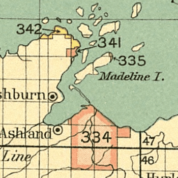
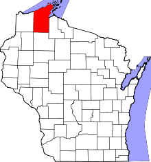
Red Cliff Band of Lake Superior Chippewa is a band of Ojibwe Native Americans. The Red Cliff Band is located on the Red Cliff Indian Reservation, on Lake Superior in Bayfield County, Wisconsin. Red Cliff, Wisconsin, is the administrative center. Red Cliff is notable for being the band closest to the spiritual center of the Ojibwe nation, Madeline Island. The reservation is located in the Town of Russell and the Town of Bayfield, north and northwest of the city of Bayfield, Wisconsin.
History

The Red Cliff Band is one of the successors of the Lake Superior Chippewa the group of Ojibwe that moved west along the south shore of Lake Superior from Sault Ste. Marie. According to tradition, the Ojibwe came from the Atlantic coast via several stopping places to Chequamegon Bay directed by the Great Spirit {Gichi Manidoo} to find the "food that grows on water" (wild rice). Madeline Island represented the final stopping place.
During the 17th century, French fur traders and Jesuits arrived on Madeline Island and set up a trading post at La Pointe with a Catholic mission. In the 18th century, the La Pointe Ojibwe spread throughout the mainland of what would become Wisconsin and Minnesota. The Ojibwe that remained in the vicinity of Madeline Island were referred to as the La Pointe Band.
After a disastrous 1850 attempt at removing the Lake Superior bands resulting in the Sandy Lake Tragedy, the US Government agreed to setting up permanent reservations in Wisconsin with the Treaty of La Pointe (1854). At this point, the La Pointe band split with Roman Catholic members under the leadership of Chief Buffalo taking a reservation at Red Cliff, and those maintaining traditional Midewiwin beliefs settling at Bad River. The two bands, however, maintain close relations to this day.
During the early reservation period, most tribal members were forced to make their living working for white employers in nearby Bayfield, Wisconsin. The commercial fishing industry drew many of these workers.
At the turn of the 19th century, the Commission of Indian Affairs allowed lumbering companies to cut most of the timber on the reservation. Many tribal members found work in logging, but the tribe largely missed out on the timber revenues.[Either a typo or untrue, considering the Commission of Indian Affairs was not founded until 1824]
Revival
During the 20th century commercial fishing in Lake Superior sustained many Red Cliff families. Despite the fact that the Ojibwe had reserved the rights to hunt, fish, and gather in treaties signed in Wisconsin Supreme Court case Gurnoe vs. Wisconsin (1972) the court found in favor of a Red Cliff tribal member upholding that the tribe reserved the right to harvest reasonable amounts of fish. This was an important precedent for the Voigt decision.
During the Wisconsin Walleye War (1987–1991), Red Cliff was not a site of violence in the way other Lake Superior bands were. However, Red Cliff tribal members began exercising treaty rights, and member Walter Bresette emerged as a major leader of the treaty-rights movement.
Today

Today, Red Cliff is the site of a fish hatchery run by the Red Cliff Band of Lake Superior Chippewa. Red Cliff also runs Legendary Waters Resort and Casino, which sits on the Banks of Lake Superior. The band has also taken control of the reservation's Head Start program, and offers an Ojibwe language immersion program for young children. Tribal member Rabbett Strickland is a highly prolific contemporary artist.[1]
Notes
- ↑ Nakao, Annie. "Artist Rabbett Strickland creates a mythological Indian world inside his tiny S.F. apartment." SF Gate." 30 Jan 2003 (retrieved 21 July 2010)
References
- Loew, Patty (2001) Indian Nations of Wisconsin: Histories of Endurance and Renewal. Wisconsin Historical Society Press, Madison.
External links
| Wikimedia Commons has media related to Red Cliff Indian Reservation. |
- official website of the Red Cliff Band of Lake Superior Chippewa
- Bemaadizing: An Interdisciplinary Journal of Indigenous Life (An online journal)
- Eni–gikendaasoyang "Moving Towards Knowledge Together" Center for Indigenous Knowledge and Language Revitalization
Coordinates: 46°56′49″N 90°52′20″W / 46.94694°N 90.87222°W
| ||||||||||
| |||||||||||||||||||||||||||||||||||||
