RHS Garden Rosemoor


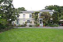
RHS Garden Rosemoor is an internationally renowned public display garden run by the Royal Horticultural Society in North Devon, England.
The Lady Anne Palmer created the original garden of 8 acres (3.2 ha) in 1959, and developed it over a 30-year period. The garden was first opened to the public in 1967, under the National Gardens Scheme.[1] Lady Palmer gave it to the Royal Horticultural Society (RHS) in 1988, together with an additional 32 acres (13 ha) of land.[2] Nowadays Rosemoor Garden covers 65 acres (26 ha) and it hosts, apart from a range of gardens, a visitor centre, with a library, a plant centre, a shop, a restaurant and the Wisteria tearoom. In 2009 the garden received 129,690 visitors.
Rosemoor is situated 1 km south-east of Great Torrington on A3124 to Exeter. It is surrounded by over 100 acres (40 ha) woodlands; with the River Torridge running along the western border.[3]
It has given its name to a variety of Clematis.[4]
Some of the highlights of Rosemoor Garden are:
- the Rose Garden, with about 2000 roses
- the Arboretum
- the Herb, Fruit and Vegetable Gardens
- the Alpine House
History
The estate of Rosemoor alias "Rowes Moor" appears to have been a possession of the Walpole family, Earls of Orford, whose Devon seat, inherited from his wife a member of the Rolle family, was Heanton Satchville, Petrockstowe.[5]
The Rolle Canal terminated at Lord Rolle's limekilns at Rosemoor, which survive as ruins in 2013.
References
Notes
- ↑ Brent Elliott: The Royal Horticultural Society, A History 1804-2004. Published by Phillimore & Co. Ltd. ISBN 1-86077-272-2.
- ↑ Webster 2013, pp. 46.
- ↑ Webster 2013, pp. 45.
- ↑ http://apps.rhs.org.uk/plantselector/plant?plantid=4796
- ↑ North Devon Record Office, Doe family of Great Torrington, B70 M/20 1840-1960, "newspaper cuttings on R H M Walpole's inheritance of the Earl of Orford's estates, including Rosemoor, Torrington, 1928"
Bibliography
- Webster, Jonathan (2013), "RHS Garden Rosemoor: Today and Tomorrow", The Garden (Royal Horticultural Society) 138 (3): 45–48
External links
| Wikimedia Commons has media related to RHS Garden Rosemoor. |
Coordinates: 50°56′27″N 4°08′15″W / 50.940801°N 4.137416°W