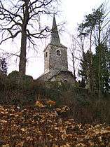
Chaumont-Gistoux
| Chaumont-Gistoux | ||
|---|---|---|
| Municipality | ||
 | ||
| ||
 Chaumont-Gistoux Location in Belgium | ||
|
The municipality of Chaumont-Gistoux in Walloon Brabant  | ||
| Coordinates: 50°40′37″N 4°43′10″E / 50.67686°N 4.71956°ECoordinates: 50°40′37″N 4°43′10″E / 50.67686°N 4.71956°E | ||
| Country | Belgium | |
| Community | French Community | |
| Region | Wallonia | |
| Province | Walloon Brabant | |
| Arrondissement | Nivelles | |
| Government | ||
| • Mayor | Luc Decorte (ARC) | |
| • Governing party/ies | ARC, Ecolo | |
| Area | ||
| • Total | 48.09 km2 (18.57 sq mi) | |
| Population (1 January 2013)[1] | ||
| • Total | 11,601 | |
| • Density | 240/km2 (620/sq mi) | |
| Postal codes | 1325 | |
| Area codes | 010 | |
| Website | www.chaumont-gistoux.be | |
Chaumont-Gistoux is a Walloon municipality located in the Belgian province of Walloon Brabant. On 1 January 2006 Chaumont-Gistoux had a total population of 10,926. The total area is 48.09 km² which gives a population density of 227 inhabitants per km².
It was formed from the fusion, in 1977, of Dion-Valmont (itself a fusion in 1971 of Dion-le-Val and Dion-le-Mont), Bonlez, Corroy-le-Grand, Longueville and Chaumont-Gistoux. The administrative offices are now in the village of Gistoux.
It is a semi-rural municipality with several working farms, large areas given over to fields and forests, although there is a major industry of sand extraction, now mostly in decline. Due to this history there are now several haulage and construction firms based in the municipality.
Chaumont-Gistoux is on the KW-line, a defensive line erected early in the Second World War, intended to prevent invasion from Germany. A small museum houses information about the line and many exhibits from the war.
Her Royal Highness Princess Claire of Belgium grew up in Chaumont-Gistoux. The Coombs family still resides there to this day, and the Princess, her husband Prince Laurent and their children are often seen in the municipality.
Villages in the municipality
Bonlez, Chaumont, Corroy-le-Grand, Dion-le-Mont, Dion-le-Val, Gistoux, Longueville and Vieusart or (Vieux-Sart).[lower-alpha 1]
Notes
- ↑
- Bonlez 50°42′09″N 4°41′22″E / 50.70250°N 4.68958°E
- Chaumont, 50°40′37″N 4°43′10″E / 50.67686°N 4.71956°E
- Corroy-le-Grand, 50°39′43″N 4°40′29″E / 50.66208°N 4.67466°E
- Dion-le-Mont 50°41′59″N 4°40′14″E / 50.69982°N 4.67054°E
- Dion-le-Val 50°42′58″N 4°39′42″E / 50.71623°N 4.66155°E
- Gistoux 50°41′01″N 4°41′41″E / 50.68370°N 4.69486°E
- Longueville 50°42′09″N 4°44′25″E / 50.70240°N 4.74030°E
- Vieusart or (Vieux-Sart) 50°40′47″N 4°38′52″E / 50.67968°N 4.64765°E
References
- ↑ Population per municipality on 1 January 2013 (XLS; 607.5 KB)
External links
-
 Media related to Chaumont-Gistoux at Wikimedia Commons
 |
Wavre | Grez-Doiceau |  | |
| Ottignies-Louvain-la-Neuve | |
Incourt | ||
| ||||
| | ||||
| Mont-Saint-Guibert | Walhain |
|

