Whitman County, Washington
| Whitman County, Washington | |
|---|---|
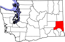
 Location in the state of Washington | |
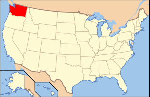
 Washington's location in the U.S. | |
| Founded | November 29, 1871 |
| Named for | Marcus Whitman |
| Seat | Colfax |
| Largest city | Pullman |
| Area | |
| • Total | 2,178 sq mi (5,641 km2) |
| • Land | 2,159 sq mi (5,592 km2) |
| • Water | 19 sq mi (49 km2), 0.9% |
| Population (est.) | |
| • (2014) | 46,827 |
| • Density | 22/sq mi (8/km²) |
| Congressional district | 5th |
| Time zone | Pacific: UTC-8/-7 |
| Website |
www |
Whitman County is a county located in the U.S. state of Washington. As of the 2010 census, the population was 44,776.[1] The county seat is Colfax,[2] and its largest city is Pullman. The county was formed out of Stevens County on November 29, 1871.[3] It is named after Marcus Whitman, a Presbyterian missionary who, with his wife Narcissa, was killed in 1847 by members of the Cayuse tribe.
Whitman County comprises the Pullman, WA Metropolitan Statistical Area.
Geography
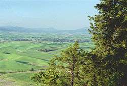
According to the U.S. Census Bureau, the county has a total area of 2,178 square miles (5,640 km2), of which 2,159 square miles (5,590 km2) is land and 19 square miles (49 km2) (0.9%) is water.[4] Whitman County is part of the Palouse, a wide and rolling prairie-like region of the middle Columbia basin.
Rivers
- Snake River
- Palouse River
- Union Flat Creek
- Rock Creek
- Pine Creek
Lakes and reservoirs
- Lake Herbert G. West, formed from Lower Monumental Dam
- Lake Bryan, named for Dr. Enoch A. Bryan, behind the Little Goose Dam
- Lower Granite Lake, behind the Lower Granite Dam
- Rock Lake
Summits and peaks
- Tekoa Mountain (elevation: 4009')
- Kamiak Butte (elevation: 3641')
- Steptoe Butte (elevation: 3612')
- Bald Butte (elevation: 3369)
Notable parks
- Steptoe Butte State Park
- Kamiak Butte County Park
- Palouse Falls State Park
- Central Ferry State Park
- Boyer Park and Marina
- Wawawai County Park
Adjacent counties
- Spokane County - north
- Benewah County, Idaho - northeast
- Latah County, Idaho - east
- Nez Perce County, Idaho - southeast
- Asotin County - south/southeast
- Garfield County - south
- Columbia County - south
- Franklin County - southwest
- Adams County - west
- Lincoln County - northwest
Major highways
Demographics
| Historical population | |||
|---|---|---|---|
| Census | Pop. | %± | |
| 1880 | 7,014 | — | |
| 1890 | 19,109 | 172.4% | |
| 1900 | 25,360 | 32.7% | |
| 1910 | 33,280 | 31.2% | |
| 1920 | 31,323 | −5.9% | |
| 1930 | 28,014 | −10.6% | |
| 1940 | 27,221 | −2.8% | |
| 1950 | 32,469 | 19.3% | |
| 1960 | 31,263 | −3.7% | |
| 1970 | 37,900 | 21.2% | |
| 1980 | 40,103 | 5.8% | |
| 1990 | 38,775 | −3.3% | |
| 2000 | 40,740 | 5.1% | |
| 2010 | 44,776 | 9.9% | |
| Est. 2014 | 46,827 | [5] | 4.6% |
| U.S. Decennial Census[6] 1790–1960[7] 1900–1990[8] 1990–2000[9] 2010–2014[1] | |||
As of the census[10] of 2000, there were 40,740 people, 15,257 households, and 8,055 families residing in the county. The population density was 19 people per square mile (7/km²). There were 16,676 housing units at an average density of 8 per square mile (3/km²). The racial makeup of the county was 88.07% White, 1.53% Black or African American, 0.73% Native American, 5.55% Asian, 0.27% Pacific Islander, 1.22% from other races, and 2.63% from two or more races. 2.99% of the population were Hispanic or Latino of any race. 21.9% were of German, 9.8% English, 8.6% Irish, 8.3% United States or American and 6.6% Norwegian ancestry.
There were 15,257 households out of which 24.60% had children under the age of 18 living with them, 44.20% were married couples living together, 6.20% had a female householder with no husband present, and 47.20% were non-families. 29.40% of all households were made up of individuals and 7.10% had someone living alone who was 65 years of age or older. The average household size was 2.31 and the average family size was 2.91.
In the county, the population was spread out with 18.10% under the age of 18, 32.60% from 18 to 24, 24.00% from 25 to 44, 16.00% from 45 to 64, and 9.20% who were 65 years of age or older. The median age was 25 years. For every 100 females there were 102.50 males. For every 100 females age 18 and over, there were 101.90 males.
The median income for a household in the county was $28,584, and the median income for a family was $44,830. Males had a median income of $33,381 versus $27,046 for females. The per capita income for the county was $15,298. About 11.00% of families and 25.60% of the population were below the poverty line, including 16.50% of those under age 18 and 5.50% of those age 65 or over.
Politics
The county is traditionally Republican, and as part of Washington's 5th congressional district it is represented by Republican Cathy McMorris Rodgers. Whitman was one of only three counties in the state to be won by Barry Goldwater in 1964. Since that election, the county has been won by the winning candidate in all but two presidential elections, 1976 and 2012. Richard Nixon, Ronald Reagan, Bill Clinton, and George W. Bush all won the county twice.
In 2008, Barack Obama received 51.57% of the Whitman County vote,[11] but in 2012, he received 46.9% of the vote, with Mitt Romney winning with a 49.7% plurality.[12] The county shows polarized voting patterns. Pullman, a university city, voted 62% for President Obama, and the agrarian remainder of the County voted 68% for Romney (source: www.wa.gov). Surprisingly, Whitman was the only county in eastern Washington to approve same-sex marriage via Referendum 74, and it was the only county to vote in favor of Referendum 74 while voting against Barack Obama. Whitman County voters also approved marijuana legalization via Initiative 502.
Economy
Whitman County has highly productive agriculture. According to Heart of Washington, Whitman County produces more barley, wheat, dry peas, and lentils than any other county in the United States.[13]
The county is also home to Schweitzer Engineering Laboratories in Pullman.
Education
Pullman is home to Washington State University, the state's land-grant university.
Communities
Cities
Towns
Census-designated place
Unincorporated communities
Ghost town
Images
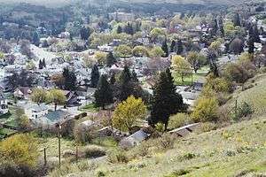
Communities
Geography
-

A farm in Whitman County
-

Lower Granite Dam and Boyer Park and Marina on the Snake River
See also
References
- 1 2 "State & County QuickFacts". United States Census Bureau. Retrieved January 8, 2014.
- ↑ "Find a County". National Association of Counties. Retrieved 2011-06-07.
- ↑ "Milestones for Washington State History — Part 2: 1851 to 1900". HistoryLink.org. March 6, 2003.
- ↑ "2010 Census Gazetteer Files". United States Census Bureau. August 22, 2012. Retrieved July 16, 2015.
- ↑ "Annual Estimates of the Resident Population for Incorporated Places: April 1, 2010 to July 1, 2014". Retrieved June 4, 2015.
- ↑ "U.S. Decennial Census". United States Census Bureau. Retrieved January 8, 2014.
- ↑ "Historical Census Browser". University of Virginia Library. Retrieved January 8, 2014.
- ↑ "Population of Counties by Decennial Census: 1900 to 1990". United States Census Bureau. Retrieved January 8, 2014.
- ↑ "Census 2000 PHC-T-4. Ranking Tables for Counties: 1990 and 2000" (PDF). United States Census Bureau. Retrieved January 8, 2014.
- ↑ "American FactFinder". United States Census Bureau. Retrieved 2011-05-14.
- ↑ "Dave Leip's Atlas of U.S. Presidential Elections - Compare Maps". uselectionatlas.org. Retrieved 7 March 2015.
- ↑ "2012 Washington state election results". The Seattle Times. Retrieved 7 March 2015.
- ↑ Heart of Washington.com
External links
| Wikisource has the text of the 1879 American Cyclopædia article Whitman. |
- Whitman County official website
- Whitman County Genealogical Society
- Whitman County Historical Society
- Whitman County Library with branches in 14 communities throughout Whitman County.
- Whitman County Heritage A collection of historic materials from the Whitman County Library and local partners.
- Whitman County @ State of Washington Office of Financial Management
- Port of Whitman County and Green IT Alliance (GITA)
 |
Lincoln County | Spokane County | Benewah County, Idaho |  |
| Adams County | |
Latah County, Idaho | ||
| ||||
| | ||||
| Franklin County | Columbia County and Garfield County | Nez Perce County, Idaho and Asotin County |
| |||||||||||||||||||||||||||||
Coordinates: 46°53′N 117°31′W / 46.89°N 117.52°W


