Prien am Chiemsee
| Prien am Chiemsee | ||
|---|---|---|
|
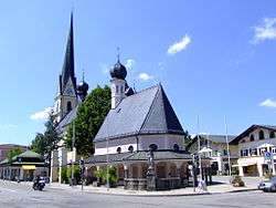
Church at the market square | ||
| ||
 Prien am Chiemsee | ||
Location of Prien am Chiemsee within Rosenheim district  | ||
| Coordinates: 47°52′N 12°20′E / 47.867°N 12.333°ECoordinates: 47°52′N 12°20′E / 47.867°N 12.333°E | ||
| Country | Germany | |
| State | Bavaria | |
| Admin. region | Oberbayern | |
| District | Rosenheim | |
| Government | ||
| • Mayor | Jürgen Seifert (Ind.) | |
| Area | ||
| • Total | 20.69 km2 (7.99 sq mi) | |
| Population (2013-12-31)[1] | ||
| • Total | 10,309 | |
| • Density | 500/km2 (1,300/sq mi) | |
| Time zone | CET/CEST (UTC+1/+2) | |
| Postal codes | 83209 | |
| Dialling codes | 08051 | |
| Vehicle registration | RO | |
| Website | www.prien.de | |
Prien am Chiemsee (official: Prien a.Chiemsee, High German [priːn], Bavarian (local) dialect [breˑɐ̯̃n]) is a municipality in the Upper Bavarian district of Rosenheim in Germany. The town is a certified air and Kneipp spa on the western shore of the lake of Chiemsee, 16 km (9.3 mi) east of Rosenheim.
The name of Prien is derived from the celtic denomination of the river Prien (Brigenna – lit. „Coming from the Mountains“).
Geography
Neighborhoods
The political municipality of Prien am Chiemsee has 36 officially denominated neighborhoods:[2]
|
|
|
|
Famous residents
- Adolf von Bomhard (1891-1976) Lieutenant General in German army, mayor
- Klaus Kotter (born 1934) — president of the International Bobsleigh and Tobogganing Federation: 1980–1994.
- Maximilian Nicu (born 1982) — Bundesliga soccer player
References
- ↑ "Fortschreibung des Bevölkerungsstandes". Bayerisches Landesamt für Statistik und Datenverarbeitung (in German). 31 December 2013.
- ↑ Online Page at the Bavarian State Library
External links
![]() Media related to Prien am Chiemsee at Wikimedia Commons
Media related to Prien am Chiemsee at Wikimedia Commons
|
This article is issued from Wikipedia - version of the Wednesday, December 30, 2015. The text is available under the Creative Commons Attribution/Share Alike but additional terms may apply for the media files.

