Port Republic Historic District
For Port Republic Historic District in Rockingham County, Virginia, see Port Republic Historic District (Virginia). For Port Republic Road Historic District in Waynesboro, Virginia, see Port Republic Road Historic District.
|
Port Republic Historic District | |
 | |
 | |
| Location | Roughly bounded by Mill Street, Clark's Landing Road, Adams Avenue, Port Republic-Smithville Road and Riverside Drive, Port Republic, New Jersey |
|---|---|
| Coordinates | 39°31′15″N 74°29′35″W / 39.52083°N 74.49306°WCoordinates: 39°31′15″N 74°29′35″W / 39.52083°N 74.49306°W |
| Area | 100 acres (40 ha) |
| Built | 1774 |
| Architect | Multiple |
| Architectural style | Greek Revival, Late Victorian, Colonial |
| NRHP Reference # | 91000596[1] |
| NJRHP # | 388[2] |
| Significant dates | |
| Added to NRHP | May 16, 1991 |
| Designated NJRHP | April 1, 1991 |
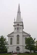
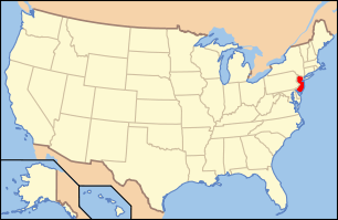
The Port Republic Historic District in Port Republic, Atlantic County, New Jersey is a 100-acre (40 ha) historic district that was listed on the National Register of Historic Places in 1991.[1]
In 1991, the district included 110 buildings deemed to contribute to the historic character of the area, and four other contributing sites.[1]
-

Amanda Blake Store
-

Home of Captain Micjah Smith
-

St. Paul's Methodist Church
References
- 1 2 3 Staff (2009-03-13). "National Register Information System". National Register of Historic Places. National Park Service.
- ↑ "New Jersey and National Registers of Historic Places - Atlantic County" (PDF). New Jersey Department of Environmental Protection - Historic Preservation Office. May 28, 2014. p. 7.
External links
-
 Media related to Port Republic Historic District at Wikimedia Commons
| |||||||||||||||||||||||||||
This article is issued from Wikipedia - version of the Wednesday, November 25, 2015. The text is available under the Creative Commons Attribution/Share Alike but additional terms may apply for the media files.
