Rougé
| Rougé | ||
|---|---|---|
|
The church of Saint-Pierre-et-Saint-Paul, in Rougé | ||
| ||
 Rougé | ||
|
Location within Pays de la Loire region  Rougé | ||
| Coordinates: 47°47′01″N 1°26′49″W / 47.7836°N 1.4469°WCoordinates: 47°47′01″N 1°26′49″W / 47.7836°N 1.4469°W | ||
| Country | France | |
| Region | Pays de la Loire | |
| Department | Loire-Atlantique | |
| Arrondissement | Châteaubriant | |
| Canton | Rougé | |
| Intercommunality | Castelbriantais | |
| Government | ||
| • Mayor (2008–2014) | Jacques Lemaitre | |
| Area1 | 56.32 km2 (21.75 sq mi) | |
| Population (2006)2 | 2,262 | |
| • Density | 40/km2 (100/sq mi) | |
| INSEE/Postal code | 44146 / 44660 | |
| Elevation | 39–109 m (128–358 ft) | |
| Website | www.cc-castelbriantais.fr | |
|
1 French Land Register data, which excludes lakes, ponds, glaciers > 1 km² (0.386 sq mi or 247 acres) and river estuaries. 2 Population without double counting: residents of multiple communes (e.g., students and military personnel) only counted once. | ||
Rougé is a commune in the Loire-Atlantique department in western France.
It lies near Rennes.
The name "Rougé" comes from the Latin "Rubiacus", means the red place. The name was used to call "the red place" because of the high iron-composition of the ground.
Geography
The river Chère forms small part of the commune's southern border.
Lords of Rougé

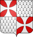
Coat of Arms of the House Rougé
Main article: House of Rougé
This town is the original lordship of a French family of the same name (Rougé-Rougé, Rougé de Derval, Rougé du Plessis-Bellière, and Rougé de Caylus).
Bibliography
- Lobineau, Dom, Mémoire pour servir de preuves à l'Histoire de Bretagne
- Courcelles, Chevalier de, Histoire généalogique de la Maison de Rougé, Béthune, 1830.
- Borel d'Hauterive, André, Notice historique et généalogique sur la Maison de Rougé, Annuaire de la Noblesse de France, 1880.
- Rougé, Vicomte Olivier de, Histoire Généalogique de la Maison de Rougé, Chartier Vendôme, 1908.
- Wismes, Armel de, Ainsi vivaient les Français, Jean-Pierre Gyss éditeur, 2001.
- Rougé, Comte Bertrand de, Le Château de Tonquédec, Editions Ouest-France, 2000.
- Morand, Paul, Fouquet ou le Soleil Offusqué.
- Bazin, Raymond, La Fronde en Normandie, Dieppe, 1907.
- Almanach de Gotha
- Bottin Mondain
- La Barre de Raillicourt, Dominique de, Les Titres authentiques de la noblesse en France, Editions Perrin, 2004.
- Quid.
| Wikimedia Commons has media related to Rougé. |
This article is issued from Wikipedia - version of the Thursday, February 05, 2015. The text is available under the Creative Commons Attribution/Share Alike but additional terms may apply for the media files.

.svg.png)