Piracicaba
| Piracicaba | |||
|---|---|---|---|
| Municipality | |||
 | |||
| |||
 Location in São Paulo state | |||
 Piracicaba Location in Brazil | |||
| Coordinates: 22°43′31″S 47°38′57″W / 22.72528°S 47.64917°WCoordinates: 22°43′31″S 47°38′57″W / 22.72528°S 47.64917°W | |||
| Country |
| ||
| Region | Southeast Region | ||
| State | São Paulo | ||
| Government | |||
| • Mayor | Gabriel Ferrato (PSDB) | ||
| Area | |||
| • Total | 1,378.07 km2 (532.08 sq mi) | ||
| Elevation | 547 m (1,795 ft) | ||
| Population (2015) | |||
| • Total | 391,449 | ||
| • Density | 280/km2 (740/sq mi) | ||
| Time zone | BRT/BRST (UTC-3/-2) | ||
| Postal code | 13400-000 | ||
| Website |
www | ||
Piracicaba is a city located in the Brazilian state of São Paulo. The population is 391,449 (2015 est.) in an area of 1378.07 km².[1] It is at an elevation of 547 m above sea level.
Name
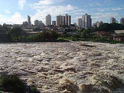
The place name comes from a word in the Tupi language that means "place where the fish stops". The name is due to the waterfalls of the Piracicaba River that bisect the city, where the "piracema" (fish swimming upstream to reproduce) or larger fish species such as the dourados can still be observed.
History
In 1766, Antonio Correa Barbosa, charged with the task of establishing a settlement on the estuary of Piracicaba river, opted for a location about 90 km from it. Piracicaba was officially founded on August 1, 1767.
In 1944, the city was made the seat of the Roman Catholic Diocese of Piracicaba.
It is famous for sugarcane plantations, traditional cane spirit production and traditional music. The city houses the oldest agricultural university in Brazil, the Luiz de Queiroz School of Agriculture of the University of São Paulo. This university is more than 100 years old and is located on a farm with a large collection of trees and plants. It is also recognized as a leader in the field of precision agriculture.
Piracicaba is known by the nickname "Noiva da Colina" (bride of the hills). Every year Piracicaba is host to the "Festa das Nações" (Nations' Fair), where people may find foods from all over the world, and the "Salão Internacional do Humor" (International Fair of Humor), where cartoonists from around the world display comic drawings.
Economy
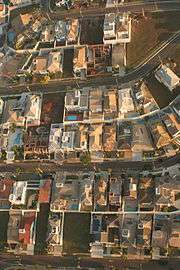
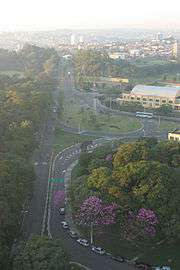
Its economy is fueled by the cultivation of sugarcane. The harvest of sugarcane produces many products, such as sugar, oil and ethanol. Copersucar, a large company that has a center of research on genetic improvement of sugarcane, helps fuel this growing industry. Another economic characteristic feature is the presence of large industries, the main ones are Caterpillar, ArcelorMittal and Hyundai.[2]
Geography
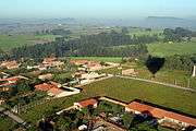
Altitude: 554 m. Temperatures through the year vary from 37.5° Celsius maximum to 16.0° Celsius minimum. Its annual rainfall is 1,230.6 mm. The city has a total area of 1,312.30 km² making it the 19th largest city in the State of São Paulo. Its urban area is 158.06 km² which has 95% of the population.
Demographics
The population in 2015 was 391,449.[1] In 2000, the Human Development Index was 0.836 (high) for the city. In 2013 the HDI was 0.744, still falling in the 'high' category.
Utilities
Water and Power supply are practically 100%. There are approximately 164 telephones and 333 cars per thousand people.
Sister cities
Notable natives
- José Altafini, also known as "Mazola", a Brazilian footballer.
- André Cypriano, documentary photographer
- Evaristo Conrado Engelberg, engineer and inventor
- Marcos Pizzelli-Brazilian footballer.
- Rubens Ometto Silveira Mello, owner of Cosan.
References
| ||||||||||||||||||||||||||||||||||||||||||||||||||||||||||||
External links
| Wikimedia Commons has media related to Piracicaba. |
|

