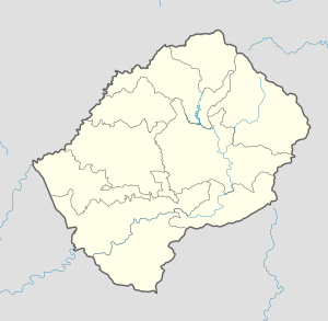
Phuthiatsana
| Phuthiatsana | |
|---|---|
| Community Council | |
 Phuthiatsana Geographic Center of Community | |
| Coordinates: 29°07′31″S 27°52′48″E / 29.12528°S 27.88000°E | |
| Country |
|
| District | Berea District |
| Elevation[1] | 5,305 ft (1,617 m) |
| Population (2006) | |
| • Total | 25,660 |
| Time zone | CAT (UTC+2) |
| Coordinates computed from Lesotho Villages file.[2] | |
Phuthiatsana is a community council located in the Berea District of Lesotho. Its population in 2006 was 25,660.[3]
Villages
Within Phuthiatsana, there are 85 villages including: Cana, Ha Bose, Ha Bulara, Ha Chaba, Ha Hlaonyane, Ha Jane, Ha Kholopane, Ha Koone, Ha Korotsoane, Ha Kotita, Ha Lebina, Ha Lechesa, Ha Lehana, Ha Lenea, Ha Lenea (Ha Mamathe), Ha Libenyane, Ha Mahleke, Ha Majara, Ha Malesela, Ha Mamathe, Ha Matelile, Ha Matseleli, Ha Moepi, Ha Mokhathi, Ha Mokhehle, Ha Mokhethi, Ha Mokoma, Ha Molala, Ha Monnanyane, Ha Morolong, Ha Mosethe, Ha Mosobela, Ha Mosoeunyane, Ha Motsoaole, Ha Motsora, Ha Mphetlane, Ha Mphunyetsane, Ha Ntebele, Ha Ntsabane, Ha Ntsang, Ha Ntsenki, Ha Patso, Ha Phalatsane, Ha Phiri, Ha Phoofolo, Ha Ramachine, Ha Ramotete, Ha Rankali, Ha Rankhalile (Likocheng), Ha Rantung, Ha Rapalo, Ha Rapopo, Ha Seele, Ha Selone, Ha Seoka, Ha Sepiriti (Moterong), Ha Seutloali, Ha Taeke (Liphakoeng), Ha Thaka-Mpholo, Ha Thube, Ha Tjobe, Ha Tšekelo, Ha Tšepo, Ha Tšoeunyane, Hlokoa-Le-Mafi, Khafung, Khalahali, Kolone, Koti-sephola, Lipatolong, Liphiring, Mafikeng, Mahlanyeng, Majaheng, Malieleng, Mamathe, Masoeling, Mohlakeng, Paballong, Phuthing, Sebala-Bala, Sefateng, Thota-Peli, Tilimaneng and Tsila-Tsila.[4]
References
- ↑ GTOPO30 via GeoNames. Retrieved 2010-08-07.
- ↑ Google Earth Download Site Retrieved 2010-07-21.
- ↑ Statoids.com
- ↑ Lesotho Bureau of Statistics, Village List 2006.