Karkinit Bay
| Karkinit Bay | |
|---|---|
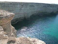
 Cape Tarkhankut is the southernmost point of the bay | |
| Location | Black Sea |
| Coordinates | 45°48′N 32°37′E / 45.800°N 32.617°ECoordinates: 45°48′N 32°37′E / 45.800°N 32.617°E |
| Ocean/sea sources | Atlantic Ocean |
| Basin countries | Ukraine |
| Max. depth | 35 m |
| Salinity | 18 ‰ |
| Settlements | Skadovsk, Armyansk, Krasnoperekopsk |
Karkinit, Karkinitski,[1] or Karkinitsky Bay (Ukrainian: Каркінітська затока, Karkinits’ka zatoka; Russian: Каркинитский залив, Karkinitskiy zaliv[2]) is a bay of the Black Sea that separates the northwestern Crimean Peninsula from the mainland Ukraine. It was named after the early Greek settlement of Kerkinitis (Κερκινίτης) on the Crimean coast in place of modern Yevpatoria.
The northeastern tip of the Karkinitis Bay, by the Isthmus of Perekop, is known as the Perekop Bay or Gulf of Perekop.
The bay contains the preserve Karkinits'ka Zatoka State Zakaznik.
References
- ↑ The Commission on the Protection of the Black Sea against Pollution. "Geography: BSIMAP". 2009. Accessed 18 Mar 2014.
- ↑ These names are also sometimes translated as the Karkinite or Karkinitian "Gulf" or "Bight".
This article is issued from Wikipedia - version of the Monday, May 05, 2014. The text is available under the Creative Commons Attribution/Share Alike but additional terms may apply for the media files.