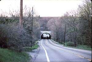
Pequest Fill

The Pequest Fill is a large railroad embankment on the Lackawanna Cut-Off in northwestern New Jersey, touted at its 1911 completion as the largest railroad fill in the world.[1] [2]
Thought to have been the brainchild of Lackawanna Railroad president William Truesdale, the Pequest Fill was one of several remarkable features of the Lackawanna Cut-Off, a project that aimed to reduce the length, grades, and curvature of the railroad's main line over the hilly terrain between Port Morris, New Jersey, and the Delaware Water Gap. During planning, Truesdale rejected 13 prospective routes that skirted the Pequest Valley in favor of a bold, costly, yet operationally superior route across it. In order to maintain a more or less level grade across the valley, a fill of enormous proportions would be required to connect Andover and Green Township.[3][4]
Planning for the route continued through 1906; the final survey map for the line was completed on September 1, allowing the railroad to proceed with eminent domain and hire contractors. The 28.5-mile (46-km) Cut-Off project was divided among seven contractors. Whether by design or happenstance, the responsibility for building the Pequest Fill was divided roughly in half between David W. Flickwir to the east and Walter H. Gahagan to the west.[5]

Construction on the Cut-Off began August 1, 1908. The foundation for the three-mile (4.8 km) Pequest Fill was constructed of 6.625 million cubic yards of fill material, far more than could be provided by classic cut-and-fill techniques. (These require a relatively even balance between the amount of dirt and rock material that is removed from an area of the right-of-way to provide a cut through a hill and the needs of a nearby fill.) So the railroad bought 760 acres of farmland and dug it out to a depth of about 20 feet (6 m). Several of these borrow pits have filled with water over the years and have become sizeable ponds. Construction wrapped up in autumn 1911.[6]
The Pequest Fill crosses four roadways (US Route 206 and three county roads), two railroad rights-of-way (the Sussex Branch and the Lehigh & Hudson River Railway), and one river (the Pequest River). There are no overhead bridges or grade crossings. The east end of Greendell Siding continued onto the Pequest Fill for a short distance; otherwise, the railroad was two tracks wide on the fill. The Cut-Off saw rail service between 1911 (when the Lackawanna Cut-Off opened) to 1979 (when Conrail discontinued rail service). In between, the Lackawanna Railroad operated trains over the Pequest Fill for 49 years; the Erie Lackawanna Railroad for 16 years; and Conrail for three years. After discontinuing service, Conrail sought abandonment of the line and eventually removed the tracks in 1984.
In 1985, the Cut-Off was sold to a land developer who proposed to use the entire Pequest Fill for the now-defunct Westway Project in New York City. That never occurred; by 2001, the entire Cut-Off had been acquired by the State of New Jersey.
By 2011, NJ Transit had received approval to begin construction on relaying track between Port Morris Junction and Andover. As of 2012, work on this project continues and is slated to open for rail service in 2018. As of 2015, there is no funding and no projected completion date for service west of Andover, over the Pequest Fill.
References
- ↑ "Pequest Fill - The Lackawanna Cutoff - Then & Now". GSMRRClub. Retrieved 17 December 2011.
- ↑ The Delaware, Lackawanna & Western Railroad in the Twentieth Century (Volume 1), Thomas T. Taber III, Lycoming Printing Company, 1980.
- ↑ The Lackawanna Railroad in Northwest New Jersey, Larry Lowenthal and William T. Greenberg, Jr., Tri-State Railway Historical Society, Inc., 1987.
- ↑ The Delaware, Lackawanna and Western Railroad in the Twentieth Century (Volume 1), Thomas T. Taber, Lycoming Printing Company, 1980.
- ↑ The Delaware, Lackawanna and Western Railroad in the Twentieth Century (Volume 1), Thomas T. Taber III, Lycoming Printing Company, 1980.
- ↑ The Delaware, Lackawanna & Western Railroad in the Twentieth Century (Volume 1), Thomas T. Taber III, Lycoming Printing Company, 1980.
Coordinates: 40°58′44″N 74°45′47″W / 40.979°N 74.763°W