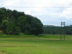
Payyampally
| Payyampally | |
|---|---|
| village | |
|
Oorpally, Payyampally | |
 Payyampally Location in Kerala, India | |
| Coordinates: 11°48′40″N 76°3′20″E / 11.81111°N 76.05556°ECoordinates: 11°48′40″N 76°3′20″E / 11.81111°N 76.05556°E | |
| Country |
|
| State | Kerala |
| District | Wayanad |
| Population (2001) | |
| • Total | 12,391 |
| Languages | |
| • Official | Malayalam, English |
| Time zone | IST (UTC+5:30) |
| PIN | 6XXXXX |
| Vehicle registration | KL- |
| Nearest city | manathavady |
Payyampally is a village in Wayanad district in the state of Kerala, India.[1]
Demographics
As of 2001 India census, Payyampally had a population of 12391 with 6276 males and 6115 females.'Kuruva Island' the well known tourist place is cituated in Payyampally.St Catherine's HSS, Govt. Higher Secondary School Arattuthara, Mary Matha Arts & Science College And St. Patrick's English Medium School are the main Education institutions in Payyampally. The well known temple 'Valliyoor Kavu' also here.Mananthavady river and Panamaram river are joining in Koodalkadavu which is in Payyampally and thus the starting of Kabani river.The first migration in Wayanad took place in Payyampally in the years 1929-30 by Late. Mr. Devassya Kudakkachira.Most of the Tribes in Wayanad like Kurichiya,Pulaya,Adiya,Paniya and Kuruma are the main population of Payyampally Village.In these Kurichiya are the 'Army of Pazhassi Raja'.[1]
References
- 1 2 "Census of India : Villages with population 5000 & above". Retrieved 2008-12-10.
|first1=missing|last1=in Authors list (help)
| ||||||||||||||||||||
