Paxton, Indiana
| Paxton | |
|---|---|
| Unincorporated community | |
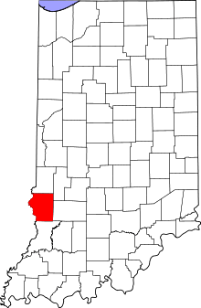 Sullivan County's location in Indiana | |
 Paxton Sullivan County, Indiana | |
| Coordinates: 39°01′16″N 87°23′19″W / 39.02111°N 87.38861°WCoordinates: 39°01′16″N 87°23′19″W / 39.02111°N 87.38861°W | |
| Country | United States |
| State | Indiana |
| County | Sullivan |
| Township | Haddon |
| Elevation[1] | 522 ft (159 m) |
| ZIP code | 47865 |
| FIPS code | 18-58500[2] |
| GNIS feature ID | 449706 |
Paxton is a near extinct town in Haddon Township, Sullivan County, Indiana. It is part of the Terre Haute Metropolitan Statistical Area.
A handful of houses and a post office are all that remain of Paxton today.
Geography
Paxton is located at 39°01′16″N 87°23′19″W / 39.02111°N 87.38861°W.Paxton is located off highway 41 between Carlisle and Sullivan in the Wabash river valley.
References
- ↑ "US Board on Geographic Names". United States Geological Survey. 2007-10-25. Retrieved 2008-01-31.
- ↑ "American FactFinder". United States Census Bureau. Retrieved 2008-01-31.
| |||||||||||||||||||||||||
This article is issued from Wikipedia - version of the Monday, September 08, 2014. The text is available under the Creative Commons Attribution/Share Alike but additional terms may apply for the media files.