Oxford, New Zealand
| Oxford | |
|---|---|
| Village | |
|
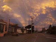
The main street (Inland Scenic Route) of Oxford | |
 Oxford | |
| Coordinates: 43°18′46″S 172°11′26″E / 43.31278°S 172.19056°ECoordinates: 43°18′46″S 172°11′26″E / 43.31278°S 172.19056°E | |
| Country |
|
| Region | Canterbury |
| Territorial authority | Waimakariri District |
| Electorates |
Waimakariri Te Tai Tonga (Maori electorate)[1] |
| Population (June 2015 estimate)[2] | |
| • Total | 2,100 |
| Time zone | NZST (UTC+12) |
| • Summer (DST) | NZDT (UTC+13) |
| Postcode(s) | 7430 |
| Area code(s) | 03 |
| Website |
www |
Oxford is a small town of around 2,100 people serving the farming community of North Canterbury, New Zealand.[3] It is part of the Waimakariri District and is a linear town, approximately 2 kilometres (1.2 mi) long. Originally, it was served by the Oxford Branch railway, and had two stations, East Oxford and West Oxford. The line closed in 1959 and was dismantled. Some railway signs and the remnants of railway platforms can still be seen along Oxford Road on the way to Rangiora.
It was originally a logging town: trees were felled from forests in the area, and hauled by beast to Christchurch. A mural depicting life from that era is painted on the side wall of the butchers shop.
Oxford has won awards for the most beautiful village and the most beautiful toilet.[4]
Geography


Oxford is located at the inland edge of the Canterbury Plains, approximately 50 km northwest of Christchurch. The township is about 30 km from Rangiora to the East, and the townships of Sheffield and Darfield to the west.
Oxford can be reached from Christchurch by means of Tram Road, which has the longest straight section of road in New Zealand.
Naming
It is unclear whether the town is named after Oxford in England or after its university, but it is more probable that it was named after Samuel Wilberforce, who was the Bishop of Oxford from 1845 to 1870. It was named by the chief surveyor of the Canterbury Association, Joseph Thomas, in 1849.[5][6]
Education
The town has one school, Oxford Area School.[7] It is a state composite (Year 1–13) school with a role of 543 students (as of November 2015).[8] The principal is Mike Hart.
Amenities

Oxford's excellent historical museum is in a building that was built by the community from more than 20,000 hand-made bricks.
Oxford has five cafe/restaurants/bakery: Cafe 51, Under the Oaks, vintage cupcake store Pink Sugar, Sheffield Pie Shop and Rustic Country.
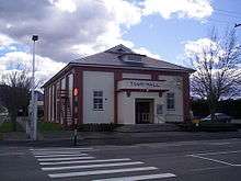
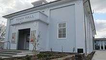
The Oxford Farmers' Market operates in Main St, between the service Centre and the butcher, each Sunday morning from 9:30 to 12:30. This is one of the few Canterbury farmers' markets to operate year round. A Craft Market runs on the first Sunday of each month in the Town Hall, opened in 1931. The new (current) town hall was intended to replace two previous town halls and was seen as one means to unify East Oxford and West Oxford into a single township.
Community

The community saved hard during 2005 and 2006 to raise funds for projects such as the Oxford Community Pool, a community-based swimming pool in Burnett Street, and a first-response ambulance. The town prides itself on its ability to self-fund community projects through organizations such as the Lions.
Oxford has several Churches and organisations:
Oxford Union Church (Presbyterian)
Oxford Baptist Church
Catholic Church
Seventh Day Adventist Church
Anglican Church
Tawera Masonic Lodge
Oxford Working Men’s Club
West Oxford Hotel (Public House - The West)
Transport
Oxford was linked to Christchurch in 1878 by the narrow-gauge Oxford Branch from Oxford West to Rangiora to meet the broad gauge from Christchurch. With the gauge conversion of 1878, it became easier to transfer passengers and freight from the branch line to Christchurch, though passengers still had to change at Rangiora from the Waipara train to the branch train. The branch stretched from Rangiora through Bennetts Junction (where the Eyreton Branch joined), Oxford and Sheffield. This necessitated a high road-rail bridge across the Waimakariri Gorge.
From Oxford to Sheffield closed in 1931 along with the Eyreton Branch, leaving the Oxford branch as a rural branch line. It lost its passenger service in the 1940s. Due to declining revenue, the branch closed on 31 May 1959 and the track was sold to Scotts Engineering of Christchurch, which used the rails from several branch lines to build farm sheds.
The line was latterly worked by the A and AB class 4-6-2 and C class 2-6-2 tender locomotives. No diesel locomotives or railcars are known to have used the branch, although thought was given in the 1940s to running a small railcar.
Oxford Benevolent and Improvement League
The OB&I was formed during World War I to provide charitable support to war widows. To raise money, it showed films in the old Oxford Town Hall. It provides charitable support to the citizens of Oxford. Movies are screened in the Town Hall approximately every other Saturday during the winter. The heyday of the OB&I movies was the middle of the 20th century, when three or four films would be shown every week and queues often extended around the building. This was before private car ownership became popular, as the nearest cinema was in Christchurch, some 50 km distant.
Renovation of Main Street


During 2009, Main Street underwent a major renovation with the road resurfaced, pedestrian refuges in strategic locations and new footpaths with garden beds. The old welcome signs were replaced with new "Experience Oxford" signs at east and west entries. This project was a joint undertaking by the Waimakariri District Council and the Oxford Promotions and Action Committee (OPAC), but they ran out of money and did not finish both sides of the street.
References
- ↑ http://www.elections.org.nz/mapping/
- ↑ "Subnational Population Estimates: At 30 June 2015 (provisional)". Statistics New Zealand. 22 October 2015. Retrieved 23 October 2015. For urban areas, "Infoshare; Group: Population Estimates - DPE; Table: Estimated Resident Population for Urban Areas, at 30 June (1996+) (Annual-Jun)". Statistics New Zealand. 22 October 2015. Retrieved 23 October 2015.
- ↑ 2013 Census QuickStats about a place:Oxford
- ↑ Waimakariri District Council (2000). "District public toilet strategy" (PDF). Retrieved 2012-06-28.
- ↑ Reed, A. W. (2010). Peter Dowling, ed. Place Names of New Zealand. Rosedale, North Shore: Raupo. p. 297. ISBN 9780143204107.
- ↑ Hight, James; C. R. Straubel (1957). A History of Canterbury. Volume I : to 1854. Christchurch: Whitcombe and Tombs Ltd. p. 120.
- ↑ "Oxford Area School Website". Retrieved 30 April 2014.
- ↑ "Directory of Schools - as at 01 December 2015". New Zealand Ministry of Education. Retrieved 2015-12-29.
External links
![]() Media related to Oxford, New Zealand at Wikimedia Commons
Media related to Oxford, New Zealand at Wikimedia Commons
| ||||||||||||||||||||||||||||||||||||||||||||||||||||||||||||||||||||||||||