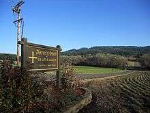
Our Lady of Guadalupe Trappist Abbey


Our Lady of Guadalupe Trappist Abbey is a monastery in a rural area of the U.S. state of Oregon. The monks are members of the Order of Cistercians of the Strict Observance, commonly called the Trappists. It is located in Yamhill County north of Lafayette about 30 miles (48 km) southwest of Portland.
Currently the Abbey is home to about 28 monks. The monks live communally in the abbey. Their day is balanced by prayer, work, reading, and contemplation.
The Abbey is located on 1,300 acres (530 ha) of forestland in low hills of the western Willamette Valley. The forest adds to the spiritual setting for the community, acts as a buffer to neighbors, and allows for cloistered retreat. It is also the basis for a sustainable forestry enterprise that provides income to the monks. Other income-generating enterprises include a book bindery, a wine warehouse for local wineries, and a fruitcake bakery.
History
The Abbey began in April 1948 in Pecos, New Mexico as a foundation established by the Trappist community at Valley Falls, Rhode Island which later became St. Joseph's Abbey in Spencer, Massachusetts. In March 1955, the monks, not finding farming sufficiently productive in northern New Mexico, sold the property to Benedictine monks and moved the abbey to its present site in Oregon.
The title Our Lady of Guadalupe commemorating the Virgin Mary's apparitions at Tepeyac, near Mexico City in 1531, was originally chosen because of the Mexican influence in the southwestern U.S., and was gladly brought along to the Northwest.
The Abbey serves as a spiritual sanctuary for guests. The monks operate a non-denominational retreat facility for both men and women who stay in small cottages and make use of a library and a meditation hall.
A new 10,000-square-foot (930 m2) church was built in 2007, combining traditional Cistercian architecture with Pacific Northwest design elements.
External links
Coordinates: 45°17′02″N 123°05′28″W / 45.284°N 123.091°W
| |||||||||||||||||||||||||||||||||
