Orthophoto


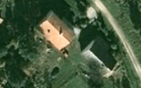
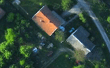
An orthophoto, orthophotograph or orthoimage is an aerial photograph geometrically corrected ("orthorectified") such that the scale is uniform: the photo has the same lack of distortion as a map. Unlike an uncorrected aerial photograph, an orthophotograph can be used to measure true distances, because it is an accurate representation of the Earth's surface, having been adjusted for topographic relief,[1] lens distortion, and camera tilt.
Orthophotographs are commonly used in the creation of a Geographic Information System (GIS). Software can display the orthophoto and allow an operator to digitize or place linework, text annotations or geographic symbols (such as hospitals, schools, and fire stations). Some software can process the orthophoto and produce the linework automatically.
Production of orthophotos was historically achieved using mechanical devices. [2]
See also
- ImageStation Suite
- Aerial Photography
- Digital Orthophoto Quadrangle (DOQ) and Digital Orthophoto Quarter Quadrangle (DOQQ)
- Leica Photogrammetry Suite Orthorectification Software
- GRASS GIS (i.ortho.photo module)
- Photogrammetry
- Photomapping
- TopoFlight
- Socet set Orthophoto Software
- U.S. Geological Survey
- Rational Polynomial Coefficient
References
- ↑ Smith, Gary S. "DIGITAL ORTHOPHOTOGRAPHY AND GIS." ESRI Conference. http://proceedings.esri.com/library/userconf/proc95/to150/p124.html
- ↑ BBC Tomorrow's World: How maps are corrected and updated using aerial photography and optical machinery. 18 December 1970.
- Bolstad, P., (2005), GIS Fundamentals: A First Text on Geographic Information Systems, Eider Press, White Bear Lake, MN, 2nd ed.
- Demers, Michael N., (1997). Fundamentals of Geographic Information Systems, John Wiley & Sons.
- Fernandez, E., Garfinkel, R. & Roman Arbiol (May–June 1998). "Mosaicking of Aerial Photographic Maps Via Seams Defined by Bottleneck Shortest Paths". Operations Research 46 (3): 293–304. doi:10.1287/opre.46.3.293..
- Petrie, G., (1977), Transactions of the Institute of British Geographers: Orthophotomaps New Series, vol. 2, no.1, Contemporary Cartography., pg. 49-70
- Robinson, A.H., Morrison, J.L., Muehrcke, P.C., Kimerling, A.J., Stephen Guptill, (1995) Elements of Cartography: John Wiley & Sons Inc., Canada, 6th ed.
- United States Geological Survey, US Department of Interior, USGS Fact Sheet May 2001 http://erg.usgs.gov/isb/pubs/factsheets/fs05701.html