Olonets
| Olonets (English) Олонец (Russian) Anuksenlinnu (Karelian) | |
|---|---|
| - Town[1] - | |
 A street in Olonets | |
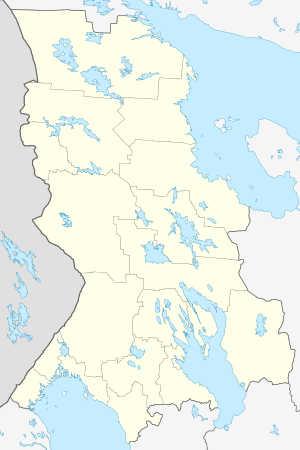
.svg.png) Location of the Republic of Karelia in Russia | |
 Olonets | |
|
| |
_(1781).png) | |
|
| |
| Administrative status (as of April 2013) | |
| Country | Russia |
| Federal subject | Republic of Karelia[1] |
| Administrative district | Olonetsky District[1] |
| Administrative center of | Olonetsky District[1] |
| Municipal status (as of April 2013) | |
| Municipal district | Olonetsky Municipal District[2] |
| Urban settlement | Olonetskoye Urban Settlement[2] |
| Administrative center of | Olonetsky Municipal District,[3] Olonetskoye Urban Settlement[2] |
| Statistics | |
| Population (2010 Census) | 9,056 inhabitants[4] |
| Time zone | MSK (UTC+03:00)[5] |
| First mentioned | 1137 |
| Town status since | 1649 |
| Olonets on Wikimedia Commons | |
Olonets (Russian: Оло́нец; Karelian: Anus, Anuksenlinnu; Finnish: Aunus, Aunuksenlinna or Aunuksenkaupunki) is a town and the administrative center of Olonetsky District of the Republic of Karelia, Russia, located on the Olonka River to the east from Lake Ladoga. Population: 9,056 (2010 Census);[4] 10,240 (2002 Census);[6] 11,888 (1989 Census).[7]
History
Olonets is the oldest documented settlement in Karelia, mentioned by Novgorodian sources as early as 1137. Its history is obscure until 1649, when a fortress was built there to protect the Grand Duchy of Moscow against the Swedes. The same year it was granted town privileges. Until the Great Northern War, Olonets developed as a principal market for Russian trade with Sweden. To the south from the town, there sprawled a belt of fortified abbeys, of which the Alexander-Svirsky Monastery was the most important.
In the 18th century, Olonets' importance shifted from trade to ironworking industries. In 1773, it was made the seat of Olonets Governorate. Eleven years later, however, the seat was moved to Petrozavodsk and Olonets started to decline.
Modern Olonets is classified as a historical town of the Republic of Karelia and is the only town in the republic where Karelians are in majority (over 60% as of 2004).
Administrative and municipal status
Within the framework of administrative divisions, Olonets serves as the administrative center of Olonetsky District, to which it is directly subordinated.[1] As a municipal division, the town of Olonets, together with eight rural localities, is incorporated within Olonetsky Municipal District as Olonetskoye Urban Settlement.[2]
Notable people
- Witold Pilecki (1901–1948) was born in Olonets. He was a Polish National hero, soldier and a member of Armia Krajowa who was executed in 1948 by the Polish communist regime.
International relations
Twin towns and sister cities
Olonets is twinned with:
 Hyrynsalmi, Finland
 Mikkeli, Finland
 Puolanka, Finland
 Ristijärvi, Finland
References
Notes
- 1 2 3 4 5 Law #871-RZK
- 1 2 3 4 Law #813-RZK
- ↑ Law #825-ZRK
- 1 2 Russian Federal State Statistics Service (2011). "Всероссийская перепись населения 2010 года. Том 1" [2010 All-Russian Population Census, vol. 1]. Всероссийская перепись населения 2010 года (2010 All-Russia Population Census) (in Russian). Federal State Statistics Service. Retrieved June 29, 2012.
- ↑ Правительство Российской Федерации. Федеральный закон №107-ФЗ от 3 июня 2011 г. «Об исчислении времени», в ред. Федерального закона №248-ФЗ от 21 июля 2014 г. «О внесении изменений в Федеральный закон "Об исчислении времени"». Вступил в силу по истечении шестидесяти дней после дня официального опубликования (6 августа 2011 г.). Опубликован: "Российская газета", №120, 6 июня 2011 г. (Government of the Russian Federation. Federal Law #107-FZ of June 31, 2011 On Calculating Time, as amended by the Federal Law #248-FZ of July 21, 2014 On Amending Federal Law "On Calculating Time". Effective as of after sixty days following the day of the official publication.).
- ↑ Russian Federal State Statistics Service (May 21, 2004). "Численность населения России, субъектов Российской Федерации в составе федеральных округов, районов, городских поселений, сельских населённых пунктов – районных центров и сельских населённых пунктов с населением 3 тысячи и более человек" [Population of Russia, Its Federal Districts, Federal Subjects, Districts, Urban Localities, Rural Localities—Administrative Centers, and Rural Localities with Population of Over 3,000] (XLS). Всероссийская перепись населения 2002 года [All-Russia Population Census of 2002] (in Russian). Retrieved August 9, 2014.
- ↑ Demoscope Weekly (1989). "Всесоюзная перепись населения 1989 г. Численность наличного населения союзных и автономных республик, автономных областей и округов, краёв, областей, районов, городских поселений и сёл-райцентров" [All Union Population Census of 1989: Present Population of Union and Autonomous Republics, Autonomous Oblasts and Okrugs, Krais, Oblasts, Districts, Urban Settlements, and Villages Serving as District Administrative Centers]. Всесоюзная перепись населения 1989 года [All-Union Population Census of 1989] (in Russian). Институт демографии Национального исследовательского университета: Высшая школа экономики [Institute of Demography at the National Research University: Higher School of Economics]. Retrieved August 9, 2014.
Sources
- Законодательное Собрание Республики Карелия. Закон №871-ЗРК от 29 апреля 2005 г. «Об административно-территориальном устройстве Республики Карелия», в ред. Закона №1895-ЗРK от 2 июня 2015 г. «О внесении изменения статью 9 Закона Республики Карелия "Об административно-территориальном устройстве Республики Карелия"». Вступил в силу со дня официального опубликования. Опубликован: газета "Карелия", №48, 7 мая 2005 г. (Legislative Assembly of the Republic of Karelia. Law #871-ZRK of April 29, 2005 On the Administrative-Territorial Structure of the Republic of Karelia, as amended by the Law #1895-ZRK of June 2, 2015 On Amending Article 9 of the Law of the Republic of Karelia "On the Administrative-Territorial Structure of the Republic of Karelia". Effective as of the official publication date.).
- Законодательное Собрание Республики Карелия. Закон №813-ЗРК от 1 ноября 2004 г. «О городских, сельских поселениях в Республике Карелия», в ред. Закона №1694-ЗРK от 2 апреля 2013 г. «О преобразовании муниципальных образований "Нюхчинское сельское поселение" и "Сумпосадское сельское поселение" Беломорского муниципального района и внесении изменений в некоторые законодательные акты Республики Карелия». Вступил в силу по истечении десяти дней со дня официального опубликования. Опубликован: газета "Карелия", №124, 126, 129, 132, 135, 136, 139, 4 ноября — 9 декабря 2004 г. (Legislative Assembly of the Republic of Karelia. Law #813-ZRK of November 1, 2004 On the Urban, Rural Settlements in the Republic of Karelia, as amended by the Law #1694-ZRK of April 2, 2013 On the Transformation of the Municipal Formations of "Nyukhchinskoye Rural Settlement" and "Sumposadskoye Rural Settlement" of Belomorsky Municipal District of the Republic of Karelia and on Amending Various Legislative Acts of the Republic of Karelia. Effective as of the day which is ten days after the day of the official publication.).
- Законодательное Собрание Республики Карелия. Закон №825-ЗРК от 1 декабря 2004 г. «О муниципальных районах в Республике Карелия», в ред. Закона №1694-ЗРK от 2 апреля 2013 г. «О преобразовании муниципальных образований "Нюхчинское сельское поселение" и "Сумпосадское сельское поселение" Беломорского муниципального района и внесении изменений в некоторые законодательные акты Республики Карелия». Вступил в силу по истечении десяти дней со дня официального опубликования. Опубликован: газета "Карелия", №141, 16 декабря 2004 г. (Legislative Assembly of the Republic of Karelia. Law #825-ZRK of December 1, 2004 On the Municipal Districts in the Republic of Karelia, as amended by the Law #1694-ZRK of April 2, 2013 On the Transformation of the Municipal Formations of "Nyukhchinskoye Rural Settlement" and "Sumposadskoye Rural Settlement" of Belomorsky Municipal District of the Republic of Karelia and on Amending Various Legislative Acts of the Republic of Karelia. Effective as of the day which is ten days after the day of the official publication.).
| |||||||||||||||||||||
|