Nomans Land Range
| Noman’s Land Range | |
|---|---|
| Part of United States Navy | |
| Chilimark, Massachusetts | |
|
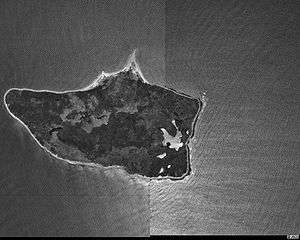
Nomans Land in 1995 | |
| Coordinates | Coordinates: 41°15′18.00″N 70°48′54.00″W / 41.2550000°N 70.8150000°W |
| Type | Range |
| Site information | |
| Owner | Chilmark, Massachusetts |
| Controlled by | State of Massachusetts |
| Open to the public | Yes |
| Site history | |
| In use | 1944-1946 |
The Noman’s Land Range was a former naval bomb range for aviators, located on Nomans Land, in Chilmark, Massachusetts.
History
Nomans Land was first used as a gunnery and bomb range, beginning in 1943. It was used as a practice area for bombers for the next 53 years, until 1996.[1] Two restricted airspace areas, R-4105A and R-4105B, currently overlay the island due to the sites former use as a range.
References
- ↑ Freeman, Paul. "Abandoned & Little-Known Airfields: Southeastern Massachusetts". Abandoned & Little-Known Airfields. Retrieved 4 March 2012.
External links
- Nomans Land Island National Wildlife Refuge at the U.S. Fish & Wildlife Service site
- Annals of Chilmark, "Nomans Land". From The History of Martha's Vineyard, Volume II by Dr. Charles E. Banks. 1911.
| ||||||||||||||||||||||||||||||||||||||||||||||||||||||||||||||||||||||||||||||||||||||||||||||||||||||||||||||||||||||||||||||||||||||||||||||||||||||||||||||||||||||||||||||||||||||||||||
This article is issued from Wikipedia - version of the Sunday, March 04, 2012. The text is available under the Creative Commons Attribution/Share Alike but additional terms may apply for the media files.

