Nodaway, Missouri
| Nodaway, Missouri | |
|---|---|
| Township | |
 | |
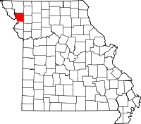
 Nodaway, Missouri Location within the state of Missouri | |
| Coordinates: 39°54′32″N 94°58′04″W / 39.90889°N 94.96778°WCoordinates: 39°54′32″N 94°58′04″W / 39.90889°N 94.96778°W | |
| Country | United States |
| State | Missouri |
| County | Nodaway |
| Time zone | Central (CST) (UTC-6) |
| • Summer (DST) | CDT (UTC-5) |
Nodaway, Missouri is a former town in Andrew County, Missouri near the confluence of the Nodaway River and Missouri River
The Lewis and Clark Expedition camped by the town on Nodaway Island on July 8, 1804 and took note of the river, on their trip to explore what would become the Oregon Country.
The explorers recommended the same spot for the winter headquarters for the next expedition, called the Astor Expedition, from St. Louis to mouth of the Columbia River. Fur trader John Jacob Astor financed that venture, and Wilson Price Hunt led the overland portion. Members of the party included British naturalist Thomas Nuttall.
When Missouri entered the Union, one proposal would have defined the state's western border in relation to the mouth of the river. It was decided instead to use Kaw Point, at the confluence of the Kansas and Missouri rivers, to define the border; Kaw Point lies about 20 miles east of Nodaway, and a fair distance south. Later, the Missouri would expand in its northwestern corner, past this initial border.
| |||||||||||||||||||||||||
