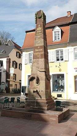
Blieskastel
| Blieskastel | ||
|---|---|---|
 | ||
| ||
 Blieskastel | ||
Location of Blieskastel within Saarpfalz district 
 | ||
| Coordinates: 49°13′59″N 7°15′0″E / 49.23306°N 7.25000°ECoordinates: 49°13′59″N 7°15′0″E / 49.23306°N 7.25000°E | ||
| Country | Germany | |
| State | Saarland | |
| District | Saarpfalz | |
| Government | ||
| • Mayor | Annelie Faber-Wegener (CDU) | |
| Area | ||
| • Total | 108.27 km2 (41.80 sq mi) | |
| Population (2013-12-31)[1] | ||
| • Total | 20,879 | |
| • Density | 190/km2 (500/sq mi) | |
| Time zone | CET/CEST (UTC+1/+2) | |
| Postal codes | 66431–66440 | |
| Dialling codes | 06842 | |
| Vehicle registration | HOM | |
| Website | www.blieskastel.de | |
Blieskastel German pronunciation: [ˈbliːsˌkast(ɘ)l] is a municipality in the Saarpfalz district, in Saarland, Germany which is divided into villages, one of the largest being Wolfersheim. It is situated on the river Blies, approximately 8 kilometres (5 miles) west of Zweibrücken, and 20 km (12 mi) east of Saarbrücken.
International relations
Blieskastel is twinned with:
 Le Creusot, France, since 1989
 Castellabate, Italy, since 2008
References
- ↑ "Fläche und Bevölkerung - Stand: 31.12.2013 (Basis Zensus 2011)" (PDF). Statistisches Amt des Saarlandes (in German). September 2014.
External links
![]() Media related to Blieskastel at Wikimedia Commons
Media related to Blieskastel at Wikimedia Commons
| ||||||||
|
This article is issued from Wikipedia - version of the Friday, January 15, 2016. The text is available under the Creative Commons Attribution/Share Alike but additional terms may apply for the media files.
