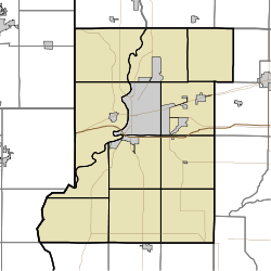
New Goshen, Indiana
| New Goshen | |
|---|---|
| census-designated place | |
 Vigo County's location in Indiana | |
 New Goshen Location in Vigo County, Indiana | |
| Coordinates: 39°34′52″N 87°27′44″W / 39.58111°N 87.46222°WCoordinates: 39°34′52″N 87°27′44″W / 39.58111°N 87.46222°W | |
| Country | United States |
| State | Indiana |
| County | Vigo |
| Township | Fayette |
| Elevation | 643 ft (196 m) |
| ZIP code | 47863 |
| FIPS code | 18-52956[1] |
| GNIS feature ID | 440049[2] |
New Goshen is an unincorporated census-designated place in Fayette Township, Vigo County, Indiana. It is part of the Terre Haute Metropolitan Statistical Area.
History
New Goshen was platted and laid out May 17, 1853, by Hamilton Smith, William Ferguson, George Smith and John Hay. As of 1890 the population was approximately 180.[3] Future Indiana Senator, Birch Bayh, was a resident and graduated from New Goshen High; New Goshen High closed in 1959 and was consolidated into today's West Vigo High School.
Geography
New Goshen is located at 39°34′52″N 87°27′44″W / 39.58111°N 87.46222°W at an elevation of 643 feet.
It is bisected by U.S. Highway 150 that connects it to Paris, IL to the northwest and West Terre Haute to the southwest.
References
- ↑ "American FactFinder". United States Census Bureau. Retrieved 2008-01-31.
- ↑ "New Goshen, Indiana". Geographic Names Information System. United States Geological Survey. Retrieved 2009-10-17.
- ↑ Bradsby, H.C. (1891). History of Vigo County, Indiana, with Biographical Selections. Chicago: S. B. Nelson & Co. p. 479.
| |||||||||||||||||||||||||||||||||