| [3] |
Name on the Register |
Image |
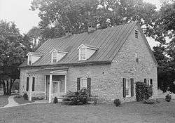
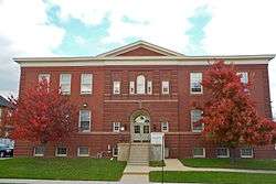
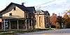
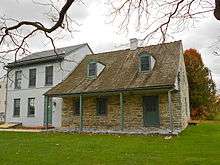
Date listed[4] |
Location |
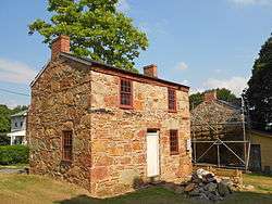
City or town |
Description |
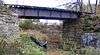
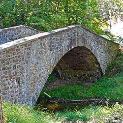
|---|
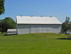
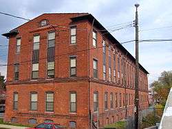
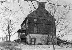
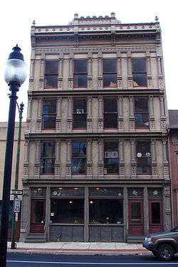
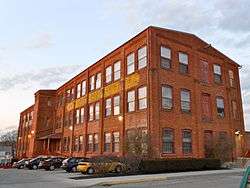
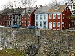
| 1 |
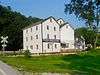
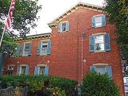
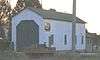
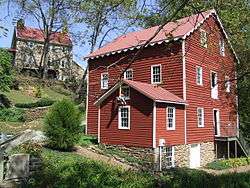
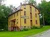
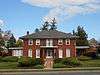
Ashley and Bailey Company Silk Mill |
|
000000001991-02-21-0000February 21, 1991
(#91000090) |
1237 West Princess Street
39°57′07″N 76°45′03″W / 39.951944°N 76.750833°W / 39.951944; -76.750833 (Ashley and Bailey Company Silk Mill) |
West York |
|
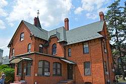
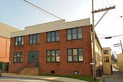
| 2 |
Ashton-Hursh House |
|
000000002003-11-15-0000November 15, 2003
(#03001155) |
204 Limekiln Road, south of New Cumberland
40°12′54″N 76°52′23″W / 40.215°N 76.873°W / 40.215; -76.873 (Ashton-Hursh House) |
Fairview Township |
|
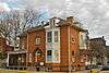
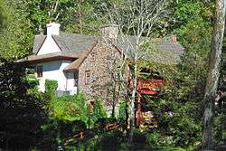
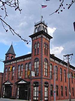
| 3 |
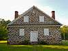
Henry and Elizabeth Berkheimer Farm |
Upload image |
000000002000-11-15-0000November 15, 2000
(#00001382) |
240 Bentz Mill Road
40°02′26″N 77°00′50″W / 40.040556°N 77.013889°W / 40.040556; -77.013889 (Henry and Elizabeth Berkheimer Farm) |
Washington Township |
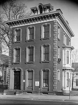
|
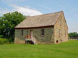
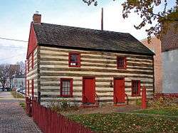
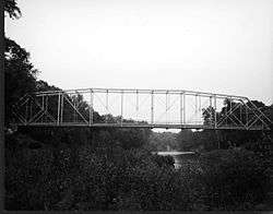
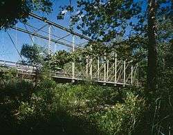
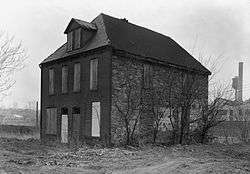
| 4 |
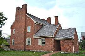
Billmeyer House |
|
000000001970-11-10-0000November 10, 1970
(#70000557) |
East Market Street
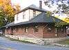
39°57′51″N 76°43′23″W / 39.964167°N 76.723056°W / 39.964167; -76.723056 (Billmeyer House) |
York |
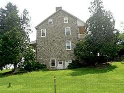
|
| 5 |
Michael and Magdealena Bixler Farmstead |
|
000000002000-07-27-0000July 27, 2000
(#00000850) |
400 Mundis Race Road
40°01′15″N 76°42′16″W / 40.020833°N 76.704444°W / 40.020833; -76.704444 (Michael and Magdealena Bixler Farmstead) |
East Manchester Township |
|
| 6 |
Barnett Bobb House |
|
000000001975-10-29-0000October 29, 1975
(#75001682) |
Rear of 157 West Market Street
39°57′43″N 76°43′54″W / 39.961944°N 76.731667°W / 39.961944; -76.731667 (Barnett Bobb House) |
York |
|
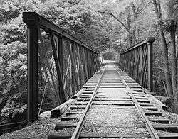
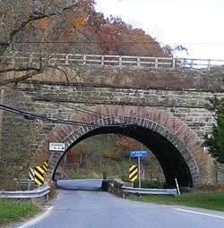
| 7 |
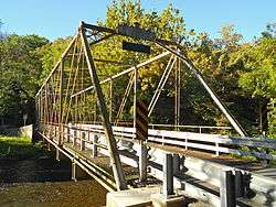
Bridge 182+42, Northern Central Railway |
|
000000001995-05-04-0000May 4, 1995
(#95000542) |
Northern Central railroad tracks over Pennsylvania Route 616 and Codorus Creek, south of Glen Rock
39°46′39″N 76°43′25″W / 39.7775°N 76.723611°W / 39.7775; -76.723611 (Bridge 182+42, Northern Central Railway) |
Shrewsbury Township |
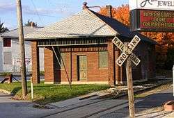
|
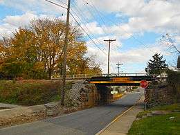
| 8 |
Bridge 5+92, Northern Central Railway |
|
000000001995-05-04-0000May 4, 1995
(#95000548) |
Northern Central railroad tracks over South Main Street, north of Pennsylvania Route 214
39°51′15″N 76°46′18″W / 39.854167°N 76.771667°W / 39.854167; -76.771667 (Bridge 5+92, Northern Central Railway) |
Seven Valleys |
|
| 9 |
Bridge 634, Northern Central Railway |
|
000000001995-05-04-0000May 4, 1995
(#95000543) |
Northern Central Railroad tracks over an Pleasent Valley Rd. and Codorus Creek, northwest of Railroad
39°46′23″N 76°43′14″W / 39.773056°N 76.720556°W / 39.773056; -76.720556 (Bridge 634, Northern Central Railway) |
Shrewsbury Township |
|
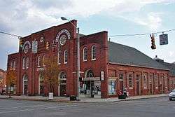
| 10 |
Bridge between East Manchester and Newberry Townships |
|
000000001988-06-22-0000June 22, 1988
(#88000795) |
York-Haven Rd. (State Route 181) over Conewago Creek
40°04′53″N 76°43′03″W / 40.081389°N 76.7175°W / 40.081389; -76.7175 (Bridge between East Manchester and Newberry Townships) |
East Manchester and Newberry Townships |
|
| 11 |
Bridge in Washington Township |
|
000000001988-06-22-0000June 22, 1988
(#88000817) |
Legislative Route 66150 over Bermudian Creek, south of Kralltown
40°00′31″N 76°58′29″W / 40.008611°N 76.974722°W / 40.008611; -76.974722 (Bridge in Washington Township) |
Washington Township |
|
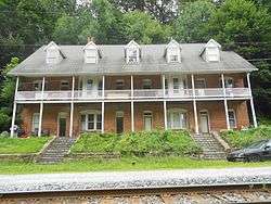
| 12 |
S. B. Brodbeck Housing |
|
000000001990-09-06-0000September 6, 1990
(#90001413) |
Main Street in Brodbecks
39°46′13″N 76°49′39″W / 39.770278°N 76.8275°W / 39.770278; -76.8275 (S. B. Brodbeck Housing) |
Codorus Township |
|
| 13 |
Burgholtshouse |
|
000000001979-06-22-0000June 22, 1979
(#79002369) |
South of East Prospect on Pennsylvania Route 124
39°57′57″N 76°30′54″W / 39.965833°N 76.515°W / 39.965833; -76.515 (Burgholtshouse) |
Lower Windsor Township |
|
| 14 |
Chestnut Hill |
Upload image |
000000002001-09-01-0000September 1, 2001
(#01000952) |
1105 Windsor Road
39°56′22″N 76°37′01″W / 39.939444°N 76.616944°W / 39.939444; -76.616944 (Chestnut Hill) |
Windsor Township |
|
| 15 |
Clear Spring Mill |
|
000000001996-11-04-0000November 4, 1996
(#96001199) |
Western corner of the junction of Capitol Hill and Clear Spring Roads, south of Dillsburg
40°03′25″N 77°03′53″W / 40.056944°N 77.064722°W / 40.056944; -77.064722 (Clear Spring Mill) |
Franklin Township |
|
| 16 |
Codorus Forge and Furnace Historic District |
|
000000001991-09-06-0000September 6, 1991
(#91001132) |
Junction of River Farm and Furnace Roads, southeast of Saginaw
40°03′05″N 76°39′26″W / 40.051389°N 76.657222°W / 40.051389; -76.657222 (Codorus Forge and Furnace Historic District) |
Hellam Township |
|
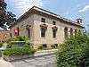
| 17 |
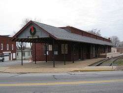
Consumers Cigar Box Company |
|
000000001999-09-24-0000September 24, 1999
(#99001196) |
121 First Avenue
39°53′48″N 76°36′21″W / 39.896667°N 76.605833°W / 39.896667; -76.605833 (Consumers Cigar Box Company) |
Red Lion |
Factory building converted to apartments
|
| 18 |
Cookes House |
|
000000001972-10-05-0000October 5, 1972
(#72001182) |
438-440 Cookes House Lane
39°57′18″N 76°44′09″W / 39.955°N 76.73575°W / 39.955; -76.73575 (Cookes House) |
York |
|
| 19 |
Coulsontown Cottages Historic District |
|
000000001985-01-31-0000January 31, 1985
(#85000175) |
Ridge Road and Main, east of Delta
39°43′29″N 76°18′28″W / 39.724722°N 76.307667°W / 39.724722; -76.307667 (Coulsontown Cottages Historic District) |
Peach Bottom Township |
|
| 20 |
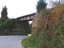
Deer Creek Bridge, Stewartstown Railroad |
Upload image |
000000001995-05-04-0000May 4, 1995
(#95000544) |
Stewartstown Railroad tracks over Deer Creek at Deer Creek Road, east of Shrewsbury
39°45′30″N 76°38′55″W / 39.758333°N 76.648611°W / 39.758333; -76.648611 (Deer Creek Bridge, Stewartstown Railroad) |
Hopewell and Shrewsbury Townships |
|
| 21 |
Delta Historic District |
|
000000001983-09-15-0000September 15, 1983
(#83002288) |
Main Street
39°43′27″N 76°19′53″W / 39.724167°N 76.331389°W / 39.724167; -76.331389 (Delta Historic District) |
Delta |
|
| 22 |
Delta Trestle Bridge, Maryland and Pennsylvania Railroad |
Upload image |
000000001995-05-04-0000May 4, 1995
(#95000550) |
Maryland and Pennsylvania Railroad tracks over an unnamed stream, east of Bunker Hill Road, north of Delta
39°43′44″N 76°19′49″W / 39.728889°N 76.330278°W / 39.728889; -76.330278 (Delta Trestle Bridge, Maryland and Pennsylvania Railroad) |
Peach Bottom Township |
|
| 23 |
Diamond Silk Mill |
|
000000001992-07-24-0000July 24, 1992
(#92000949) |
Junction of Ridge Avenue and Hay Street in East York
39°58′35″N 76°42′00″W / 39.976389°N 76.7°W / 39.976389; -76.7 (Diamond Silk Mill) |
Springettsbury Township |
|
| 24 |
Dill's Tavern |
|
000000002004-03-18-0000March 18, 2004
(#04000195) |
227 North Baltimore Street
40°06′55″N 77°02′14″W / 40.115278°N 77.037222°W / 40.115278; -77.037222 (Dill's Tavern) |
Dillsburg |
|
| 25 |
Dritt Mansion |
|
000000001977-08-16-0000August 16, 1977
(#77001206) |
3.5 miles (5.6 km) south of Wrightsville on Pennsylvania Route 624
39°58′39″N 76°29′48″W / 39.9775°N 76.496667°W / 39.9775; -76.496667 (Dritt Mansion) |
Lower Windsor Township |
|
| 26 |
East York Historic District |
|
000000001999-03-12-0000March 12, 1999
(#99000326) |
Bounded by Oxford Street, Wallace Street, Royal Street, and Eastern Boulevard
39°58′27″N 76°41′17″W / 39.974167°N 76.688056°W / 39.974167; -76.688056 (East York Historic District) |
Springettsbury Township |
|
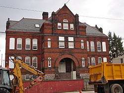
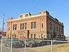
| 27 |
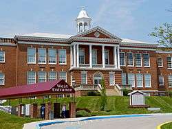
Eichelberger High School |
|
000000001995-04-27-0000April 27, 1995
(#95000517) |
195 Stock Street
39°48′21″N 76°59′11″W / 39.805833°N 76.986389°W / 39.805833; -76.986389 (Eichelberger High School) |
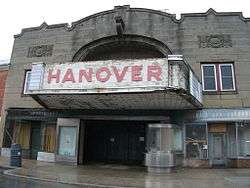
Hanover |
|
| 28 |
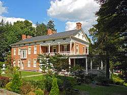
Emig Mansion |
|
000000001984-09-07-0000September 7, 1984
(#84003586) |
3342 North George Street in Emigsville
40°01′10″N 76°43′42″W / 40.019444°N 76.728472°W / 40.019444; -76.728472 (Emig Mansion) |
Manchester Township |
|
| 29 |
Etters Bridge |
|
000000001986-02-27-0000February 27, 1986
(#86000308) |
Green Lane Drive and Yellow Breeches Creek
40°13′26″N 76°53′51″W / 40.223889°N 76.8975°W / 40.223889; -76.8975 (Etters Bridge) |
Fairview Township |
Extends into Cumberland County
|
| 30 |
Fairmount Historic District |
|
000000001999-11-30-0000November 30, 1999
(#99001428) |
Roughly bounded by Cherry Lane, Stevens Avenue, and Cottage Hill Road
39°58′03″N 76°43′59″W / 39.9675°N 76.733056°W / 39.9675; -76.733056 (Fairmount Historic District) |
York |
|
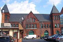
| 31 |
Farmers Market |
|
000000001977-11-25-0000November 25, 1977
(#77001207) |
380 West Market Street
39°57′33″N 76°44′13″W / 39.959167°N 76.736944°W / 39.959167; -76.736944 (Farmers Market) |
York |
|
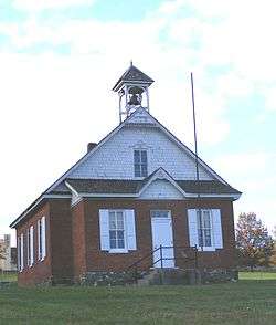
| 32 |
Fissel's School |
|
000000001997-10-24-0000October 24, 1997
(#97001253) |
Junction of Fissel's Church Road and Country Club Road
39°46′05″N 76°44′00″W / 39.768056°N 76.733333°W / 39.768056; -76.733333 (Fissel's School) |
Shrewsbury Township |
|
| 33 |
Forry House |
|
000000001977-12-27-0000December 27, 1977
(#77001208) |
149 North Newberry Street
39°57′46″N 76°44′09″W / 39.962778°N 76.735833°W / 39.962778; -76.735833 (Forry House) |
York |
|
| 34 |
Gen. Horatio Gates House |
|
000000001971-12-06-0000December 6, 1971
(#71000737) |
157-159 West Market Street
39°57′43″N 76°43′47″W / 39.961944°N 76.729722°W / 39.961944; -76.729722 (Gen. Horatio Gates House) |
York |
|
| 35 |
Gilbert Bridge |
Upload image |
000000001989-05-05-0000May 5, 1989
(#89000355) |
Bishop Road / Gilbert Road over Yellow Breeches Creek, northwest of Siddonsburg
40°09′13″N 76°58′52″W / 40.153583°N 76.981111°W / 40.153583; -76.981111 (Gilbert Bridge) |
Monaghan Township |
Extends into Upper Allen Township in Cumberland County
|
| 36 |
Glen Rock Historic District |
|
000000001997-05-30-0000May 30, 1997
(#97000518) |
Roughly bounded by Glenvue Road and Hanover, Manchester, Valley, Church, and Center Streets
39°47′34″N 76°43′58″W / 39.792778°N 76.732778°W / 39.792778; -76.732778 (Glen Rock Historic District) |
Glen Rock |
|
| 37 |
Goldsboro Historic District |
|
000000001984-06-14-0000June 14, 1984
(#84003589) |
Roughly bounded by North, 3rd, Fraser, and Railroad Streets
40°09′11″N 76°45′02″W / 40.153056°N 76.750556°W / 40.153056; -76.750556 (Goldsboro Historic District) |
Goldsboro |
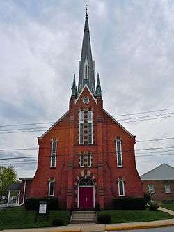
|
| 38 |
Guinston United Presbyterian Church |
|
000000001976-01-11-0000January 11, 1976
(#76001682) |
East of Laurel off Pennsylvania Route 74 (14130 Guinston Forge Road)
39°50′04″N 76°29′30″W / 39.834444°N 76.491667°W / 39.834444; -76.491667 (Guinston United Presbyterian Church) |
Chanceford Township |
|
| 39 |
Hammersly-Strominger House |
|
000000001978-12-20-0000December 20, 1978
(#78002487) |
Northeast of Lewisberry on Pennsylvania Route 177
40°08′37″N 76°51′01″W / 40.143611°N 76.850278°W / 40.143611; -76.850278 (Hammersly-Strominger House) |
Newberry Township |
|
| 40 |
Hanover Historic District |
|
000000001997-01-02-0000January 2, 1997
(#96001552) |
Roughly bounded by Elm Avenue, Broadway, Eisenhower Drive, Hollywood Avenue, and the Hanover borough boundary line
39°48′23″N 76°58′58″W / 39.806389°N 76.982778°W / 39.806389; -76.982778 (Hanover Historic District) |
Hanover |
|
| 41 |
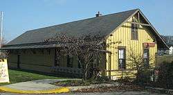
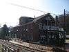
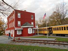
Hanover Junction Railroad Station |
|
000000001983-12-29-0000December 29, 1983
(#83004258) |
Pennsylvania Route 616 at Hanover Junction
39°50′37″N 76°46′38″W / 39.843611°N 76.777222°W / 39.843611; -76.777222 (Hanover Junction Railroad Station) |
North Codorus Township |
|
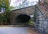
| 42 |
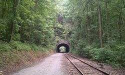
Howard Tunnel, Northern Central Railway |
|
000000001995-05-19-0000May 19, 1995
(#95000541) |
Northern Central railroad tracks near the South Branch of Codorus Creek, southeast of New Salem
39°53′28″N 76°45′02″W / 39.891111°N 76.750556°W / 39.891111; -76.750556 (Howard Tunnel, Northern Central Railway) |
North Codorus Township |
|
| 43 |
Indian Steps Cabin |
|
000000001990-03-09-0000March 9, 1990
(#90000416) |
Indian Steps Road, north of Airville
39°51′48″N 76°22′33″W / 39.863333°N 76.375833°W / 39.863333; -76.375833 (Indian Steps Cabin) |
Lower Chanceford Township |
|
| 44 |
Kise Mill Bridge |
|
000000001988-06-22-0000June 22, 1988
(#88000799) |
Legislative Route 66003 over Bennett Run, east of Lewisberry
40°06′56″N 76°48′38″W / 40.115556°N 76.810556°W / 40.115556; -76.810556 (Kise Mill Bridge) |
Newberry Township |
|
| 45 |
Kise Mill Bridge Historic District |
|
000000001980-10-15-0000October 15, 1980
(#80003650) |
Junction of Kise Mill and Roxberry Roads, east of Lewisberry[5]
40°07′00″N 76°48′36″W / 40.116528°N 76.809972°W / 40.116528; -76.809972 (Kise Mill Bridge Historic District) |
Newberry Township |
|
| 46 |
Laurel-Rex Fire Company House |
|
000000001976-10-08-0000October 8, 1976
(#76001683) |
South Duke Street
39°57′42″N 76°43′31″W / 39.961667°N 76.725278°W / 39.961667; -76.725278 (Laurel-Rex Fire Company House) |
York |
|
| 47 |
Byrd Leibhart Site (36YO170) |
|
000000002009-01-14-0000January 14, 2009
(#84003955) |
Native Lands County Park[6]
39°58′41″N 76°29′54″W / 39.978167°N 76.498333°W / 39.978167; -76.498333 (Byrd Leibhart Site (36YO170)) |
Lower Windsor Township |
|
| 48 |
Oscar Leibhart Site (36YO9) |
Upload image |
000000001984-05-24-0000May 24, 1984
(#84003597) |
Along the Susquehanna River, south of Trinity Church Road and west of Long Level Road[7]
39°59′20″N 76°30′01″W / 39.989000°N 76.500278°W / 39.989000; -76.500278 (Oscar Leibhart Site (36YO9)) |
Lower Windsor Township |
|
| 49 |
McCalls Ferry Farm |
Upload image |
000000002000-11-08-0000November 8, 2000
(#00001344) |
447 McCalls Ferry Road
39°49′30″N 76°21′22″W / 39.825°N 76.356111°W / 39.825; -76.356111 (McCalls Ferry Farm) |
Lower Chanceford Township |
|
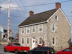
| 50 |
Englehart Melchinger House |
|
000000001992-08-12-0000August 12, 1992
(#92000990) |
5 North Main Street
40°00′06″N 76°51′03″W / 40.001667°N 76.850833°W / 40.001667; -76.850833 (Englehart Melchinger House) |
Dover |
|
| 51 |
Muddy Creek Bridge, Maryland and Pennsylvania Railroad |
Upload image |
000000001995-05-04-0000May 4, 1995
(#95000540) |
Maryland and Pennsylvania railroad tracks over Muddy Creek, east of Creek Ridge Road, south of Sunnyburn
39°45′37″N 76°21′05″W / 39.760278°N 76.351389°W / 39.760278; -76.351389 (Muddy Creek Bridge, Maryland and Pennsylvania Railroad) |
Lower Chanceford and Peach Bottom Townships |
|
| 52 |
Muddy Creek Forks Historic District |
|
000000001994-04-29-0000April 29, 1994
(#94000397) |
Junction of Muddy Creek Forks and New Park Roads at Muddy Creek Forks
39°48′27″N 76°28′31″W / 39.8075°N 76.475278°W / 39.8075; -76.475278 (Muddy Creek Forks Historic District) |
East Hopewell, Fawn, and Lower Chanceford Townships |
|
| 53 |
George Nace (Neas) House |
|
000000001972-04-26-0000April 26, 1972
(#72001181) |
113-115 West Chestnut Street
39°48′03″N 76°59′10″W / 39.800833°N 76.986111°W / 39.800833; -76.986111 (George Nace (Neas) House) |
Hanover |
|
| 54 |
New Freedom Railroad Station, Northern Central Railway |
|
000000001995-05-04-0000May 4, 1995
(#95000539) |
Front Street
39°44′24″N 76°42′04″W / 39.74°N 76.701111°W / 39.74; -76.701111 (New Freedom Railroad Station, Northern Central Railway) |
New Freedom |
|
| 55 |
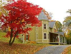
The Nook |
|
000000001982-03-01-0000March 1, 1982
(#82003821) |
1101 Farquhar Drive, south of York
39°56′44″N 76°43′27″W / 39.945556°N 76.724167°W / 39.945556; -76.724167 (The Nook) |
Spring Garden Township |
|
| 56 |
Northwest York Historic District |
|
000000001983-09-12-0000September 12, 1983
(#83002289) |
Roughly bounded by Carlisle, Texas, Pennsylvania, Newberry, Park, and Linden Avenues
39°57′42″N 76°44′54″W / 39.961667°N 76.748333°W / 39.961667; -76.748333 (Northwest York Historic District) |
York |
|
| 57 |
Old Columbia-Wrightsville Bridge |
|
000000001988-06-22-0000June 22, 1988
(#88000764) |
Legislative Route 128 over the Susquehanna River and a railroad line
40°01′50″N 76°30′41″W / 40.030556°N 76.511389°W / 40.030556; -76.511389 (Old Columbia-Wrightsville Bridge) |
Wrightsville |
Extends into Lancaster County
|
| 58 |
Payne's Folly |
|
000000001986-03-06-0000March 6, 1986
(#86000422) |
Watters Road
39°43′32″N 76°30′06″W / 39.725556°N 76.501667°W / 39.725556; -76.501667 (Payne's Folly) |
Fawn Township |
|
| 59 |
Pettit's Ford |
|
000000001983-05-03-0000May 3, 1983
(#83002290) |
4400 Colonial Road, west of Dover
39°59′17″N 76°55′50″W / 39.988167°N 76.930639°W / 39.988167; -76.930639 (Pettit's Ford) |
Dover Township |
|
| 60 |
Pierceville Run Agricultural Historic District |
Upload image |
000000002013-02-01-0000February 1, 2013
(#12000902) |
Roughly bounded by Fair School, Myers, Meckley, Rockville, & Narrow Gauge Rds., & Pierceville Run
39°46′32″N 76°45′51″W / 39.775429°N 76.764078°W / 39.775429; -76.764078 (Pierceville Run Agricultural Historic District) |
Codorus Township |
|
| 61 |
Pleasureville Historic District |
|
000000002000-02-18-0000February 18, 2000
(#00000057) |
Roughly along North Sherman Street between Cherry Lane and Park View Road in Springettsbury
40°00′09″N 76°42′17″W / 40.0025°N 76.704722°W / 40.0025; -76.704722 (Pleasureville Historic District) |
Springettsbury Township |
|
| 62 |
Rev. Anderson B. Quay House |
|
000000001997-10-24-0000October 24, 1997
(#97001255) |
22 North Baltimore Street
40°06′41″N 77°02′09″W / 40.111389°N 77.035833°W / 40.111389; -77.035833 (Rev. Anderson B. Quay House) |
Dillsburg |
|
| 63 |
Railroad Borough Historic District |
|
000000001984-03-22-0000March 22, 1984
(#84003601) |
Shaub Road North, East, and South Main Street
39°45′37″N 76°41′54″W / 39.760278°N 76.698333°W / 39.760278; -76.698333 (Railroad Borough Historic District) |
Railroad |
|
| 64 |
Red Lion Borough Historic District |
|
000000002000-08-10-0000August 10, 2000
(#00000847) |
Roughly bounded by Edgewood Avenue, the Windsor Township line, a Maryland and Pennsylvania line, Chestnut Road, Country Club Road, and the York Township line
39°53′55″N 76°36′35″W / 39.898611°N 76.609722°W / 39.898611; -76.609722 (Red Lion Borough Historic District) |
Red Lion |
|
| 65 |
Ridge Road Bridge, Stewartstown Railroad |
|
000000001995-05-04-0000May 4, 1995
(#95000545) |
Stewartstown Railroad tracks over Ridge Road, west of Stewartstown
39°45′35″N 76°37′33″W / 39.759722°N 76.625833°W / 39.759722; -76.625833 (Ridge Road Bridge, Stewartstown Railroad) |
Hopewell Township |
|
| 66 |
Martin Schultz House |
|
000000001993-03-11-0000March 11, 1993
(#93000057) |
155 Emig Street
40°00′02″N 76°36′33″W / 40.000556°N 76.609167°W / 40.000556; -76.609167 (Martin Schultz House) |
Hallam |
|
| 67 |
Scott Creek Bridge-North, Maryland and Pennsylvania Railroad |
Upload image |
000000001995-05-04-0000May 4, 1995
(#95000551) |
Maryland and Pennsylvania railroad tracks over Scott Creek, west of Watson's Corner and south of Pennsylvania Route 851
39°44′46″N 76°20′29″W / 39.746111°N 76.341389°W / 39.746111; -76.341389 (Scott Creek Bridge-North, Maryland and Pennsylvania Railroad) |
Peach Bottom Township |
|
| 68 |
William Shelly School and Annex |
|
000000002001-05-02-0000May 2, 2001
(#01000464) |
201 North Adams Street
39°57′22″N 76°45′40″W / 39.9562°N 76.7610°W / 39.9562; -76.7610 (William Shelly School and Annex) |
West York |
|
| 69 |
Shrewsbury Historic District |
|
000000001984-03-22-0000March 22, 1984
(#84003605) |
Roughly bounded by Highland and Sunset Drives, Park Avenue, and Church and Pine Streets
39°46′03″N 76°40′49″W / 39.7675°N 76.680278°W / 39.7675; -76.680278 (Shrewsbury Historic District) |
Shrewsbury |
|
| 70 |
Shrewsbury Railroad Station, Stewartstown Railroad |
|
000000001995-05-04-0000May 4, 1995
(#95000546) |
South Main Street at the Stewartstown Railroad tracks
39°45′26″N 76°40′41″W / 39.757222°N 76.678056°W / 39.757222; -76.678056 (Shrewsbury Railroad Station, Stewartstown Railroad) |
Shrewsbury |
|
| 71 |
Sinking Springs Farms |
|
000000002000-07-27-0000July 27, 2000
(#00000848) |
Roughly bounded by Church Road, Sinking Springs Ln., North George Street, Locust Lane, the Susquehanna Trail, and Pennsylvania Route 238
40°00′37″N 76°44′33″W / 40.010278°N 76.7425°W / 40.010278; -76.7425 (Sinking Springs Farms) |
Manchester Township |
|
| 72 |
South Road Bridge, Northern Central Railway |
Upload image |
000000001995-05-04-0000May 4, 1995
(#95000549) |
Former Northern Central railroad tracks over an unnamed creek at the South Branch of the Codorus Creek, at Larue
39°49′14″N 76°45′39″W / 39.820556°N 76.760833°W / 39.820556; -76.760833 (South Road Bridge, Northern Central Railway) |
Springfield Township |
|
| 73 |
Spring Grove Borough Historic District |
|
000000001984-05-25-0000May 25, 1984
(#84003608) |
Roughly bounded by College Avenue and Jackson, Water, East, and Church Streets
39°52′25″N 76°51′55″W / 39.873611°N 76.865278°W / 39.873611; -76.865278 (Spring Grove Borough Historic District) |
Spring Grove |
|
| 74 |
Springdale Historic District |
|
000000002001-08-30-0000August 30, 2001
(#01000926) |
Bounded by South George Street, Lombardy Alley, South Queen Street, and Rathon Road
39°56′58″N 76°43′04″W / 39.949444°N 76.717778°W / 39.949444; -76.717778 (Springdale Historic District) |
York |
|
| 75 |
Stevens School |
|
000000001983-12-29-0000December 29, 1983
(#83004263) |
606 West Philadelphia Street
39°57′31″N 76°44′40″W / 39.958611°N 76.744444°W / 39.958611; -76.744444 (Stevens School) |
York |
|
| 76 |
Stewartstown Engine House, Stewartstown Railroad |
|
000000001995-05-04-0000May 4, 1995
(#95000554) |
North Hill Street
39°45′16″N 76°35′47″W / 39.754444°N 76.596389°W / 39.754444; -76.596389 (Stewartstown Engine House, Stewartstown Railroad) |
Stewartstown |
|
| 77 |
Stewartstown Railroad Station |
|
000000001995-05-18-0000May 18, 1995
(#95000553) |
Junction of West Pennsylvania Avenue and Hill Street
39°45′15″N 76°35′43″W / 39.754167°N 76.595278°W / 39.754167; -76.595278 (Stewartstown Railroad Station) |
Stewartstown |
|
| 78 |
Stone Arch Road Bridge, Stewartstown Railroad |
|
000000001995-05-04-0000May 4, 1995
(#95000547) |
Stewartstown Railroad tracks over Stone Arch Road, east of Railroad
39°45′01″N 76°41′14″W / 39.750278°N 76.687222°W / 39.750278; -76.687222 (Stone Arch Road Bridge, Stewartstown Railroad) |
Shrewsbury Township |
|
| 79 |
Samuel Stoner Homestead |
Upload image |
000000001976-01-30-0000January 30, 1976
(#76001684) |
South of York off Pennsylvania Route 182
39°55′25″N 76°45′48″W / 39.923611°N 76.763333°W / 39.923611; -76.763333 (Samuel Stoner Homestead) |
West Manchester Township |
|
| 80 |
Strickler Family Farmhouse |
|
000000001991-02-21-0000February 21, 1991
(#91000093) |
1205 Williams Road, east of York
39°59′16″N 76°39′33″W / 39.987778°N 76.659167°W / 39.987778; -76.659167 (Strickler Family Farmhouse) |
Springettsbury Township |
|
| 81 |
Swigart's Mill |
|
000000001980-07-23-0000July 23, 1980
(#80003649) |
North of Hanover on Berlin Road
39°56′04″N 76°58′18″W / 39.934583°N 76.971667°W / 39.934583; -76.971667 (Swigart's Mill) |
Paradise Township |
|
| 82 |
United Cigar Manufacturing Company |
|
000000001999-10-28-0000October 28, 1999
(#99001289) |
201 North Penn Street
39°57′45″N 76°44′19″W / 39.9625°N 76.738611°W / 39.9625; -76.738611 (United Cigar Manufacturing Company) |
York |
|
| 83 |
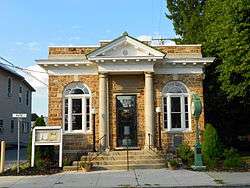
US Post Office-Hanover |
|
000000001992-12-24-0000December 24, 1992
(#92001719) |
141 Broadway
39°48′07″N 76°58′56″W / 39.801944°N 76.982222°W / 39.801944; -76.982222 (US Post Office-Hanover) |
Hanover |
|
| 84 |
Valley Road Bridge, Stewartstown Railroad |
|
000000001995-05-04-0000May 4, 1995
(#95000552) |
Stewartstown Railroad tracks over Valley Road, west of Stewartstown
39°45′19″N 76°36′35″W / 39.755278°N 76.609722°W / 39.755278; -76.609722 (Valley Road Bridge, Stewartstown Railroad) |
Hopewell Township |
|
| 85 |
Wallace-Cross Mill |
|
000000001977-12-22-0000December 22, 1977
(#77001204) |
South of Felton
39°47′58″N 76°32′27″W / 39.799444°N 76.540833°W / 39.799444; -76.540833 (Wallace-Cross Mill) |
East Hopewell Township |
|
| 86 |
Warrington Meetinghouse |
|
000000001975-02-20-0000February 20, 1975
(#75001681) |
Pennsylvania Route 74, east of Wellsville
40°03′11″N 76°55′49″W / 40.053056°N 76.930278°W / 40.053056; -76.930278 (Warrington Meetinghouse) |
Warrington Township |
|
| 87 |
Wellsville Historic District |
|
000000001977-12-06-0000December 6, 1977
(#77001205) |
Pennsylvania Route 74
40°03′04″N 76°56′26″W / 40.051111°N 76.940556°W / 40.051111; -76.940556 (Wellsville Historic District) |
Wellsville |
|
| 88 |
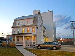
West Side Sanitarium |
|
000000002004-05-05-0000May 5, 2004
(#04000400) |
1253-1261 West Market Street
39°57′14″N 76°45′24″W / 39.953889°N 76.756667°W / 39.953889; -76.756667 (West Side Sanitarium) |
West York |
|
| 89 |
Willis House |
|
000000001979-04-20-0000April 20, 1979
(#79002370) |
135 Willis Run Road, north of York
39°58′20″N 76°44′15″W / 39.972222°N 76.7375°W / 39.972222; -76.7375 (Willis House) |
Manchester Township |
|
| 90 |
Wrightsville Historic District |
|
000000001983-09-12-0000September 12, 1983
(#83002291) |
Roughly bounded by the Susquehanna River and Vine, 4th, and Willow Streets
40°01′26″N 76°31′41″W / 40.023889°N 76.528056°W / 40.023889; -76.528056 (Wrightsville Historic District) |
Wrightsville |
|
| 91 |
York Armory |
|
000000001990-04-18-0000April 18, 1990
(#90000421) |
369 North George Street
39°58′07″N 76°43′50″W / 39.968611°N 76.730556°W / 39.968611; -76.730556 (York Armory) |
York |
|
| 92 |
York Central Market |
|
000000001978-06-09-0000June 9, 1978
(#78002488) |
Philadelphia and Beaver Streets
39°57′46″N 76°43′47″W / 39.962778°N 76.729722°W / 39.962778; -76.729722 (York Central Market) |
York |
|
| 93 |
York Dispatch Newspaper Offices |
|
000000001978-03-08-0000March 8, 1978
(#78002489) |
15 and 17 East Philadelphia Street
39°57′50″N 76°43′41″W / 39.964°N 76.728167°W / 39.964; -76.728167 (York Dispatch Newspaper Offices) |
York |
|
| 94 |
York Historic District |
|
000000001979-08-29-0000August 29, 1979
(#79002371) |
Roughly bounded by railroad tracks, Hartley Street, Lilac Lane, and Cordorus Creek
39°57′30″N 76°43′34″W / 39.958333°N 76.726111°W / 39.958333; -76.726111 (York Historic District) |
York |
|
| 95 |
York Iron Company Mine |
|
000000001985-03-15-0000March 15, 1985
(#85000580) |
North of Green Valley Road, south of Spring Grove
39°50′29″N 76°48′35″W / 39.841389°N 76.809722°W / 39.841389; -76.809722 (York Iron Company Mine) |
North Codorus Township |
|
| 96 |
York Meetinghouse |
|
000000001975-05-06-0000May 6, 1975
(#75001683) |
134 West Philadelphia Street
39°57′42″N 76°44′10″W / 39.961667°N 76.736111°W / 39.961667; -76.736111 (York Meetinghouse) |
York |
|


_Dover_PA.JPG)