National Highway 4A (India)
| ||||
|---|---|---|---|---|
| Route information | ||||
| Length: |
153 km (95 mi) Phase III: 153 km (95 mi) | |||
| Major junctions | ||||
| From: | Belgaum, Karnataka | |||
|
NH 4 in Belgaum NH 17B in Ponda NH 17 in Panaji | ||||
| To: | Panaji, North Goa, Goa | |||
| Location | ||||
| States: |
Karnataka: 82 km (51 mi) Goa: 71 km (44 mi) | |||
| Primary destinations: | Anmod - Ponda | |||
| Highway system | ||||
| ||||

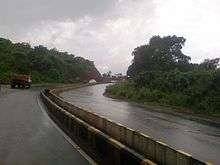
NH4A near Old Goa
National Highway 4A (NH 4A) is a National Highway in India that starts from Belgaum in Karnataka and ends at Panaji in North Goa district. The highway is 153 km (95 mi) long, of which 82 km (51 mi) is in Karnataka and 71 km (44 mi) is in Goa. [1]
Route
See also
- List of National Highways in India (by Highway Number)
- List of National Highways in India
- National Highways Development Project
References
- ↑ Start and end points of National Highways
External links
This article is issued from Wikipedia - version of the Monday, July 06, 2015. The text is available under the Creative Commons Attribution/Share Alike but additional terms may apply for the media files.


