Seaboard-All Florida Railway

The Seaboard-All Florida Railway was a subsidiary of the Seaboard Air Line Railroad that oversaw two major extensions of the system in the early 1920s to southern Florida on each coast during the land boom. One line extended the Seaboard’s tracks on the east coast from West Palm Beach down to Miami, while the other extension on the west coast extended the tracks Fort Ogden to Fort Myers and Naples, with branches to LaBelle and Punta Rassa. These two extensions were championed by Seaboard president S. Davies Warfield (who died months after its completion), and were constructed by Foley Brothers railroad contractors. Both extensions also allowed the Seaboard to better compete with the Florida East Coast Railway and the Atlantic Coast Line Railroad, who already served the lower east and west coasts of Florida respectively. Today, only the east coast route survives.
Grand Opening Celebration

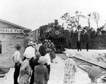
The Seaboard All-Florida Railway's west coast route opened on January 7, 1927, and the east coast route opened the next day. On the opening days of each route, President S. Davies Warfield rode aboard a special section of the Seaboard's Orange Blossom Special with a number of special guests including Florida Governor John W. Martin. The train stopped at points along the lines for public ovation with nearly 20,000 people attending. The two-day celebration is considered one of the largest public relations events in the history of American railroads.[1][2]
East Coast

The east coast route began at the terminus of the Seaboard Air Line Railroad’s recently constructed Florida Western and Northern Railroad from Coleman to West Palm Beach via Auburndale and Sebring. From West Palm Beach, the extension continued the route south along the east coast closely paralleling the Florida East Coast Railway down through Delray Beach, Boca Raton, and on into Fort Lauderdale.
South of Fort Lauderdale, the line shifted inland slightly passing through Opa-locka, and Hialeah and then southeast into Miami, terminating in the Allapattah neighborhood where the original Miami passenger depot was built. A later extension branched off the line in Hialeah (near Miami International Airport) southwest towards Homestead and Florida City.[3]

Today, the east coast route runs closely parallel to Interstate 95 and is now the state-owned South Florida Rail Corridor. The Florida Department of Transportation purchased the line from CSX Transportation (Seaboard's successor through various mergers) in 1988 in order to establish Tri-Rail, South Florida's commuter rail service, after an unsuccessful attempt to establish it on the adjacent Florida East Coast Railway. FDOT maintains the line and provide dispatching, and has double tracked it from West Palm Beach to Hialeah in recent years.[4] The Homestead extension has been slightly realigned throughout the years to accommodate expansion of Miami International Airport. CSX continues to have freight trackage rights over the line, which they still refer to as their Miami Subdivision. CSX still owns the Homestead extension, which is now their Homestead Subdivision. Amtrak operates the Silver Meteor and Silver Star service from New York City to Miami over the line, both of which are former Seaboard passenger services.
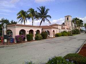
Today, the original 1920s Seaboard stations are used by Amtrak and Tri-Rail for service at West Palm Beach, Deerfield Beach, Fort Lauderdale, Hollywood, Though no longer in use, the Seaboard stations at Delray Beach, Opa-locka, Hialeah, and Homestead are still standing.
West Coast
The west coast route began in Fort Ogden, where it branched off of the Seaboard's recently acquired Charlotte Harbor and Northern Railway, and proceeded directly south to Fort Myers. It crossed the Caloosahatchee River on a long drawbridge directly beside the original Tamiami Trail Bridge. The pier at Riverside Park in East Fort Myers is located where the bridge crossed the river.
In Fort Myers, the passenger depot (which survives today) was located just south of the river at the intersection of Palm Beach Boulevard (SR 80) and East Riverside Drive. A separate freight depot (which also survives) was located a short distance south of the passenger depot on Michigan Avenue.
From Fort Myers, the route continued south out of the city along Palm Avenue and the west side of the Ten Mile Canal, directly paralleling the Atlantic Coast Line Railroad's competing route (which still in service today, operated by Seminole Gulf Railway) which ran along the east side of the canal. At Mullock Creek, it turned more southeast and headed through Estero (just west of the Koreshan State Historic Site) to Bonita Springs (this portion of the right-of-way now services an FPL power line easement).[5] Once in Bonita Springs, it turned south again, and a passenger depot existed just south of Bonita Beach Road (near the site of First Presbyterian Church).[1] Continuing south, it joined the current route of Goodlette-Frank Road near Vanderbilt Beach and headed into downtown Naples, terminating at the Naples passenger depot on Fifth Avenue South. President Warfield had hoped to build a deepwater port in Naples, which was never built.

In addition to the main route, two significant branches existed from Fort Myers to LaBelle and Punta Rassa. The thirty-mile LaBelle branch began just south of the Fort Myers freight depot and ran just south of Michigan Avenue before turning northeast and continuing just south of State Road 80. It terminated in downtown LaBelle at a depot at Main Street and Seminole Avenue.[6] In the 1940s, a seven-mile spur was built from the LaBelle branch southeast to Buckingham Army Airfield.[7] The 8-mile Punta Rassa branch departed the main line just south of Fort Myers near the Six Mile Cypress Slough. Despite its name, the branch never fully reached Punta Rassa, where President Warfield also hoped to estsblish a deep-water port. It actually terminated in Truckland near Iona, just two miles short of Punta Rassa. The branch ran from the main route west along the current route of Six Mile Cypress Parkway, through the center of today's Lakes Park, then southwest along the current routes of Summerlin Road and Pine Ridge Road before turning back north slightly to its terminus at McGregor Boulevard in Truckland. The Punta Rassa branch ended up mostly serving agricultural land and gladiolus fields near Biggar.[8] Power line easements run on some of the former right of way of both the Labelle and Punta Rassa Branches.[9]
Unlike the east coast route, the west coast route was not as successful and would exist for less than thirty years. The Seaboard Air Line went bankrupt in 1930 after the collapse of the land boom and discontinued service Naples in 1942. The southernmost 7 miles of the route from Vanderbilt Beach to downtown Naples and the Naples depot were purchased by the Atlantic Coast Line Railroad, who connected it to their adjacent line near Vanderbilt Beach and made it their main route into Naples, which remained in service until the mid 1980s.[10] The rest of the west coast route was abandoned and removed by 1952. The Coast Line also reconstructed the first mile and a half of the Punta Rassa branch from their main line in the 1960s to briefly service a rock mine just east of the Tamiami Trail (US 41) (site of Lakes Park).
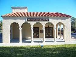
Today, the Naples depot on Fifth Avenue South is now the home of a historical museum. The Fort Myers depot most recently housed the Reilly Brothers Construction company, but the building is currently vacant. The Fort Myers freight depot on Michigan Avenue is now home to Gully's Discount Store Fixtures (the name "Ft. Myers Seaboard Freight Station" is faintly engraved on the side of the building).[10] The eastbound lanes of State Road 80 (Seaboard Street) run along some of the former right of way east of downtown Fort Myers. The John Yarbrough Linear Park also runs near some of the line's former right of way south of Fort Myers next to the Ten Mile Canal.
References
- 1 2 Cottrill, Cathy (December 31, 2013). "Remember: Details sought about the Seaboard Air Line Railroad in Bonita Springs". The Banner. Retrieved 17 May 2014.
- ↑ Turner, Gregg M. (2004). A Milestone Celebration: The Seaboard Railway to Naples and Miami. AuthorHouse. ISBN 9781468517378.
- ↑ Turner, Gregg M. (2005). Florida Railroads in the 1920s. Arcadia Publishing.
- ↑ "South Florida transportation authority to take over rail corridor operation from CSXT". Progressive Railroading. Retrieved 13 October 2013.
- ↑ "Estero Bay State Park Preserve". MPAtlas. Retrieved 15 November 2014.
- ↑ "National Register of Historic Places Multiple Property Documentation Form" (PDF). National Park Service. United States Department of the Interior. Retrieved 4 November 2015.
- ↑ "MOS 580 — Remote Control Turret Mechanic-Gunner: SGT Floyd Richard McCormick" (PDF). Ancestry.com. Retrieved 11 October 2014.
- ↑ "Seaboard served Ft. Myers from 1926 to 1952". Railroad Museum SWFL. Retrieved 4 November 2015.
- ↑ "History at Hickey's Creek Mitigation Park" (PDF). Lee County Parks and Recreation. Retrieved 15 November 2014.
- 1 2 Turner, Gregg M. (December 1, 1999). Railroads of Southwest Florida. Images of America. Arcadia Publishing.