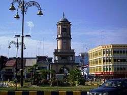
Muar District
See also: Muar town
| Muar District دايره موار 麻坡县 | |||
|---|---|---|---|
| |||
|
Motto: "Cekap Amanah Dinamik Makmur" (Malay) "Efficient Trustworthy Dynamic Prosperous" | |||
 | |||
 Muar District دايره موار 麻坡县 | |||
| Coordinates: 2°3′00″N 102°34′00″E / 2.05000°N 102.56667°E | |||
| Country | Malaysia | ||
| State | Johor | ||
| Government | |||
| • District Officer | Tuan Haji Ramlee A. Rahman | ||
| Area | |||
| • Total | 1,376 km2 (531 sq mi) | ||
| Elevation | 36.88 m (121 ft) | ||
| Population (2010) | |||
| • Total | 247,957 | ||
| • Density | 180/km2 (470/sq mi) | ||
| • Demonym | Muarian | ||
| Time zone | MST (UTC+8) | ||
| • Summer (DST) | Not observed (UTC) | ||
| Postal code | 84xxx | ||
| National calling code | 06 | ||
| License plate prefix | Jxx | ||
| Website |
www www | ||
Muar District is a district in the state of Johor, Malaysia. Muar is located at the mouth of the Muar River, on the coast of the Straits of Malacca. The Muar District covers 1,376 km2, with a population of 247,957 (2010).[1]
Towns
- Muar
- Pagoh
- Parit Jawa
- Sungai Balang
- Bukit Kepong
- Bukit Pasir
- Panchor
- Lenga
- Pekan Bakri, Jalan Bakri
- Bukit Naning
See also
| Wikimedia Commons has media related to Muar. |
References
- ↑ "Taburan Penduduk dan Ciri-ciri Asas Demografi, Malaysia, 2010" (PDF). Jabatan Perangkaan Malaysia. p. 27. Retrieved 17 July 2012.
This article is issued from Wikipedia - version of the Tuesday, February 02, 2016. The text is available under the Creative Commons Attribution/Share Alike but additional terms may apply for the media files.

