Moelfre Isaf
| Moelfre Isaf | |
|---|---|
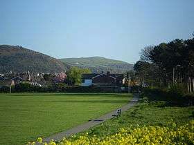
 Moelfre Isaf from Pentre Mawr park, Abergele | |
| Highest point | |
| Elevation | 317 m (1,040 ft) |
| Prominence | 121 m (397 ft) |
| Listing | HuMP |
| Geography | |
| Location | Conwy, Wales |
| OS grid | SH951733 |
Moelfre Isaf is a 317 m (1,040 ft) hill located to the south of the town of Abergele. There are views towards the Clwydian Range, Snowdonia and the Isle of Man can be seen on a clear day. Nearby is the small settlement of Moelfre, which has a chapel.
External links
Coordinates: 53°14′47″N 3°34′25″W / 53.24632°N 3.57353°W
This article is issued from Wikipedia - version of the Sunday, June 14, 2015. The text is available under the Creative Commons Attribution/Share Alike but additional terms may apply for the media files.