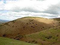
Moel y Gaer, Llanbedr

Moel y Gaer (Welsh for "bald hill of the fortress") is an Iron Age hillfort located on a western spur of the Clwydian Range, near the village of Llanbedr, Denbighshire, Wales.
The defensive works at Moel y Gaer consist of a double bank and a ditch with two entrances, one on the west and one on the northeast. There is an additional bank to the northeast, across the ridge connecting the hill to the higher ground leading to Moel Famau.[1] A 2007 survey of the site reported that the defensive structures enclosed an area of 2.63 hectares (6.5 acres), with a possible annex including another 0.26 hectares (0.64 acres); it also identified 15 roundhouse platforms within the enclosure, along with possible evidence that the inner rampart was faced with stone at some time during the site's occupation.[2]
See also
References
- ↑ "Heather and Hillforts: The Clwydian Hillforts Condition Survey". Clwyd-Powys Archaeological Trust. Retrieved 26 September 2009.
- ↑ Brooks, I. P.; K. Laws (2007). Heather and Hillforts Survey Report: Moel y Gaer, Llanbedr (PDF). Engineering Archaeological Services Ltd. p. 3. Retrieved 26 September 2009.
External links
- Royal Commission on the Ancient and Historical Monuments of Wales page
- Report on 2009 excavations at the site by a Bangor University team
Coordinates: 53°08′46″N 3°16′28″W / 53.1461°N 3.2744°W