Middleton Beach, Western Australia
| Middleton Beach Albany, Western Australia | |||||||||||||
|---|---|---|---|---|---|---|---|---|---|---|---|---|---|
|
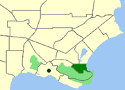
Map of Middleton Beach within Albany. | |||||||||||||
| Population | 652 (2011 census)[1] | ||||||||||||
| • Density | 650/km2 (1,690/sq mi) | ||||||||||||
| Postcode(s) | 6330 | ||||||||||||
| Area | 1.0 km2 (0.4 sq mi) | ||||||||||||
| Location | 4 km (2 mi) from Albany | ||||||||||||
| LGA(s) | City of Albany | ||||||||||||
| State electorate(s) | Albany | ||||||||||||
| Federal Division(s) | O'Connor | ||||||||||||
| |||||||||||||
Middleton Beach is a coastal suburb of Albany, Western Australia, located within the City of Albany approximately 4 kilometres (2.5 mi) east of the city centre. It is home to a caravan park and numerous holiday units which provide accommodation for visitors to the Albany region.
Geography
Middleton Beach is bounded by Wollaston Road and the Albany Golf Course to the north, King George Sound to the east and Heritage Park to the west and south.[2] The suburb has a population of 652.[1]
History
It was named after Captain Middleton in 1834, but was not officially gazetted as a suburb name until 1979.[3] In the early years of Albany's settlement, Middleton Beach provided a handy spot to off-load supplies and stock onto shore as some of the larger boats could not navigate the entrance into Princess Royal Harbour (the main port).
The beach is famous for its multiple Esplanade Hotels. In 1892, the first of the Esplanades opened, only to be burnt down in 1908. The rebuilt hotel was finished in 1911 and became more popular as a road was built connecting Albany town to Middleton beach, as before the only way to get there was by boat or bush track. In the 1940s it was to be demolished and rebuilt into a bigger hotel; it was finished in 1949 and became very popular. In the 1970s the old hotel was demolished and made way for a new hotel.
Then in 1990 it was demolished by Paul Terry, who had a dream to build a 5-star boutique, colonial-style hotel with bar and restaurant. It also had a separate building called the Extravaganza; it housed a few shops and a vintage car museum (the museum was later closed in 1993 due to Paul Terry's death and the collection was sold as too was the hotel). In 2006 plans were made to demolish the Esplanade and surrounding buildings for a new modern apartment hotel. The Extravaganza building and adjoining units were demolished in early December while the existing hotel was demolished in early 2007. The controversial move resulted in mass protest, and the site lies empty to this day. The Singaporean investors responsible put the hotel site back on the market in 2010. In November 2014, the site was sold to Landcorp (a department of the Government of Western Australia) for AUD$7,000,000 and will be developed at some time in 2015.
Attractions
Middleton Beach is the main swimming beach for Albany and offers swimming and recreational beach activities. The waters are protected by King George Sound; the Southern Ocean's waves do not usually reach these sheltered waters.
Middleton Beach boasts a jetty, and in summer a pontoon (a floating structure that can support many people) is placed in the ocean for enjoyment of swimmers. There is a cafe, a cafe/deli, a restaurant, and a fish and chip shop all within walking distance of the beach.
There is also accommodation ranging from a caravan park to motels and independent 'bed and breakfasts'.
Middleton Beach also provides an easily accessible location for viewing Southern Right and Humpback whales during their annual migration to the Southern Ocean. Whales enter the bay to rest and can sometimes be seen as close as 20–30 metres from the shore or frolicking out in the deeper waters of the bay.

References
- 1 2 Australian Bureau of Statistics (31 October 2012). "Middleton Beach (State Suburb)". 2011 Census QuickStats. Retrieved 2015-01-04.
- ↑ Department of Land Information. StreetSmart® Perth Street Directory (54 (2013) ed.). West Australian Newspapers Ltd. pp. Map A6. ISBN 978-0-909439-67-5.
- ↑ "Naming of Localities - Town of Albany (per 3773/57 V4)". Western Australia Government Gazette. 8 June 1979. p. 1979:1501.
| ||||||
Coordinates: 35°01′25″S 117°54′49″E / 35.02361°S 117.91361°E
