Meru County
| Meru County | |||
|---|---|---|---|
| County | |||
|
Lake Michaelson is in the background | |||
| |||
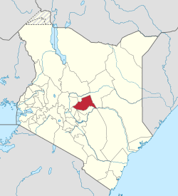
 Location of Meru County in Kenya | |||
| Coordinates: 0°3′N 37°38′E / 0.050°N 37.633°ECoordinates: 0°3′N 37°38′E / 0.050°N 37.633°E | |||
| Country |
| ||
| Formed | March 4, 2013 | ||
| Capital and largest town | Meru | ||
| Government | |||
| • Governor | Peter Munya | ||
| Area | |||
| • Total | 6,936 km2 (2,678 sq mi) | ||
| Population (2009)[1] | |||
| • Total | 1,356,301 | ||
| • Density | 200/km2 (510/sq mi) | ||
| Time zone | EAT (UTC+3) | ||
| Website |
meru | ||
Meru County is one of the 47 counties of Kenya, located in the former Eastern Province.
Meru County is the home of the Ngaa People (Meru) ethnicity, which is sometimes described as being related to other ethnicities living around the Mount Kenya region: the Kikuyu, Embu people and to some extent the Kamba people. The Ameru generally fit into the "Bantu" group of people who have been native to the Mt. Kenya area for many years — well before colonization of Kenya by Great Britain in the 19th Century. The people of Meru County are now predominantly Christian — Methodist, Presbyterian, Roman Catholic, and other denominations, reflecting the work of missionaries — with also minorities of Indian descent, who are mainly Hindus, and African/Arab descent, who are Muslims. Meru County also has some resident Europeans predominantly British in ancestry.
The county headquarters is in the town of Meru. The current governor of Meru County is Hon. Peter Munya APK, who is also the current chairman of the Council of Governors. .
History
In 1992, the former Meru District was split into Meru Central District, Meru North District, Meru South District, and Tharaka District. In 1998, Tharaka District was again split into Nithi District and Tharaka District. A Supreme Court decision in September 2009 ruled that the split had been unconstitutional, and the first two of these were re-amalgamated into Meru District, which became Meru County in 2010. The same ruling amalgamated Meru South, Tharaka and Nithi districts into Tharaka-Nithi District, which became Tharaka-Nithi County in 2010.
Electoral constituencies
- Igembe South Constituency
- Igembe Central Constituency
- Igembe North Constituency
- Tigania West Constituency
- Tigania East Constituency
- North Imenti Constituency
- Buuri Constituency
- Central Imenti Constituency
- South Imenti Constituency


